| 15°S 180°
82.1 km (51.0 miles) N of Thikombia Island, Fiji
|  | 15°N 0°
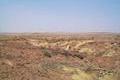
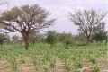
40.2 km (25.0 miles) SW of Tessit, Gao, Mali
|
|
 | 0° 180°
384.0 km (238.5 miles) WSW of Howland Island (US), Pacific Ocean, International Waters
[incomplete] |  | 0° 0°
in the Gulf of Guinea, Atlantic Ocean, International Waters
|
|
| 17°S 179°W
184.0 km (114.3 miles) ESE of Labasa, Fiji
|  | 17°N 1°E
77.3 km (48.0 miles) NW of Télataï, Gao, Mali
|
|
| 14°S 178°W
38.0 km (23.6 miles) NNE of Sigave, Futuna Island, Wallis and Futuna
|  | 14°N 2°E
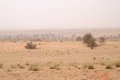
2.6 km (1.6 miles) NW of Tafo Kwara, Tillabéri, Niger
|
|
| 44°S 177°W
19.1 km (11.9 miles) SSW of Somes Point (Cape), Chatham Island, Chatham Islands, NZ
|  | 44°N 3°E
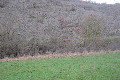
2.3 km (1.4 miles) NE of Roquefort-sur-Soulzon, Aveyron, Occitanie, France
|
|
| 20°S 175°W
37.0 km (23.0 miles) S of Kao Island, Tonga
|  | 20°N 5°E
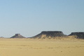
295.9 km (183.8 miles) S of Amsel, Tamanrasset, Algeria
|
|
| 16°S 174°W
30.0 km (18.6 miles) WSW of Falehau, Tonga
|  | 16°N 6°E
27.0 km (16.8 miles) ENE of Tchin Tabaraden, Tahoua, Niger
|
|
 | 14°S 172°W
35.0 km (21.7 miles) WSW of Apia, Samoa
[incomplete] |  | 14°N 8°E
1.8 km (1.1 miles) E of Dogon Chimgué, Maradi, Niger
|
|
| 13°S 172°W
60.0 km (37.3 miles) NE of Fagomalo, Samoa
|  | 13°N 8°E
11.7 km (7.3 miles) SSW of Babauri, Katsina, Nigeria
|
|
 | 14°S 171°W
47.0 km (29.2 miles) NW of Pago Pago, island of Tutuila, American Samoa
[incomplete] | 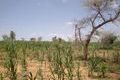 | 14°N 9°E
2.6 km (1.6 miles) SE of Kan Karawa, Zinder, Niger
|
|
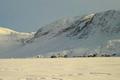
| 79°S 169°W
152.8 km (94.9 miles) WNW of Center of Roosevelt Island (Island), Longitude 180 to 91 West, Antarctica
|  | 79°N 11°E
21.5 km (13.4 miles) WNW of Ny-Ålesund, Svalbard
|
|
| 80°S 168°W
380.1 km (236.0 miles) WNW of Siple Dome Camp, Longitude 180 to 91 West, Antarctica
|  | 80°N 12°E
89.0 km (55.3 miles) WNW of Ivorytoppen (Peak), Svalbard
|
|
| 79°S 168°W
456.7 km (283.6 miles) NW of Siple Dome Camp, Longitude 180 to 91 West, Antarctica
|  | 79°N 12°E
7.5 km (4.7 miles) N of Ny-Ålesund, Svalbard
|
|
| 80°S 166°W
102.5 km (63.7 miles) SW of Center of Roosevelt Island (Island), Longitude 180 to 91 West, Antarctica
|  | 80°N 14°E
39.4 km (24.5 miles) NE of Puddingen (Peak), Svalbard
|
|
| 80°S 165°W
88.1 km (54.7 miles) SW of Center of Roosevelt Island (Island), Longitude 180 to 91 West, Antarctica
|  | 80°N 15°E
38.1 km (23.7 miles) NW of Ivorytoppen (Peak), Svalbard
|
|
| 79°S 164°W
403.5 km (250.6 miles) NW of Siple Dome Camp, Longitude 180 to 91 West, Antarctica
|  | 79°N 16°E
86.5 km (53.7 miles) E of Ny-Ålesund, Svalbard
|
|
| 80°S 163°W
67.8 km (42.1 miles) SSW of Center of Roosevelt Island (Island), Longitude 180 to 91 West, Antarctica
|  | 80°N 17°E
13.0 km (8.1 miles) NNW of Olympen (Peak), Svalbard
|
|
| 23°N 162°W
6.5 miles (10.4 km) SW of Nihoa (Island), Honolulu, HI, USA
|  | 23°S 18°E
9.4 km (5.8 miles) S of Heimat, Khomas, Namibia
|
|
| 81°S 160°W
196.7 km (122.2 miles) WNW of Siple Dome Camp, Longitude 180 to 91 West, Antarctica
|  | 81°N 20°E
54.0 km (33.5 miles) N of Nordkapp (Point), Svalbard
|
|
| 21°N 158°W
21.6 miles (34.8 km) SW of Diamond Head (Cape, Oahu), Honolulu, HI, USA
|  | 21°S 22°E
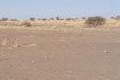
47.2 km (29.3 miles) N of Kkhoutsiri, Ghanzi, Botswana
|
|
| 22°N 158°W
19.7 miles (31.7 km) N of Kahuku Point (Cape, Oahu), Honolulu, HI, USA
|  | 22°S 22°E
37.5 km (23.3 miles) S of Sunnyside, Ghanzi, Botswana
|
|
| 19°N 157°W
72.3 miles (116.4 km) W of Miloli'i, Hawaii, HI, USA
|  | 19°S 23°E
4.1 km (2.5 miles) SSW of Sadibas, North-West, Botswana
|
|
| 18°N 156°W
66.4 miles (106.9 km) SSW of Ka Lae (Cape), Hawaii, HI, USA
|  | 18°S 24°E
4.1 km (2.5 miles) NNW of Mamili, Caprivi, Namibia
|
|
| 19°N 156°W
8.1 miles (13.1 km) WSW of Kauna Point (Cape), Hawaii, HI, USA
|  | 19°S 24°E
17.1 km (10.6 miles) NNE of Shaleshanto, North-West, Botswana
|
|
 | 21°N 156°W
13.7 miles (22.0 km) NE of Keanae, Maui, HI, USA
[incomplete] |  | 21°S 24°E
36.4 km (22.6 miles) W of Sesume, Central, Botswana
|
|
