|

Estonia
8.8 km (5.5 miles) NNW of Ristna Neem (Cape), Hiiu (Island), Hiiumaa, Estonia
Approx. altitude: 0 m
(0 ft)
([?] maps: Google MapQuest OpenStreetMap ConfluenceNavigator)
Antipode: 59°S 158°W
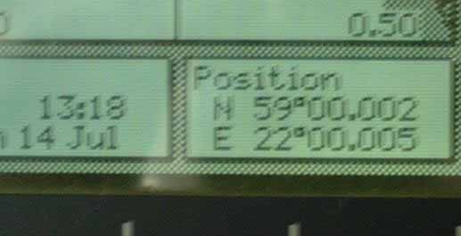
Accuracy: 6 m (19 ft)
Quality: good
Click on any of the images for the full-sized picture.


| 59°N 22°E |

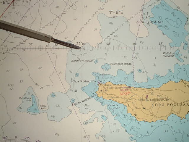
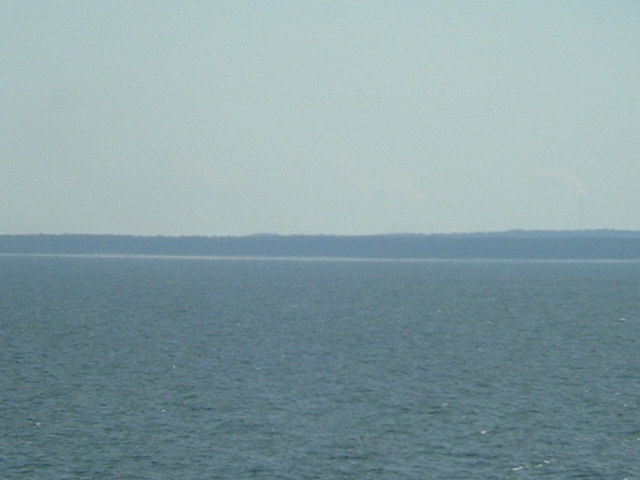
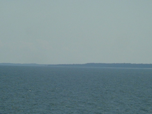
(visited by Captain Peter, Volodymyr Sydorenko and Stanislav Shulga) 14-Jul-2002 -- On our shuttle service from various ports to Saint Petersburg we had passed this confluence already several times, but due to night time or bad visibility we could realize a successful visit only today. The confluence is located Northeast of the Kõpu Peninsula (Kõpu Poolsaar) which belongs to Hiiumaa Island and extends about 20 km towards West. Kopu Peninsula is densely wooded. A range of hills runs the length of the peninsula and rises to a height of about 70 metres (200 feet). The coast is partly beaches consisting of sand. The West end of Kopu Pensinsula is divided into two Capes, namely Põhja Ristnanina, which means Northern Ristna Cape, and Lõuna Ristnanina (Southern Cape Ristna). The national name of Estonia is "Eesti Vabariik", and the capital is Tallinn, the old Hanse-Town of Reval. Estonians are one of the longest settled European peoples whose forebears lived on the southeastern shore of the Baltic Sea more than 5000 years ago.During the first century AD Eastonia hd a population of already more than 150,000 and remained the last corner of medieval Europe to be christianized. It also managed to remain independent from the Vikings to the West and the Kievan Rus (the later Russians) to the East. However, the Danes eventually conquered Toompea, a hilled fortress at what is now the centre of Tallinn, and in 1227 the German crusading Order of the Sword Brethren defeated the last Estonian stronghold. The people were christianized, colonized and enserfed. 1236, the Sword Brethren, allied with the Order of the Teutonic Knights, and became known as the Livonian Order of the Teutonic Knights. In 1436 the Danes sold their part to the Livonian Order. Northern Estonia submitted to Swedish control in 1561 during the Livonian Wars and Southern Estonia became part of Lithuania's Duchy of Courland (Kurland). The Swedish were then defeated by Russia and the resulting 1721 Treaty of Nystad imposed Imperial Russian rule in the territory that became modern Estonia. Following the First World War and independent republic was proclaimed in 1919 and this remained so until 1940, when under the terms of the secret protocol of the Soviet-German agreement of 1939 (Hitler-Stalin Nichtangriffspakt (non agression-treaty), signed by their foreign ministers Joachim von Ribbentrop and Vyechislav Molotov in Moscow), Estonia was declared to be "part of the Soviet interest area" and Soviet forces occupied Estonia. A pro-Soviet regime was installed, which immediately applied for admission to the Soviet Union. On 30th March 1990 the Estonian Supreme Soviet proclaimed that the occupation of Estonia in 1940 has disrupted the continuity of the former republic and adopted a declaration calling for the eventual re-establishment of souvereignity. A referendum in March 1991 showed a large majority in favor of independence, and while an attempted coup was taking place in the USSR, parliament declared independence on 20th August 1991, being the first Socialist Soviet Republic doing so. Estonia's independent status was formally recognized by the USSR on 6th September 1991. The population is about 1.5 million, whereof 65% are Estonians, and 35% Russians. Estonian, which resembles to Finnish, is the official language, but Russian is widely spoken and understood by everybody
------------------------------------- |
| All pictures |
| #1: North Ristna Cape, the closest point of land to the confluence #2: Map #3: GPS #4: The beach on Kõpu Peninsula ALL: All pictures on one page |
| Notes |
|
In the Baltic Sea, with a view of land. |