|

China : Fújiàn Shěng
1.1 km (0.7 miles) ESE of Huqiu, Fújiàn, China
Approx. altitude: 228 m
(748 ft)
([?] maps: Google MapQuest OpenStreetMap ConfluenceNavigator)
Antipode: 25°S 62°W
Accuracy: 5 m (16 ft)
Quality: good
Click on any of the images for the full-sized picture.


| 25°N 118°E |

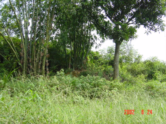
(visited by Targ Parsons) 24-Aug-2002 -- My visit to 25°N 119°E complete, I left nearby Zhangcuo shortly before 9 a.m., travelling first by motorbike to Jingfeng, then by a series of four buses to Hui'an, Quanzhou, Anxi and Huqiu, arriving in Huqiu at 1 p.m., just one kilometre from this next confluence. This journey took me through an area, centred on the large city of Quanzhou, that was very much devoted to stone carving. Many roadside establishments were engaged in the trade, and their wares were prominently displayed for all passers-by to see. The hottest items by far were stone lions, which were being chiselled out in their tens of thousands. After all, what self-respecting Chinese building would dare be without its obligatory pair of stone lions guarding the front entranceway? The road west and inland from Quanzhou to Anxi followed the path of a river that showed no signs of flooding at all (quite the opposite in fact), despite reports of devastating floods further inland in Hunan Province, where massive Dongting Lake was in jeopardy of bursting its banks at any moment, a disaster that would have caused widespread destruction. From the small town of Huqiu, there was a side-road that conveniently led off in the general direction of the confluence. The intersection boasted a large bilingual sign, indicating that this was also the way to the Hong'en Grotto Scenic Spot. However, that was not my destination today. My target was the confluence, which lay on a hillside on the opposite side of a small river valley. I followed the Hong'en Grotto road until I was 175 metres from the confluence, then found a small path that took me the rest of the way. It was now 2 p.m., and I had been walking uphill for the past hour, during what was the hottest part of the day, with the sun belting down through a cloudless sky. Despite having paused along the way to change into shorts and a light top, I was now completely drenched in my own sweat, which was literally pouring off me, making my eyes sting, saturating the pages of my notebook, and doing who knows what to my digital camera. Barely able to see, I nevertheless managed to wipe the sweat from the face of the GPS, get a shot of it showing a perfect reading, then dig out my compass and take the standard set of photos facing north, south, east and west. All in all, it was a fairly nondescript confluence, although just 25 metres uphill, behind a stand of bamboo, there was quite an elaborate grave, sporting its own little tomb-side pavilion. Next stop, 27°N 119°E. |
| All pictures |
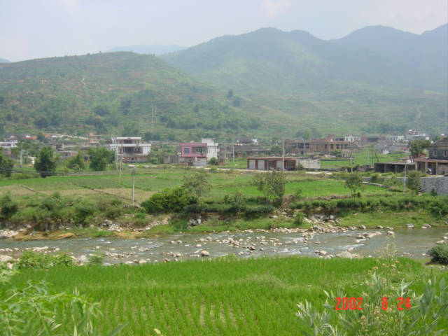
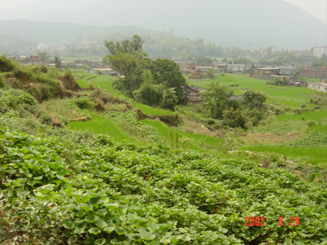
| #1: Facing west. #2: Large, bilingual sign, indicating the way to Hong'en Grotto Scenic Spot. #3: Confluence on hillside on opposite side of river valley. #4: Perfect reading: N 25°00'00.0", E 118°00'00.0" #5: Facing north. #6: Facing south. #7: Facing east. #8: Elaborate grave, sporting its own little tomb-side pavilion. ALL: All pictures on one page |