|
Canada : British Columbia
19.6 km (12.2 miles) WSW of Criss Creek, BC, Canada
Approx. altitude: 1257 m
(4123 ft)
([?] maps: Google MapQuest OpenStreetMap topo topo250 ConfluenceNavigator)
Antipode: 51°S 59°E
Accuracy: 7 m (22 ft)
Quality: good
Click on any of the images for the full-sized picture.
| 51°N 121°W (visit #3) |

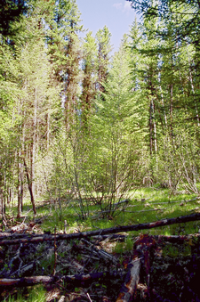
(visited by Dave Patton) 03-Jun-2003 -- This is the first of two confluence visits I made today. Despite both being almost "drive to" confluences, you'll see from the narratives that doesn't mean they are trivial to get to. Also, although the distinction of Primary vs Secondary confluences is necessary for the Project, this one, which is Primary, and the second one of the day, 51N 122W, which is Secondary, are both about equal in terms of effort needed to reach the confluence. Both of these confluences were previously visited by Frank Majcenovic, and my narratives will make more sense if you read Frank's narratives first. Zeroing the odometer at Cache Creek at the intersection of Highways 1 and 97, I headed East on Highway 1. AT 32.1km, I turned North onto Deadman - Vidette road. At 47.8km is the junction with the Deadman - Cache Creek road. Photo #3 of the Deadman river and the rock formations was taken just north of the junction. At 52.8km I turned left onto road 552-20. AT 55.3km this road comes to a fork, which is where the tree with the "43" painted on it is located. The left-hand branch has a sign on a tree that reads "Sky Hi Lodge". I took the right-hand branch, and at 56.9km crossed a small creek via an old bridge with a "STOP CAUTION" sign. I continued up the gravel road, gaining elevation. In Photo #4, taken from this road, you can see the Deadman - Vidette road going through the valley, from lower left towards the center, and near the center you may be able to make out where road 552-20 branches off, just next to the pasture, with the gravel road making it's way through the forest beneath the rock bluffs. At 61.2km, I took the left-hand branch at a fork in the road, and did the same at a fork at 63.3km. At 65.1km I turned right onto an older road. This is where my path to the confluence differs from the one Frank took. He continued along the road, until he "crossed the N51 latitude along the road", at which point he "still had 680 meters east to confluence". Although the other roads, almost from Highway 1, had been gravel, this old road was much rougher, and would require a high-clearance vehicle, and in some conditions, 4-wheel drive(which I have). There were sections where people(maybe hunters or farmers?) had been on this road when it was somewhat muddy and soft, so there were sections filled with ruts. Further along, small trees and bushes are growing in the middle of the road. At 65.1km the old road ends at a clearing from some old logging activity. I parked at this point, which is only 249 meters from the confluence. A few minutes walk across the clearing, along some trails likely made by cattle, and through the woods brought me to the confluence. My GPS put the confluence within about 10 meters of the tree shown in Frank's photo. After taking the confluence photos, I drove back the way I came, stopping along the road where I took the photo of the valley to have some lunch, before proceeding to 51N 122W. |
| All pictures |
| #1: North #2: South #3: Deadman river and rock formations #4: Deadman river valley #5: GPS ALL: All pictures on one page |


![Visit #2: [21-Apr-02] Visit #2: [21-Apr-02]](/ca/bc/n51w121v2/preview.jpg)
![Visit #1: [18-Aug-01] Visit #1: [18-Aug-01]](/ca/bc/n51w121/preview.jpg)