|
Canada : British Columbia
16.5 km (10.2 miles) W of Kelly Lake, BC, Canada
Approx. altitude: 1104 m
(3622 ft)
([?] maps: Google MapQuest OpenStreetMap topo topo250 ConfluenceNavigator)
Antipode: 51°S 58°E
Accuracy: 25 m (82 ft)
Quality: good
Click on any of the images for the full-sized picture.
| 51°N 122°W (visit #2) | (secondary) |

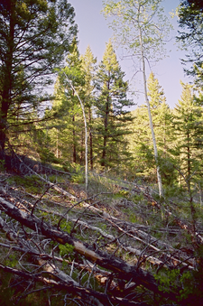
(visited by Dave Patton) 03-Jun-2003 -- This is the second of two confluence visits I made today. Despite both being almost "drive to" confluences, you'll see from the narratives that doesn't mean they are trivial to get to. Also, although the distinction of Primary vs Secondary confluences is necessary for the Project, this one, which is Secondary, and the first one of the day, 51N 121W, which is Primary, are both about equal in terms of effort needed to reach the confluence. Both of these confluences were previously visited by Frank Majcenovic, and my narratives will make more sense if you read Frank's narratives first. After returning to Cache Creek, at the intersection of Highways 1 and 97, I headed North on Highway 97, and then West on Highway 99 to Lillooet. I turned off Highway 99, through Lillooet, and onto the Bridge River Road, which heads North from Lillooet, on the West side of the Fraser River, and then just past the Bridge River turns to the West towards Goldbridge. At this point I turned off to the right onto the West Pavillion Forest Service Road, and zeroed the odometer. This road soon rises steeply in a series of switchbacks, gaining quite a bit of elevation above the Fraser River below. I continued along the main road, passing the Lee Creek and Slok Creek Forest Service Roads on the left at 25.8 and 27.4 km. I also passed a "hitchhiker" along the way, but didn't pick them up ;-) Just past the 38km sign on the road, are the Ginseng Gardens. To the left at 40.4km is Upper McKay Forest Service Road, and at 44.3km I turned left onto the West Pavillion - Leon Creek Forest Service Road. This is where my approach to the confluence differs from the one Frank used. I zeroed the odometer again at this point. I went straight at a junction at 1.9km, at 7.8km kept to the right after crossing a bridge, and at 8.3km I stayed to the left. At 11.6km there was a junction with a "Warning Road Deactivated" sign on the left, and a "Warning Road Closed" sign on the right. I went to the right, and then at 11.9km headed right again. This old road led somewhat downhill as it curved around a hill to the left, and at 12.7km I went to the left, parking my truck at 12.8km, due to the many small trees growing in the old roadbed. At this point, I was parked only 61.4 meters from the confluence! I had hoped that the confluence was located on the old road, so I could drive right to it, but is was in the woods, just uphill from the road. I had started the trip to the 51N 121W confluence in Cache Creek at 9AM, and was now at my second confluence of the day, at 6:15PM. I went back the way I came, and found a spot to camp, and to have some pasta and red wine, and reflect on a day that was both fun and interesting :-) |
| All pictures |
| #1: North #2: South #3: "hitchhiker" on West Pavillion road #4: Ginseng Gardens sign #5: View of the Fraser River from West Pavillion road #6: GPS ALL: All pictures on one page |


![Visit #1: [20-Apr-02] Visit #1: [20-Apr-02]](/ca/bc/n51w122/preview.jpg)