|

Sweden
14.8 km (9.2 miles) SE of Svanhalla, Blekinge, Sweden
Approx. altitude: 0 m
(0 ft)
([?] maps: Google MapQuest OpenStreetMap ConfluenceNavigator)
Antipode: 56°S 164°W
Accuracy: 36 m (118 ft)
Quality: good
Click on any of the images for the full-sized picture.


| 56°N 16°E |

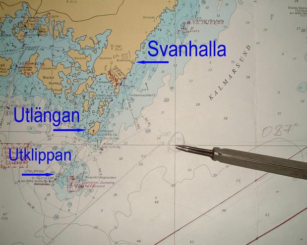
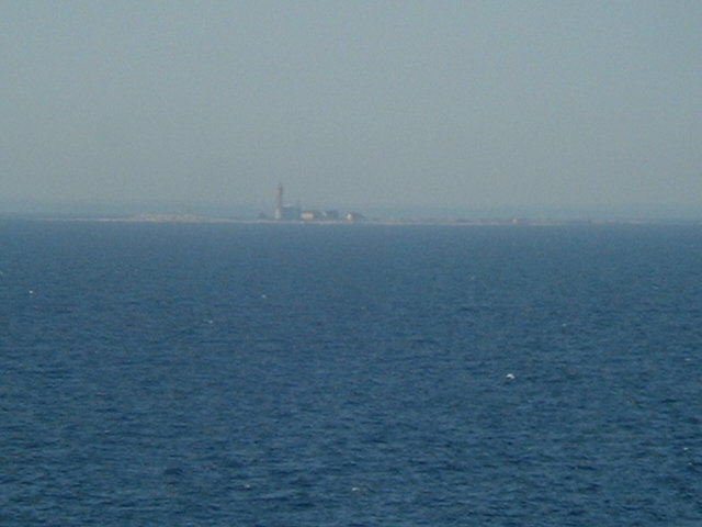
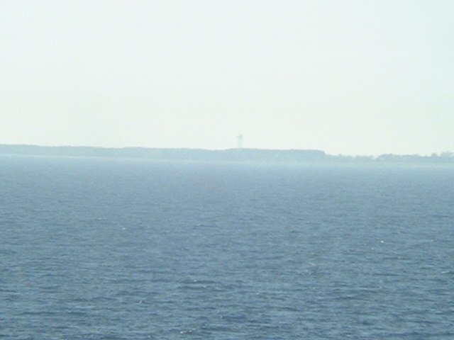
(visited by Captain Peter, Valentyn Smirnov, Volodymyr Kokorev and Volodymyr Sydorenko) 22-May-2002 -- On our way through the Baltic Sea towards Saint Petersburg this time we choose to visit 56°N/16°E. It is an offshore point at the Southern end of the Kalmar Sound, the strait between the Swedish mainland and the island of Öland. From the Confluence we could clearly see the tiny island of Utklippan and the island of Utlängan. The coast around Svanhalla was not very conspicuous, but we could at least see something. It is probably worth to mention that since our departure from Morocco we have a passenger on board. It is a carrier pigeon, carrying even a letter in a ring around its leg. It is fully tame and living now in and around the navigating bridge. We always thought these animals to be perfectly drilled to proceed with their mail immediately on the shortest way to their destination, but probably due to the fact that we do feed it well with rice and bread it has obviously forgotten about its duty and prefers to travel with us to Russia. |
| All pictures |
| #1: Svanhalla #2: GPS #3: Map #4: Utklippan #5: Utlängan #6: Captain Peter with a carrier pigeon ALL: All pictures on one page |
| Notes |
|
In the Baltic Sea, but with a view of land. |