|

Finland : Etelä-Suomen lääni
19.9 km (12.4 miles) S of Helsinki, Etelä-Suomen lääni, Finland
Approx. altitude: 0 m
(0 ft)
([?] maps: Google MapQuest OpenStreetMap ConfluenceNavigator)
Antipode: 60°S 155°W
Accuracy: 35 m (114 ft)
Quality: good
Click on any of the images for the full-sized picture.


| 60°N 25°E (visit #3) |
![Visit #2: [23-May-02]](/fi/all/n60e025v2/preview.jpg "Visit #2: [23-May-02]")
![Visit #1: [03-Jun-01]](/fi/all/n60e025/preview.jpg "Visit #1: [03-Jun-01]")

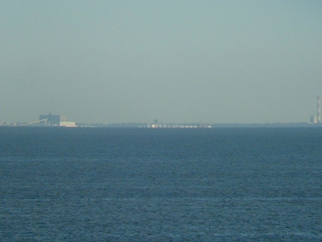
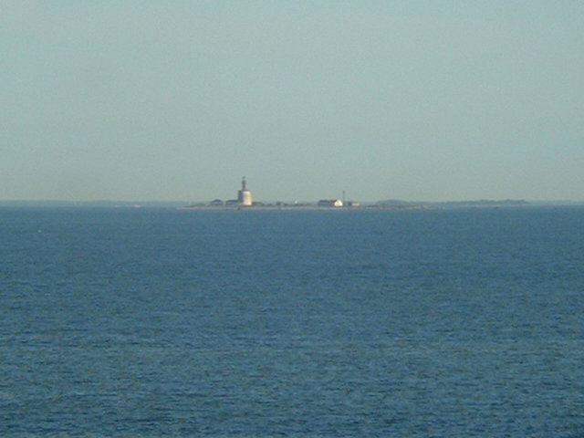
(visited by Captain Peter) 14-Jul-2002 -- First we did not intend to visit this confluence GPS again, but later in the afternoon the visibility in the gulf of Finland became so exceptionally good, that is was too inviting. It is extremely rare that from this location both the Northern and southern shore of the Guld of Finland can be seen. Helsinki is a town which hides itself from the sea. Not much can be seen, but the Estonian coast was well visible. We could clearly make out the port of Muuga, the former Novotallinsky, East of Tallinn. Then we could see the Estonian Prangli Island, densely wooded, and the tiny island of Keri, rocky and low, with its prominent lighthouse on a stone base. Finland, whose national name is Suomi, is the farthest North state in Europe (ed: This is wrong, Norway is well north of Finland) having about one-third of its land North of the Arctic Circle. It is the most wooded country in Europe. |
| All pictures |
| #1: Helsinki #2: GPS #3: Muuga #4: Prangli #5: Keri ALL: All pictures on one page |
| Notes |
|
In the Sea of Finland, but with a view of land. |