|
Sweden
0.9 km (0.6 miles) E of Högbacka, Gävleborg, Sweden
Approx. altitude: 54 m
(177 ft)
([?] maps: Google MapQuest OpenStreetMap ConfluenceNavigator)
Antipode: 61°S 163°W
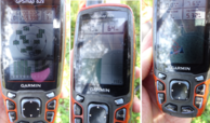
Accuracy: 6 m (19 ft)
Quality:
Click on any of the images for the full-sized picture.
| 61°N 17°E (visit #6) | (secondary) |
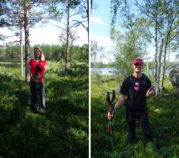
 (visited by Karl Bryk and Heidi Peschl) 18-Jul-2019 -- This the first of 3 CP visits during our annual trip to Sweden. The next is
N61 E15.
|
| All pictures |
| #1: Overview #2: North #3: East #4: South #5: West #6: GPS #7: Visitors ALL: All pictures on one page |


![Visit #5: [22-Jun-13] Visit #5: [22-Jun-13]](/se/all/n61e017v5/preview.jpg)
![Visit #4: [28-Feb-10] Visit #4: [28-Feb-10]](/se/all/n61e017v4/preview.jpg)
![Visit #3: [01-Apr-02] Visit #3: [01-Apr-02]](/se/all/n61e017v3/preview.jpg)
![Visit #2: [15-Jan-02] Visit #2: [15-Jan-02]](/se/all/n61e017v2/preview.jpg)
![Visit #1: [04-Jan-02] Visit #1: [04-Jan-02]](/se/all/n61e017/preview.jpg)