|

Italy : Trentino-Alto Adige
2.3 km (1.4 miles) SE of Lasino, Trento, Trentino-Alto Adige, Italy
Approx. altitude: 946 m
(3103 ft)
([?] maps: Google MapQuest OpenStreetMap ConfluenceNavigator)
Antipode: 46°S 169°W
Quality: good
Click on any of the images for the full-sized picture.


| 46°N 11°E (visit #1) |
![Visit #6: [16-Sep-13]](/it/all/n46e011v6/preview.jpg "Visit #6: [16-Sep-13]")
![Visit #5: [03-Aug-12]](/it/all/n46e011v5/preview.jpg "Visit #5: [03-Aug-12]")
![Visit #4: [28-Aug-10]](/it/all/n46e011v4/preview.jpg "Visit #4: [28-Aug-10]")
![Visit #3: [22-Jun-09]](/it/all/n46e011v3/preview.jpg "Visit #3: [22-Jun-09]")
![Visit #2: [02-Jun-04]](/it/all/n46e011v2/preview.jpg "Visit #2: [02-Jun-04]")
![Visit #7: [05-Nov-17]](/it/all/n46e011v7/preview.jpg "Visit #7: [05-Nov-17]")

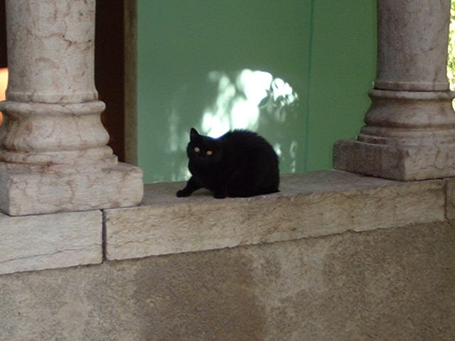
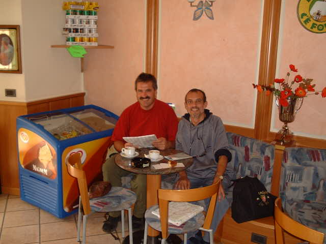
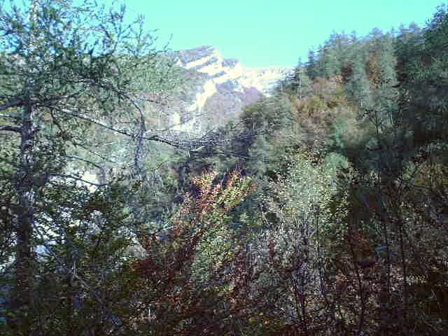
(visited by Captain Peter and Hans Augdoppler) 15-Oct-2001 -- Mr. Augdoppler (when driving back from Southern Italy to his home in Austria) and myself, (actually being on vacation in Austria) agreed to make this confluence visit in the Italian Region of Trentino-Alto Adige, an extremely beautiful part of Italy and part of the Alps. We met at 1300hrs CEST in the tiny village of Cavedine (1,000 inhabitants, near Trento and North of Lake Garda and 540 metres above sea level). We both reached Cavedine from the Highway Route A22 (Brennero-Modena), Exit Trento-Centro, then taking the State Road SS45bis (Gardesana Occidentale - the Western Garda Lake-Road) until Vezzano, and thence on Provincial Road SP84. Captain Peter arrived a little bit earlier and strolled around in Cavedine, the first inhabitant to salute him was a black cat. Italians are superstitious and black cats are supposed to bring bad luck. Shortly later Hans arrived in the center of the village, the Piazza Italia, where we had first coffee in Pedro's Café. Comparing the maps and taking compass bearings from Piazza Italia we assumed from the very beginning that the confluence is supposed to be up in the mountain, close to the rocky cliff in the center. Hans drove the car as close as possible to the foot of the mountain and we started walking. The area looks as there were a lot of forestry some decades ago, but now the paths are mostly abandoned. After an almost two hours walk through dense forest of predominantly beeches, we arrived at a small stone house, where we had a rest, 200 metres away from the point. The point itself is on a very precipice, a 950 metres above sea level. The GPS position was a little bit jumping, as due to the dense forest the signal was no good. The views to East, South and West show dense forest, the view to North is the most impressive. The most important fruits of the Trentino-Alto Adige are grapes and apples. It was quite a tough point to make, but due to the marvellous landscape and scenery we have seen it was worth to go for it. |
| All pictures |
| #1: View to the North #2: First resident encountered in Cavedine #3: The Piazza Italia, with the confluence mountain behind #4: The tiny village of Cavedine #5: Visitors preparing in Pedro's Café #6: Abandoned Paths... #7: A small stone house, 200m from the point #8: The point #9: GPS reading #10: Local fruit ALL: All pictures on one page |