|

Italy : Veneto
2.3 km (1.4 miles) NE of Marziai, Belluno, Veneto, Italy
Approx. altitude: 855 m
(2805 ft)
([?] maps: Google MapQuest OpenStreetMap ConfluenceNavigator)
Antipode: 46°S 168°W
Accuracy: 15 m (49 ft)
Quality: good
Click on any of the images for the full-sized picture.


 taken in the evening and morning")

![]()

| 46°N 12°E (visit #2) |
![Visit #7: [05-Nov-17]](/it/all/n46e012v7/preview.jpg "Visit #7: [05-Nov-17]")
![Visit #6: [27-Jun-15]](/it/all/n46e012v6/preview.jpg "Visit #6: [27-Jun-15]")
![Visit #5: [23-May-08]](/it/all/n46e012v5/preview.jpg "Visit #5: [23-May-08]")
![Visit #4: [16-Sep-06]](/it/all/n46e012v4/preview.jpg "Visit #4: [16-Sep-06]")
![Visit #1: [13-Oct-01]](/it/all/n46e012/preview.jpg "Visit #1: [13-Oct-01]")
![Visit #3: [31-Jul-01]](/it/all/n46e012v3/preview.jpg "Visit #3: [31-Jul-01]")
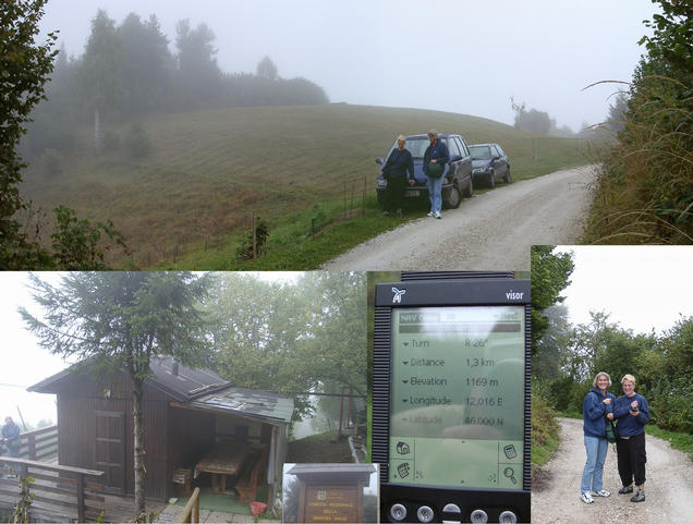
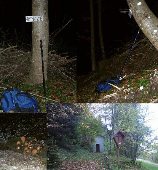
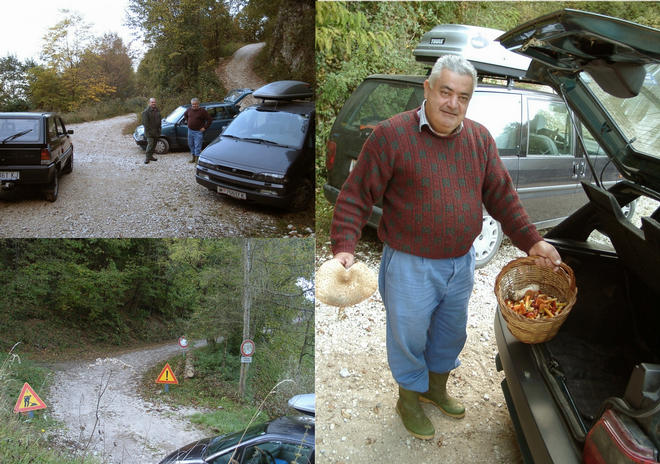
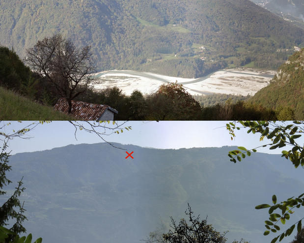
 & from (south)") (visited by Hans Augdoppler, Margit and Daniela) 13-Oct-2001 -- On September 25th on our way to Taranto we decided to have a look at 46°N 12°E. We left the Brenner-Highway at Trento and continued along the river Brenta to Feltre and further on to Lentiai. Nice scenery even the weather conditions were not very good. Our aim was to try the approach from the village of Calderù close to Monte Artent (1182m). As we reached more than 1000m of altitude the weather condition became even worse. So we followed kilometer for kilometer the narrow road with nearly seeing nothing –we had entered a cloud. We came as close as ~1.3 km and could finally see a few meters into the suspected direction. Since the terrain was very steep and wet we skipped all ideas to start a walk. We tried driving around, but could not find any closer point from this ridge. We gave up and precede downhill into the Piave valley in order to come again as close. From there we could see a village some hundred meters uphill (Stabie ?). We continued towards Taranto having in mind to try it next time from Stabie. On October 13th coming from 43N13E I started the next attempt. Coming from Venice and via Belluno & Lentiai I entered Stabie via Canai in the late afternoon. In the village of Stabie it is easy, the only way in direction CP is a very narrow road to the left, passing a huge rock, at a farmhouse the tarmac ends and changes into a steep gravel forest road. At a junction I stopped the car in spite of the unknown road conditions ahead and started to walk towards the integer. A few hundred meters were left, but the terrain is very steep and the roads are lead either in direction north or in direction south but not to the east as necessary. After some trials I turned off at a hut to cross the forest directly whereby I noticed the changed vegetation compared with central and southern Italy. No thorns and other nasty plants, just beech and spruce trees with berries. As I approached the CP I was surprised, there is a brand new forest road, which seems to be constructed to access the point. The integer itself I located at the acclivity of the road just in an inward bend of the road used as storage for freshly cut down beech trees. As the sun was setting already I put the wooden plate onto a tree close to the CP, took some photos and left the place by means of the new discovered road. I did not notice any signs of a previous visit. I realized the good condition of the road, met a hunter (not CP-hunterJ) who offered me his torchlight and finally decided to return on the next morning by car in order to shoot some more photos. The night I spent in a hostel called ‘Al Cavallino Rosso’ in Lentiai, had some good food and slept fantastic after two successful hunts. Since I’ve arranged a joint visit with Captain Peter for Sunday noon at 46N11E I was not in a hurry. So I went up the mountain again, passed the prohibition sign and met some mushroom collectors at the junction where I parked the evening before. Since I met more people who ignored the sign I was sure that I was in line with the ‘common sense’. All the locals I met are very open minded and extremely friendly and not as shy as in the southern parts of Italy. When I tried to get another ZERO reading I realized the bad GPS signal in spite of the huge trees. Finally I had to calculate the exact position from an open clearing and relocated the plate accordingly. I shot another panorama from the same position like the day before. Then I tried to continue the road but ended up at a shelter hut. On my way downhill I passed wonderful sceneries really worth to repeat this visit in the morning. In the village of Stabie the Sunday service had finished and some tourist families and mushroom collectors gathered. Then I proceeded to the village of Zermen opposite the river Piave in order to take a panorama of the confluence area. Unfortunately the morning light was diffuse therefore the picture are not as clear as necessary and the indicated location must not be very accurate. I left this lovely place for Trento and Cavedine to meet Captain Peter. On Monday I was surprised when I read that a party from Vienna must have been at this point about one hour before me. I feel sorry that I didn't meet them even I've posted my intentions go there on the 13th for weeks and asked for a joint visit, publishing my cell phone number. I'm still in favor of sharing the experience to hunt for a CP even since the unvisited points become fewer. It's a pity that the opportunity to publish your plans within the project is not taken as seriously as it should be. For more information see: http://linz.orf.at/gast/augdoppl/Confluence/Italy.htm#ItalyNorth |
| All pictures |
| #1: Confluence in the center with forest road to (north) & from (south) #2: First attempt on Sept.25th – as close 1.3 km – CP hidden by heavy fog #3: Village of Stabie with route indicated #4: CP at dawn with beech wood and hut with memorial #5: Lentiai panorama with hostel ‘Al Cavallino Rosso’ #6: Forest road with junction and mushroom collectors #7: North west panorama from the CP (close) taken in the evening and morning #8: End of forest road with shelter hut #9: Panorama above the village of Canai from NW to NE #10: Valley of river Piave and CP seen from the village of Zermen ALL: All pictures on one page |