|

Egypt : al-Jīza
10.3 km (6.4 miles) WSW of Abū Rawwāš, al-Jīza, Egypt
Approx. altitude: 167 m
(547 ft)
([?] maps: Google MapQuest OpenStreetMap ConfluenceNavigator)
Antipode: 30°S 149°W
Accuracy: 6 m (19 ft)
Quality: more pictures needed
Click on any of the images for the full-sized picture.


| 30°N 31°E (visit #1) |
![Visit #4: [15-Nov-08]](/eg/all/n30e031v4/preview.jpg "Visit #4: [15-Nov-08]")
![Visit #3: [07-May-07]](/eg/all/n30e031v3/preview.jpg "Visit #3: [07-May-07]")
![Visit #2: [20-Mar-04]](/eg/all/n30e031v2/preview.jpg "Visit #2: [20-Mar-04]")

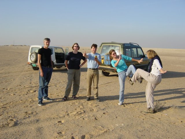
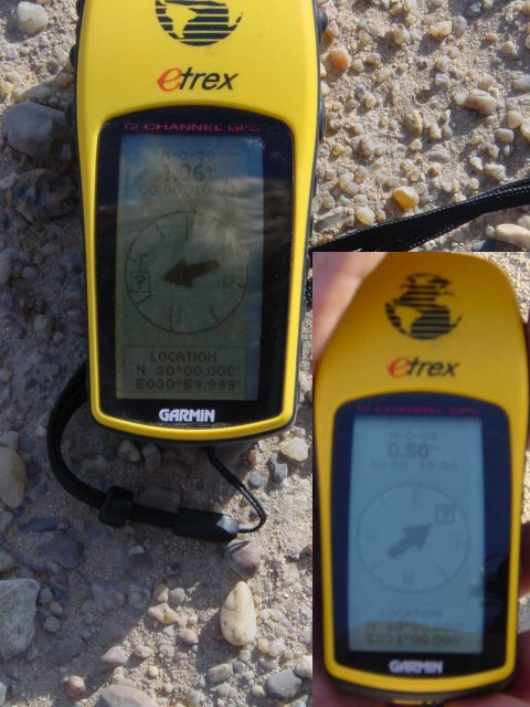
(visited by Christiaan Roelofs, Hans P, Mirjam W, Luuk S, Marlies N and Franske H) 24-Nov-2001 -- After our visit to 30°N 30°E on our way back to Cairo on the Baḥariyya road we decided to see if there was any other Confluence on our way. And there actually was one: 30°N 31°E. It turned out that the road to this second Confluence was basically the road to Cairo itself, what luck! To reach the exact point we had to cross a kind of garbage dump on the edge of some real estate projects, but the actual point was ok! On the second picture you can see a suburb of 6th of October City, one of the satellite cities around Cairo. These cities are built in the desert around Cairo to release the pressure on Cairo and its valuable agricultural resources. Of course we also made a group as well as a GPS picture. |
| All pictures |
| #1: The Confluence! #2: 6th of October City on the horizon. #3: An argument over who can be the closest to the Confluence! #4: A bit vague, but...! ALL: All pictures on one page |