|

Cape Verde
24.0 km (14.9 miles) WSW of Porto do Rincão, Ilha de São Tiago, Cape Verde
Approx. altitude: 0 m
(0 ft)
([?] maps: Google MapQuest OpenStreetMap ConfluenceNavigator)
Antipode: 15°S 156°E
Accuracy: 15 m (49 ft)
Quality: good
Click on any of the images for the full-sized picture.


| 15°N 24°W (visit #1) |
![Visit #2: [04-Jan-19]](/cv/all/n15w024v2/preview.jpg "Visit #2: [04-Jan-19]")

(visited by Captain Peter, Valentyn Smirnov, Volodymyr Kokorev and Volodymyr Sydorenko) 19-Apr-2002 -- Now the time has come to discover a new country, the Cape Verde Islands, a wonderful offshore paradise of whom we are now trying to visit a point. The Republic of Cape Verde lies about 385 nautical miles (715 km) West of the African Continent and consists of 10 islands and five islets, which can be divided into two groups known locally as: BARLAVENTO (Windward) GROUP with the Islands Sal, Bõavista, São Nicolau,
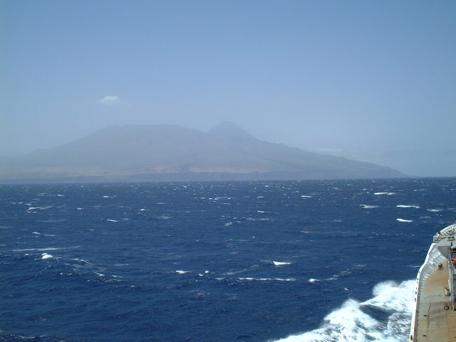
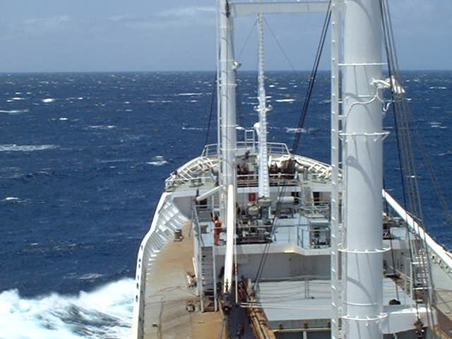
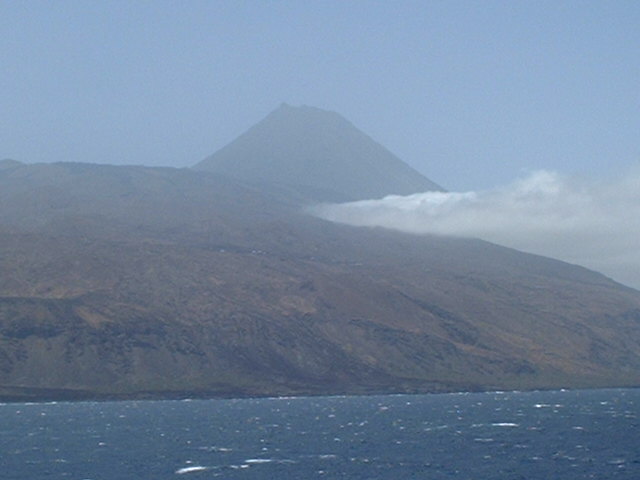
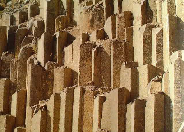
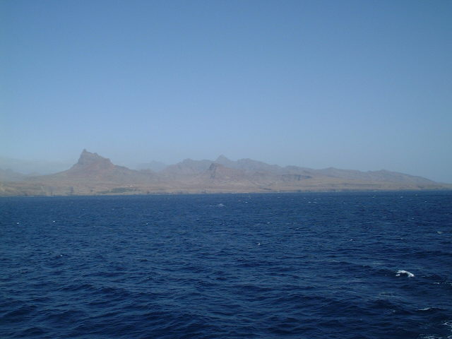
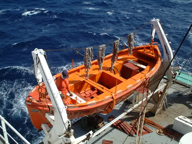
Santa Luzia, São Vicente and Santo Antão, and the The total population of the Cape Verde Islands is about 400,000, since the mid 70-ies it increased considerably due to immigration from Angola. The islands were uninhabited when discovered in 1460 by Diego Gomos, and the first settlers arrived in 1462. In the latter part of the fifteenth century and the commencement of the sixteenth century, they were colonized by the Portuguese by means of slaves obtained from the neighboring coast of Africa. The archipelago was administered by Portugal from 1587 and it became an independent republic in 1975. The islands are all mountainous and volcanic in origin. They are generally arid except in the valleys where there is luxuriant vegetation, especially in the rainy season. The climate is generally healthy, except for the raining season. The flora is tropical and comprises 70 species of wild flowers. There are a few baobab-trees. The fauna presents few distinct varieties. There are no wild animals or venomous reptiles, but there is a large lizard, elsewhere unknown. But it lives strictly on a vegetable diet. Fish and prawns are very plentiful, but some of these are poisonous. Mineral resources are salt, limestone, kaolin and pozzolana, a volcanic rock used in cement production. According to the GPS we were a 15.0 meters too much in the SW, on 14°59.992'N and 24°00.001'W at 16:12 hrs. Coming from the Brazilian coast, i.e. from South, we entered first the Sotavento-Group. From this Confluence two islands can be seen. In the West there is Ilha do Fogo ("Fire Island") in rather rough seas. Ilha do Fogo contains an active volcano. It is the loftiest island in the archipelago. The principal peak, the Cha das Caldeiras, is 2,829 m (9,281 ft) high. The most recent eruption was in 1951. On Fogo we can observe something very interesting: There are hexagonal basalt columns in several places on the shore, having formed themselves after eruptions from solidifying lava. How could that happen exactly? Well, basalt lava streams do reduce their volume when cooling off. During this process so called shrinkage gaps do develop. A part of these gaps are orientated vertically to the cooling-off surface and are thus dismantling the basalt lava into perfectly hexagonal columns. These basalt structures are of great importance for the science of paleomagnetism. It would not get us anywhere if I started now a long treatise about magnetism, but it is worth to know that in 1850 an Italian scientist, Macedonio Melloni, made an extraordinarily important discovery with basalt lava of the Vesuvio volcano near Naples. He found out, that the basalt lava had been magnetized during its cooling-off process in the direction of the Earth's magnetic field in these times. With samples of different ages he found out that these magnetizations show different directions. This fact led him to following two conclusions: In 1905 it has been found with samples of basalt from the French "Massif Central" that they were magnetized CONTRARY to the today's direction of Earth's magnetic field. And since then we know that the Earth's magnetic field has been and is still subject to reversals or pole changes (there have been three reversals within the last 4.5 million years). This enabled the scientists to gain many completely new insights into the processes in the interior of the Earth and even of its genesis. Ilha de Santiago lies E oft the confluence. It is the largest and most populous in the archipelago. With the capital of Cidade da Praia ("City of the Beach") it is the seat of the Republic's Government. Whilst we were visiting the Confluence, the crew continued with its favorite job - painting. -------------------------------------------------------- Recommended literature on the genesis of the Earth and magnetism: |
| All pictures |
| #1: Ilha de Santiago #2: GPS #3: Sotavento-Group #4: Ilha do Fogo #5: Rough seas #6: Cha das Caldeiras #7: Basalt columns #8: A seaman is giving the lifeboat a fresh touch ALL: All pictures on one page |
| Notes |
|
In the ocean |