|

France : Bretagne
3.1 km (1.9 miles) NE of Maxent, Ille-et-Vilaine, Bretagne, France
Approx. altitude: 100 m
(328 ft)
([?] maps: Google MapQuest OpenStreetMap ConfluenceNavigator)
Antipode: 48°S 178°E
Accuracy: 5 m (16 ft)
Quality: good
Click on any of the images for the full-sized picture.


")
![]()
| 48°N 2°W (visit #2) |
![Visit #12: [06-Jun-22]](/fr/all/n48w002v12/preview.jpg "Visit #12: [06-Jun-22]")
![Visit #10: [12-Jun-19]](/fr/all/n48w002v10/preview.jpg "Visit #10: [12-Jun-19]")
![Visit #11: [05-Jun-19]](/fr/all/n48w002v11/preview.jpg "Visit #11: [05-Jun-19]")
![Visit #9: [23-Dec-17]](/fr/all/n48w002v9/preview.jpg "Visit #9: [23-Dec-17]")
![Visit #8: [02-Sep-16]](/fr/all/n48w002v8/preview.jpg "Visit #8: [02-Sep-16]")
![Visit #7: [19-Jun-10]](/fr/all/n48w002v7/preview.jpg "Visit #7: [19-Jun-10]")
![Visit #6: [04-May-09]](/fr/all/n48w002v6/preview.jpg "Visit #6: [04-May-09]")
![Visit #4: [31-Aug-05]](/fr/all/n48w002v4/preview.jpg "Visit #4: [31-Aug-05]")
![Visit #3: [16-Mar-04]](/fr/all/n48w002v3/preview.jpg "Visit #3: [16-Mar-04]")
![Visit #5: [15-Sep-03]](/fr/all/n48w002v5/preview.jpg "Visit #5: [15-Sep-03]")
![Visit #1: [08-Jun-00]](/fr/all/n48w002/preview.jpg "Visit #1: [08-Jun-00]")
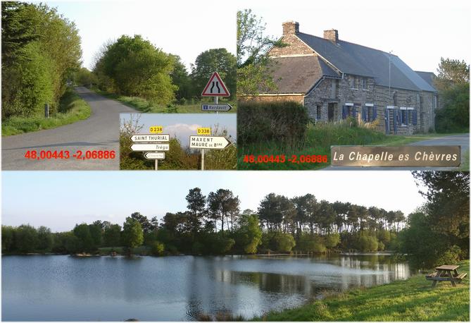
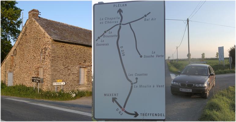
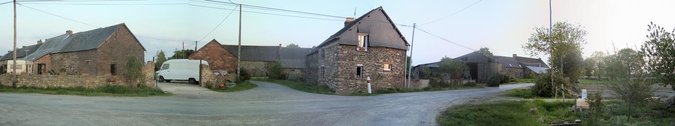
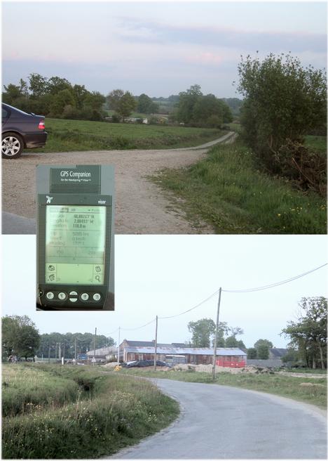
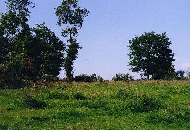
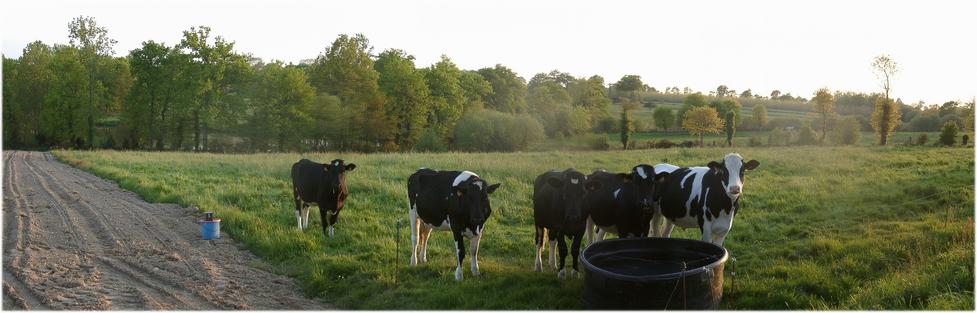
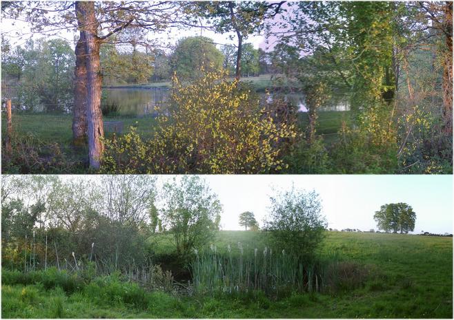
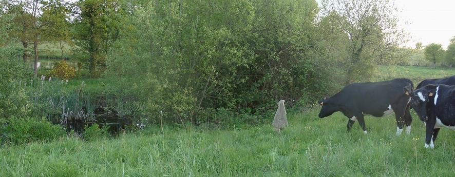
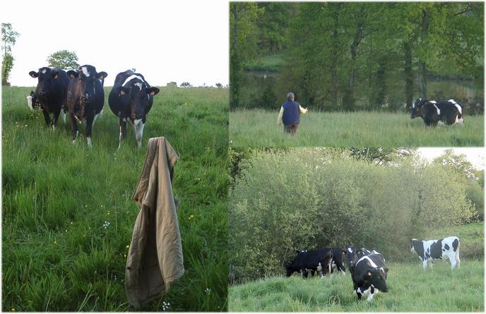
 (visited by Hans Augdoppler) 04-May-2002 -- I’ll never forget this CP - see below. This point is easy to reach. I used the N24 in direction Rennes and left it at Plélan-le-Grand (48,0281N 2,0879W). Then I continued on the secondary road D238 (48.0025N 2.0848W) towards the east, direction of Saint-Thurial [pic#2.jpg]. I passed a leisure area with a lake to the south. Then carried on towards ‚La Chapelle es Chevres’ (48,0022N 2,0335W). When I approached a farm village I had already passed the CP. Therefore I went back to a junction in a left-hand bend (48,0026N 2,0041W) and then to the east along a bumpy farm track. Finally I stopped under a big tree (see pict.3 of the visitor #1) and saw a pasture towards the south with ponds in the background. The cows seemed to be familiar with people and immediately came to the electrical fence to examine the visitor. Then I went down along the field to the brook. There I had to overcome the fence without getting hit by a high voltage pulse. A big fish pond is on the southern side of the brook, while a small one to the north. The animals were curious about my activities while I marked the CP at the northern shore of the pond with stick and jacket. I was in a hurry to shoot the photos in spite of sunset. Additionally I had to pay attention that the cattle did not use my jacket as food. On the way back to the car (farm track) the female farmer arrived with a motorbike and she spoke to the cows – therefore the friendly and trustful behaviour of them. The farmer was very kind although she for certain didn't understand my intentions. Unfortunately, she didn’t like to be photographed -- she isn't dressed well enough - a very common problem ;-) I stopped at the junction and made photos and took the coordinates on the way back. Also I shot some photos of the farmer village and then continued the journey in direction Saint-Thurial. While searching for an overnight stay place I missed the Organizer with GPS. I immediately turned back the 8 km to the junction, the last use of the device. I probably had left it at the car roof. I searched more than an hour along the roadsides without any result. At the beginning of the darkness I accepted the loss of ~ € 500. - , cancelled my further plans and made me on the way home to Austria. Map in pic#7 © MapPoint Europe http://www.microsoft.com; For more information see: http://linz.orf.at/gast/augdoppl/Confluence/Main.htm |
| All pictures |
| #1: Confluence marked with jacket - view to SW #2: Access route along the D238 with recreation area #3: Crossing La Chapelle es Chevres #4: View to CP dir. SW from farm track #5: CP area with ponds #6: Cows at CP with farmer #7: Map with GPS reading #8: from D238 to farm track (lost GPS) #9: Farming village nearby ALL: All pictures on one page |