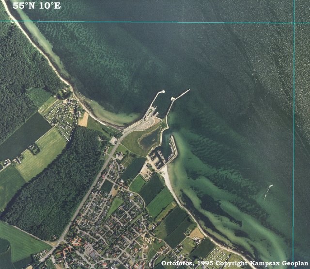
|
Denmark
2.1 km (1.3 miles) NNE of Fynshav, Sønderjylland, Denmark
Approx. altitude: 0 m
(0 ft)
([?] maps: Google MapQuest OpenStreetMap ConfluenceNavigator)
Antipode: 55°S 170°W
Accuracy: 5 m (16 ft)
Quality: good
Click on any of the images for the full-sized picture.
| 55°N 10°E |

(visited by Wolfgang Vogel and Silke Heilig) 18-May-2002 -- Whitsuntide 2002, the time for our traditional meeting with good old friends at a private small beach of the Baltic sea in Denmark. Our inflatable boat at hand we watched the map and, oh what a surprise, there is a confluence not far away and unvisited because of lying in the water. This is our aim. Sunny weather above, some people watching our preparations beside and the fairway of a ferry ahead we started canoing the 1.3 km distance to the confluence. No wind and only some waves coming from crossing motorboats made the tour an easy one. Arriving just a quarter of an hour after our start the finetuning went like this: Wolfgang adjusted the course and Silke gave the direction and took the pictures from the front of the raft. No special incidents made this trip a very nice one. Fortunately we did not go overboard because the Baltic sea was only 16 °C "warm". |
| All pictures |
| #1: South #2: West #3: North #4: East #5: GPS #6: Silke & Wolfgang ALL: All pictures on one page |
| Notes |
|
Aerial view of an offshore confluence:  |


