|

South Africa : Limpopo
5.7 km (3.5 miles) E of Ga-Molekana, Limpopo, South Africa
Approx. altitude: 1245 m
(4084 ft)
([?] maps: Google MapQuest OpenStreetMap ConfluenceNavigator)
Antipode: 24°N 151°W
Accuracy: 5 m (16 ft)
Quality: good
Click on any of the images for the full-sized picture.


| 24°S 29°E (visit #1) |
![Visit #4: [02-May-09]](/za/all/s24e029v4/preview.jpg "Visit #4: [02-May-09]")
![Visit #2: [03-Dec-02]](/za/all/s24e029v2/preview.jpg "Visit #2: [03-Dec-02]")
![Visit #3: [08-Dec-04]](/za/all/s24e029v3/preview.jpg "Visit #3: [08-Dec-04]")
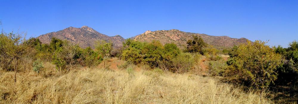
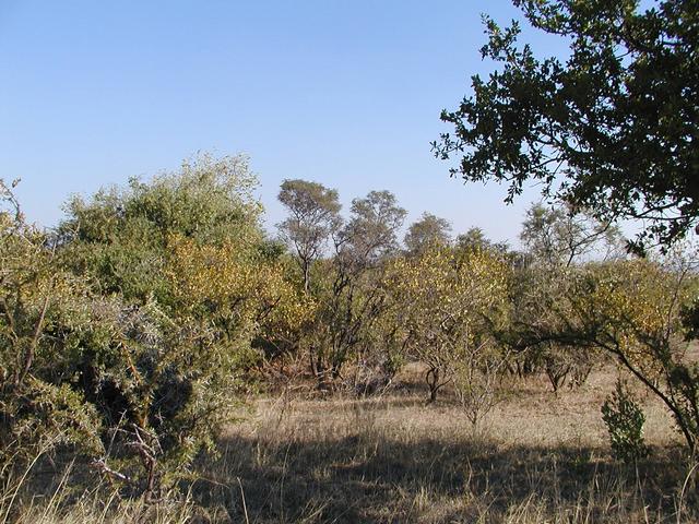
 (visited by Johan Meyer, Ina Meyer and Stéfan Meyer) 19-May-2002 -- From the 1:1,500,000 map that I used and my recollection of the area, this Confluence looked to be fairly close to the road in an area that appeared to be flat ground with surrounding rock outcroppings. We entered the town of Potgietersrus and took the road heading North-West towards Marken and the Botswana border with South Africa. We approached the Confluence about 15 km outside Potgietersrus. The road we were on made a sharp turn and headed west, away from the area we were looking for. We started to look for roads that would lead us closer to the point we were aiming at. We found a gravel road not indicated on the map, that seemed to head in the general direction of the Confluence. There was a very high game fence to the east of us, fencing in what was obviously a very large game farm. As the gravel road wound through the bush and rock outcroppings, I was hoping that the Confluence would not be located inside the game farm as it was likely that the gate to the property was miles away on the other side of the farm from where we were. The idea of traipsing around in the bush with buffalo, rhino and possibly elephant around didn’t appeal to my sense of comfort either. I wasn’t even sure whether the owner of the farm would give us permission to cross his land when we may have to abandon existing roads. It turns out there was no need to worry. The road made a sharp turn to the East and took us to a point within 700 metres of the coordinates we were aiming at. It was clear that I was not going to be able to walk directly to the point I was aiming at, as the area was covered by clumps of thick, thorny bush that was impossible to pass through. I took the camera, GPS and spare batteries and set off to find a path through the thorny bush. After a twenty minute search I found an opening in the bush, the sort made by warthogs as they run through the undergrowth on their way to and from watering holes. I had no choice but to crawl along the path on all-fours and sometimes on my stomach for about forty meters. The bush eventually opened out and I found I could walk relatively easily in the general direction of the coordinates. There was quite a lot of hoof-prints of smaller antelope. I came upon a female warthog with about six young. I tried to approach as quietly as possible, but I was slightly upwind and when they noticed me, they took off with a squeal and their characteristic tails waving comically in the air. I also saw a black-backed jackal trotting past sniffing the ground. I stood quite still next to a tree, and it passed within 10 yards of me, completely oblivious to my presence. This jackal is usually quite a rare sight in open bush during the middle of the day. It took about 45 minutes to find the point I was looking for, and once there I spent a bit of time letting the GPS settle as I wanted to get a spot-on reading. Picture 1 shows the view to the East with the magnificent rock outcropping in the background. Picture 2 shows the view to the South. Picture 3 and 4 show the western and northern views respectively. Picture 5 shows the GPS reading. Picture 6 shows the intrepid amblers posing in the setting sun. |
| All pictures |
| #1: Rock outcroppings to the East #2: View to the South #3: View to the West #4: View to the North #5: View of the GPS #6: The three intrepid amblers ALL: All pictures on one page |