|

Botswana : Kgalagadi
8.7 km (5.4 miles) WSW of Morwamotsu (Kweneng), Kgalagadi, Botswana
Approx. altitude: 1109 m
(3638 ft)
([?] maps: Google MapQuest OpenStreetMap ConfluenceNavigator)
Antipode: 24°N 157°W
Accuracy: 8 m (26 ft)
Quality: good
Click on any of the images for the full-sized picture.


| 24°S 23°E (visit #1) |
![Visit #3: [17-Nov-13]](/bw/all/s24e023v3/preview.jpg "Visit #3: [17-Nov-13]")
![Visit #2: [09-Dec-06]](/bw/all/s24e023v2/preview.jpg "Visit #2: [09-Dec-06]")

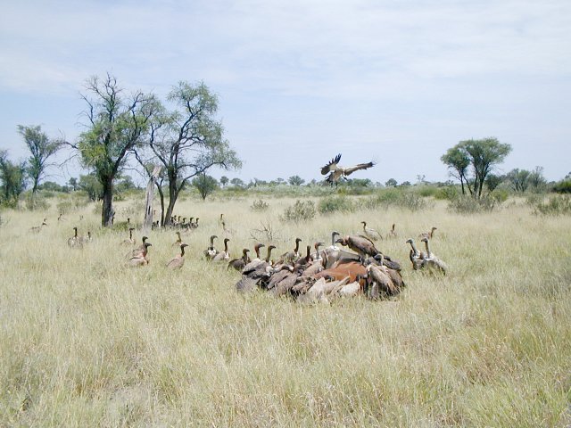
(visited by Jimmy Stone and Anita Pretorius) 04-Mar-2002 -- Our road map (scale 1:1,750,000) showed that the confluence point falls on the road but at this mapping scale anything is possible. When we got there we were disappointed to see that the confluence point lay about 1.7 km off the Trans-Kalahari Highway. We could not drive off-road very far because of the bush and walked about 1.5 km to the confluence point. At our return to the vehicle we continued to Ghanzi, in western Botswana. The lonely Trans-Kalahari Highway stretches about 800 km from the border with Namibia in the West, to the border with South Africa in the East. There are a lot of cattle, wild horses, donkeys, small buck, ostrich and other wildlife on the road and it is best not to travel at night. On our return journey we came across a huge gathering of vultures. We drove about 50 m off the road to investigate and found a dead horse. A truck probably hit it during the night. |
| All pictures |
| #1: East #2: North #3: West #4: South #5: GPS reading #6: Vultures on fresh roadkill ALL: All pictures on one page |