|

Namibia : Kunene
18.6 km (11.6 miles) N of Spitskop Pos, Kunene, Namibia
Approx. altitude: 1161 m
(3809 ft)
([?] maps: Google MapQuest OpenStreetMap ConfluenceNavigator)
Antipode: 20°N 165°W
Accuracy: 10 m (32 ft)
Quality: good
Click on any of the images for the full-sized picture.


| 20°S 15°E (visit #1) |
![Visit #5: [15-Dec-20]](/na/all/s20e015v5/preview.jpg "Visit #5: [15-Dec-20]")
![Visit #4: [25-Jul-09]](/na/all/s20e015v4/preview.jpg "Visit #4: [25-Jul-09]")
![Visit #3: [14-Jan-05]](/na/all/s20e015v3/preview.jpg "Visit #3: [14-Jan-05]")
![Visit #2: [23-Jul-03]](/na/all/s20e015v2/preview.jpg "Visit #2: [23-Jul-03]")

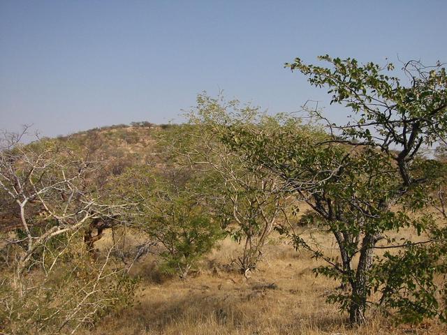
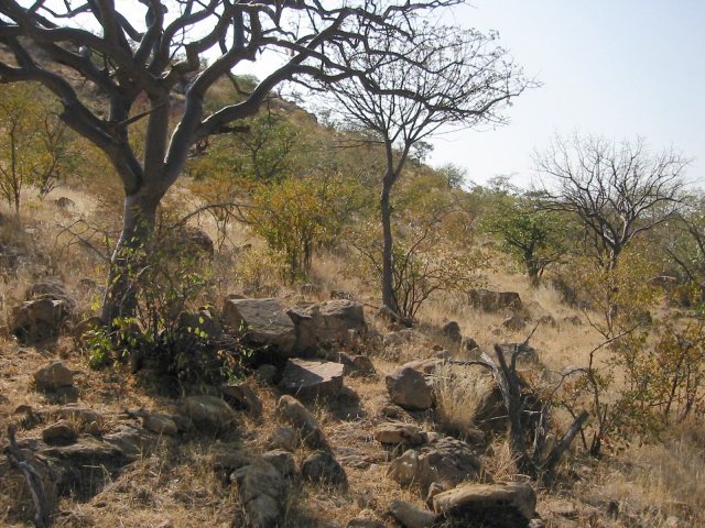
(visited by Steffen Eckert and Mario Uhlig) 04-Jul-2002 -- The main reason why we came to Namibia was that there were so many confluence points that have not been visited yet. OK, there are some minor other reasons, like watching all the wild animals and discovering Namibia's nature, but who really cares? The first confluence point we planned to visit was almost directly on the way from Waterberg-Plateau-Park to Etosha-Namutoni, almost. We figured out that the shortest distance from a small gravel road to the point was still more than 6 km, way too far to walk for us lazy people. So we decided to skip that point, while focusing on the next in our list, which seemed to be directly on the road C35, no matter which map we looked at. Three days later we left Khorixas in the early morning heading directly for 20S 15E and at least the two men of our four person group were very excited. The confluence point was supposed to be the main attraction for that day. How far would we go, if the point was not exactly on the road, was the discussion, while drawing nearer. But then came a pretty disappointing moment when the Garmin GPS told us, that the point was still at least 1.3 km off the road. While driving some hundred meters further, we noticed a small path, but suitable for our 4WD, leading towards the direction of the point. Since this was supposed to be the easiest point to reach, we decided: "Now or never, lets try the small path and see how far we can get." So we turned on all the four-wheel-drive-options of the car we could find and entered the path, while our two ladies (Kathrin Klein-Günther and Aleksandra Hum) became more and more sceptical about our efforts. But the driving turned out to be much easier than expected and we came up to 500 m close to our point. Mario and I decided to walk the rest and with the GPS, a compass, two cameras, two pocket-knifes and a bottle of water we were professionally equipped to start the adventure (although it was not a big adventure at all). Our ladies were a bit scared of possibly appearing lions, leopards, hyenas and snakes, but we decided to go anyway, one has to go in a risk to become famous. We started the hike and the worst problem we encountered turned out to be replacing the GPS's old batteries by new ones. The confluence point is located near a small hill and as one can see, the scenery is not really spectacular. But the view to the mountains in the south is still pretty good. On the stony ground only grass, bushes and some small trees are growing. Altogether the area looks rather peaceful than dangerous. After taking the necessary pictures, we returned to the car after 45 minutes, where our girls were waiting impatiently. So we've got the point, we had done our duty, the relaxing part of our journey could start. After taking some more pictures back at the car, we returned to the main road and headed for Sesfontein. |
| All pictures |
| #1: South #2: North-West #3: North-East #4: GPS #5: The four of us, #6: and our car. ALL: All pictures on one page |