|

France : Bretagne
2.5 km (1.6 miles) E of Ergué-Gabéric, Finistère, Bretagne, France
Approx. altitude: 42 m
(137 ft)
([?] maps: Google MapQuest OpenStreetMap ConfluenceNavigator)
Antipode: 48°S 176°E
Quality: good
Click on any of the images for the full-sized picture.


| 48°N 4°W (visit #3) |
![Visit #9: [03-Jun-22]](/fr/all/n48w004v9/preview.jpg "Visit #9: [03-Jun-22]")
![Visit #8: [25-Dec-17]](/fr/all/n48w004v8/preview.jpg "Visit #8: [25-Dec-17]")
![Visit #7: [02-Sep-16]](/fr/all/n48w004v7/preview.jpg "Visit #7: [02-Sep-16]")
![Visit #6: [26-Jun-10]](/fr/all/n48w004v6/preview.jpg "Visit #6: [26-Jun-10]")
![Visit #4: [07-Sep-08]](/fr/all/n48w004v4/preview.jpg "Visit #4: [07-Sep-08]")
![Visit #5: [07-Sep-01]](/fr/all/n48w004v5/preview.jpg "Visit #5: [07-Sep-01]")
![Visit #2: [23-Aug-01]](/fr/all/n48w004v2/preview.jpg "Visit #2: [23-Aug-01]")
![Visit #1: [26-Jul-01]](/fr/all/n48w004/preview.jpg "Visit #1: [26-Jul-01]")

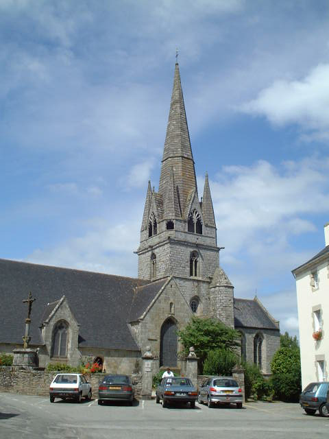
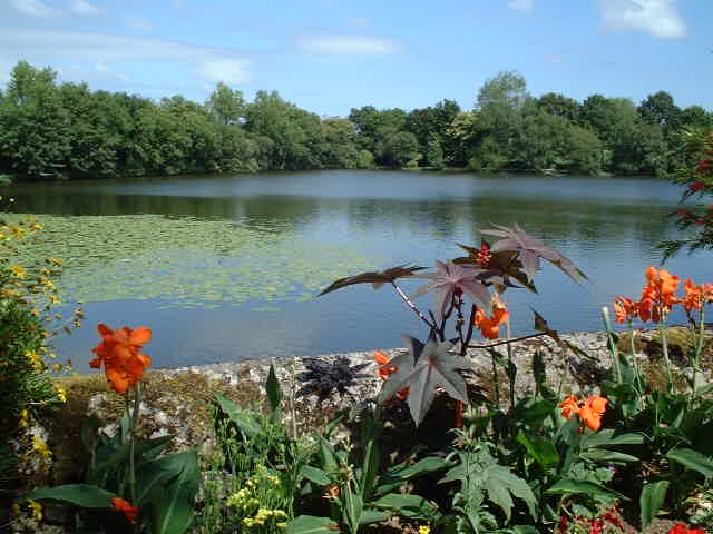
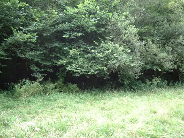
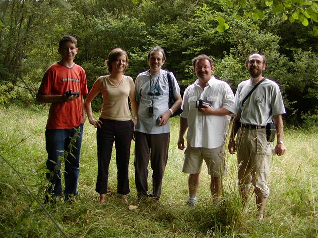
(visited by Captain Peter, Werner Furlan, Thomas Prettner, David Roth and Anika Reuner) 27-Jul-2002 -- Actually my ship is berthed in the port of Lorient in Brittany, in order to load turkey, chicken and various meat products for St. Petersburg (Russia). As Lorient has excellent high speed train connections to Central Europe, I received a bunch of visitors, - Werner, Thomas and David from Western Austria, and Anika from Germany. Loading did not take place on weekend, and so we had a lot of time. Although all confluences ashore in France are already visited, we decided to see the closest one to Lorient, 48°N 4°W. At Lorient we took a rent-a-car, and drove on the express-route N165 in direction Quimper. At Quimperlé we left it and took the D765 via Bannalec to Rosporden. At Rosporden there is a cathedral from the 14th century, built in Gothic style and situated on a lake. From there we continued until Elliant and took the D115 in direction Ergué-Gabéric. A 2,5 km before we stopped the car at the closest possible position to the confluence. The white horses were there, but they were friendly or rather not interested in us, as they understood soon that we could not supply them any food. The confluence itself is located at the Southern end of the horses' field, just were the forest begins. We were equipped with three GPS but due to the weak signal close to the confluence our opinions about the exact location were diverging. So Captain Peter, as usual, had to take the final decision. The confluence seems to be very close (or even inside) to a small river. After having taken the views to North, East, South and West, we took a picture of the whole group. |
| All pictures |
| #1: View to the North #2: GPS #3: Rosporden Cathedral #4: Lake at Rosporden #5: White horses #6: Small river at the confluence #7: View to the East #8: View to the South #9: View to the West #10: From left to right: David Roth, Anika Reuner, Captain Peter, Thomas Prettner, Werner Furlan ALL: All pictures on one page |