|
Russia : Respublika Tatarstan
3.8 km (2.4 miles) NW of Starye Chelny, Respublika Tatarstan, Russia
Approx. altitude: 134 m
(439 ft)
([?] maps: Google MapQuest OpenStreetMap ConfluenceNavigator)
Antipode: 55°S 130°W
Accuracy: 10 m (32 ft)
Quality: good
Click on any of the images for the full-sized picture.
| 55°N 50°E (visit #3) | (secondary) |
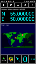
 (visited by Mikhail Romashov and Irina Romashova) 15-Июня-2019 – Продолжение после 54°N 51°E. Возвращаясь из Самары, мы по пути решили посетить точку пересечения координат около деревни Каргополь. На машине ехать к точке рекомендую только в сухую погоду. Полевые дороги из хорошего жирного чернозёма в слякоть превратятся в смесь мыла с пластилином. Заезжать рекомендую через улицу Школьная посёлка Каргополь. в её конце начинается грунтовка, которая ведёт в обход оврага и в сухую погоду доступна любой пузотёрке. Если поедете через центральную улицу Мостовую, то не доезжая пару километров до точки, упрётесь в небольшой брод, преодолимый только внедорожниками. Сама точка находится в поле и накатанных дорог к ней нет, но трава сохраняла следы предыдущих искателей и по ним можно примерно сориентироваться. Лично я не смог найти подъезд ближе 600 метров и пошёл пешком, но в реальности можно приехать прямо на точку. 15-Jun-2019 – Continued after 54°N 51°E. Returning from Samara, on the way we decided to visit the degree confluence point near the village of Kargopol. By car, I recommend to go to the point only in dry weather. Field roads from good fat chernozem [black soil] usually turn into a mixture of soap and clay in wet weather. I recommend to use Shkolnaya [School] street in Kargopol village . At its end, a gravel road begins, which leads around the ravine and in dry weather is passable on any vehicle with low clearance. If you drive through the main street (named Mostovaya) then before reaching a couple of kilometers from the CP, you will come to a small ford, surmounted only by off-road vehicles. The point itself is in the field and there were no visible roads to it, but the grass has retained the traces of previous seekers, and we had an opportunity to navigate over them. Personally, I could not find an entrance closer than 600 meters and went on foot, but in reality you can drive straight to the confluence. |
| All pictures |
| #1: #2: #3: #4: ALL: All pictures on one page |


![Visit #2: [01-Aug-06] Visit #2: [01-Aug-06]](/ru/all/n55e050v2/preview.jpg)
![Visit #1: [31-Aug-02] Visit #1: [31-Aug-02]](/ru/all/n55e050/preview.jpg)