|
Canada : Alberta
10.0 km (6.2 miles) NE of Lothrop, AB, Canada
Approx. altitude: 583 m
(1912 ft)
([?] maps: Google MapQuest OpenStreetMap topo topo250 ConfluenceNavigator)
Antipode: 56°S 62°E
Accuracy: 20 m (65 ft)
Quality: good
Click on any of the images for the full-sized picture.
| 56°N 118°W (visit #2) |
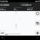
 (visited by Sacha Peter) 24-Jul-2020 -- My travels took me out to Northern Alberta, so while I was on the way, I decided to search for a couple confluences that seemed easy. This point had only been visited 20 years ago in Winter. To get to this point, off of Alberta Highway 2, turn onto township road 820, and make your way to Range Road 10. The weather had been warm and mostly dry and there weren't any issues with getting to this point. There was zero other vehicles. Although Google Satellite has it about 20 meters away from the road, I just parked on the road and snapped the pictures. The farm on the east (where the confluence is) was clearly marked with "no trespassing". |
| All pictures |
| #1: 56N118W North #2: 56N118W East #3: 56N118W South #4: 56N118W West #5: Culvert near confluence #6: No Trespassing #7: GPS ALL: All pictures on one page |


![Visit #1: [01-Feb-00] Visit #1: [01-Feb-00]](/ca/ab/n56w118/preview.jpg)