|
Lithuania
3.9 km (2.4 miles) SSE of Drąsučiai, Šiauliai, Lithuania
Approx. altitude: 101 m
(331 ft)
([?] maps: Google MapQuest OpenStreetMap ConfluenceNavigator)
Antipode: 56°S 157°W
Accuracy: 3 m (9 ft)
Quality:
Click on any of the images for the full-sized picture.
| 56°N 23°E (visit #5) | (secondary) |
 (visited by Rainer Mautz and Elionora) 24-Sep-2020 -- The story continues from 56°N 22°E. We reached this confluence point on day #45 on our leg from Kuršėnai to Šiauliai of our hiking trip to St. Petersburg.The confluence is located 5 km east of the town Kuršėnai and just 500 m north of the motorway A11 on an agricultural field. The confluence can be easily accessed from a little road that runs about 400 m west of the point. At the time of the visit, the field had been ploughed already and was without any vegetation. The confluence was so conveniently located on our hiking route, that Elionora even decided to join the little excursion and get her first Lithuanian confluence point completed. After the visit, it took us all day to reach the city of Šiauliai, where we spent the night. A summary of the trip can be found here
CP Visit Details:
The story finishes at 56°N 24°E. |
| All pictures |
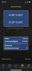
| #1: The Confluence from 20 m Distance #2: View to the South #3: View to the West #4: View to the North #5: View to the East #6: GPS Reading #7: Ground Zero #8: The Confluence Hunters ALL: All pictures on one page |


![Visit #6: [06-Aug-24] Visit #6: [06-Aug-24]](/lt/all/n56e023v6/preview.jpg)
![Visit #4: [03-Aug-16] Visit #4: [03-Aug-16]](/lt/all/n56e023v4/preview.jpg)
![Visit #3: [29-Jul-16] Visit #3: [29-Jul-16]](/lt/all/n56e023v3/preview.jpg)
![Visit #1: [23-Aug-01] Visit #1: [23-Aug-01]](/lt/all/n56e023/preview.jpg)
![Visit #2: [06-Sep-10] Visit #2: [06-Sep-10]](/lt/all/n56e023v2/preview.jpg)