|
France : Bretagne
3.1 km (1.9 miles) NE of Maxent, Ille-et-Vilaine, Bretagne, France
Approx. altitude: 100 m
(328 ft)
([?] maps: Google MapQuest OpenStreetMap ConfluenceNavigator)
Antipode: 48°S 178°E
Accuracy: 10 m (32 ft)
Quality: good
Click on any of the images for the full-sized picture.
| 48°N 2°W (visit #11) |
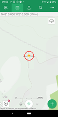
 (visited by David Williams) 05-Jun-2019 -- A very pleasant drive through Northern France - remarkably green and rural. This confluence is in a field, very recently planted with maize - June seems a bit late - but I am guessing this is for fodder and not a corn crop. In the summer - not a challenge, I bet it is very muddy after rain. I am in France for the D-Day 75 commemoration. My Uncle landed on Gold Beach, second wave, H-Hour+1 and his platoon made it furthest inland of any group that day. |
| All pictures |
| #1: The Confluence Point #2: View Looking North #3: View Looking East #4: View Looking South #5: View Looking West #6: All the Zeros #7: Looking from the road toward the confluence #8: Young maize plants ALL: All pictures on one page |


![Visit #12: [06-Jun-22] Visit #12: [06-Jun-22]](/fr/all/n48w002v12/preview.jpg)
![Visit #10: [12-Jun-19] Visit #10: [12-Jun-19]](/fr/all/n48w002v10/preview.jpg)
![Visit #9: [23-Dec-17] Visit #9: [23-Dec-17]](/fr/all/n48w002v9/preview.jpg)
![Visit #8: [02-Sep-16] Visit #8: [02-Sep-16]](/fr/all/n48w002v8/preview.jpg)
![Visit #7: [19-Jun-10] Visit #7: [19-Jun-10]](/fr/all/n48w002v7/preview.jpg)
![Visit #6: [04-May-09] Visit #6: [04-May-09]](/fr/all/n48w002v6/preview.jpg)
![Visit #4: [31-Aug-05] Visit #4: [31-Aug-05]](/fr/all/n48w002v4/preview.jpg)
![Visit #3: [16-Mar-04] Visit #3: [16-Mar-04]](/fr/all/n48w002v3/preview.jpg)
![Visit #5: [15-Sep-03] Visit #5: [15-Sep-03]](/fr/all/n48w002v5/preview.jpg)
![Visit #2: [04-May-02] Visit #2: [04-May-02]](/fr/all/n48w002v2/preview.jpg)
![Visit #1: [08-Jun-00] Visit #1: [08-Jun-00]](/fr/all/n48w002/preview.jpg)