|

South Africa : Western Cape
5.8 km (3.6 miles) NW of Knysna, Western Cape, South Africa
Approx. altitude: 44 m
(144 ft)
([?] maps: Google MapQuest OpenStreetMap ConfluenceNavigator)
Antipode: 34°N 157°W
Accuracy: 400 m (437 yd)
Quality: good
Click on any of the images for the full-sized picture.


| 34°S 23°E (visit #1) | (incomplete) |
![Visit #4: [03-Jan-21]](/za/all/s34e023v4/preview.jpg "Visit #4: [03-Jan-21]")
![Visit #3: [18-May-09]](/za/all/s34e023v3/preview.jpg "Visit #3: [18-May-09]")
![Visit #2: [07-Mar-02]](/za/all/s34e023v2/preview.jpg "Visit #2: [07-Mar-02]")

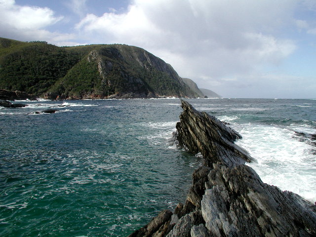
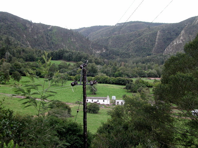
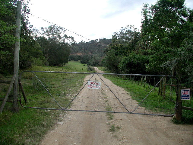
(visited by David Guier and Iwona Wasilewska) 04-Sep-2001 -- On September 4, 2001, intrepid travelling companion Iwona Wasilewska and I continued our search for South African Confluences. Driving along highway N2 west towards Mossel Bay we passed over the Storm River, which designates the beginning of the so-called Garden Route, renowned for its robust flora and fauna. About 75 kilometres from our last captured Confluence we turned north away from the Indian Ocean at the city of Knysna, following our GPS toward 34°S 23°E. This led to a series of paved and dirt roads snaking ever north until we came to a dead end with the GPS reporting the Confluence another 2.2 kilometres hence. Not ones to give up so easily, we retraced our path back to N2, turned west and approximately 5 kilometres down the road made another sortie north. Up into the heavily forested mountains we drove along one road, then another until we came to a ridge with the GPS reporting the Confluence down into a little valley 400 metres hence. Retracing our path back to the base of the ridge, we turned onto a little dirt road which led us up to a gate clearly marked – NO ENTRY. Unlike at the last Confluence, there were no local farmers right there to grant us access to the little valley and the Confluence located there. I had hoped to try to capture one more Confluence on that day but it was getting late. We were fairly content at having captured one Confluence, having come within 400 meters of another, and having set our eyes on that day on some of the most spectacular scenery you’d find anywhere in the world... |
| All pictures |
| #1: Confluence 34°S 23°E down there 400 metres #2: Mouth of Storm River #3: Flora #4: Fauna #5: No entry #6: No cigar ALL: All pictures on one page |