|

Italy : Sicilia
3.5 km (2.2 miles) ENE of Carpinteri, Siracusa, Sicilia, Italy
Approx. altitude: 486 m
(1594 ft)
([?] maps: Google MapQuest OpenStreetMap ConfluenceNavigator)
Antipode: 37°S 165°W
Quality: good
Click on any of the images for the full-sized picture.


| 37°N 15°E (visit #2) |
![Visit #11: [17-Feb-20]](/it/all/n37e015v11/preview.jpg "Visit #11: [17-Feb-20]")
![Visit #10: [25-Apr-17]](/it/all/n37e015v10/preview.jpg "Visit #10: [25-Apr-17]")
![Visit #9: [12-Oct-11]](/it/all/n37e015v9/preview.jpg "Visit #9: [12-Oct-11]")
![Visit #8: [26-Apr-11]](/it/all/n37e015v8/preview.jpg "Visit #8: [26-Apr-11]")
![Visit #7: [29-Mar-10]](/it/all/n37e015v7/preview.jpg "Visit #7: [29-Mar-10]")
![Visit #5: [14-Oct-05]](/it/all/n37e015v5/preview.jpg "Visit #5: [14-Oct-05]")
![Visit #4: [25-Oct-04]](/it/all/n37e015v4/preview.jpg "Visit #4: [25-Oct-04]")
![Visit #3: [22-Nov-02]](/it/all/n37e015v3/preview.jpg "Visit #3: [22-Nov-02]")
![Visit #1: [13-Aug-01]](/it/all/n37e015/preview.jpg "Visit #1: [13-Aug-01]")
![Visit #6: [05-Apr-07]](/it/all/n37e015v6/preview.jpg "Visit #6: [05-Apr-07]")

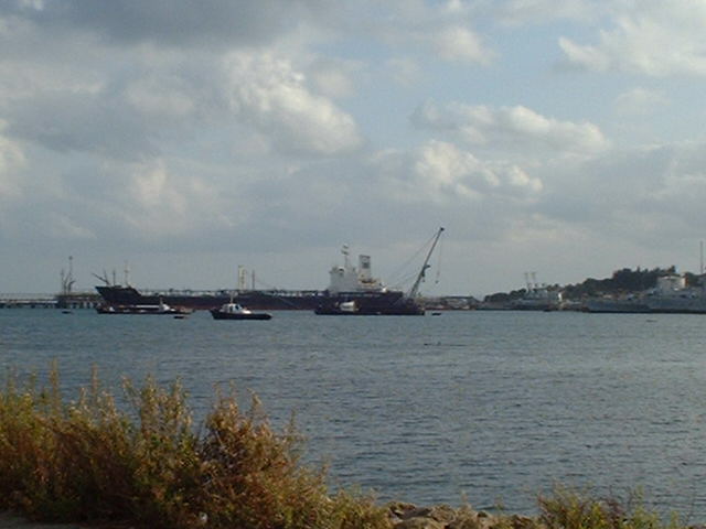
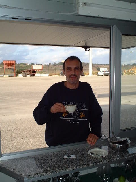
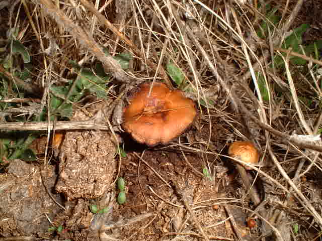
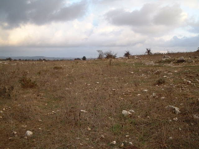
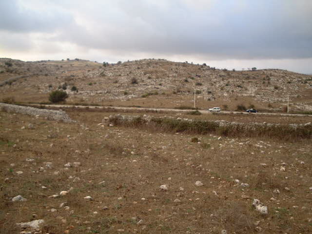
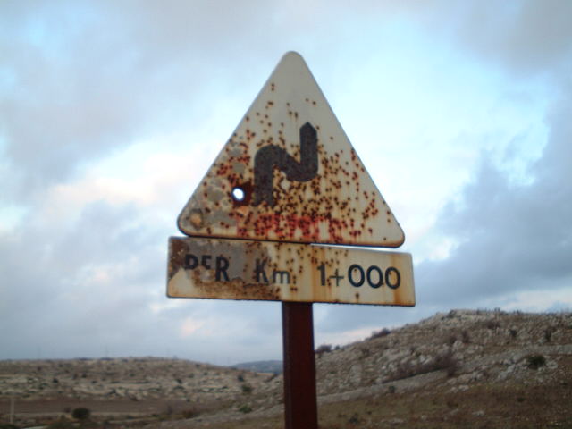
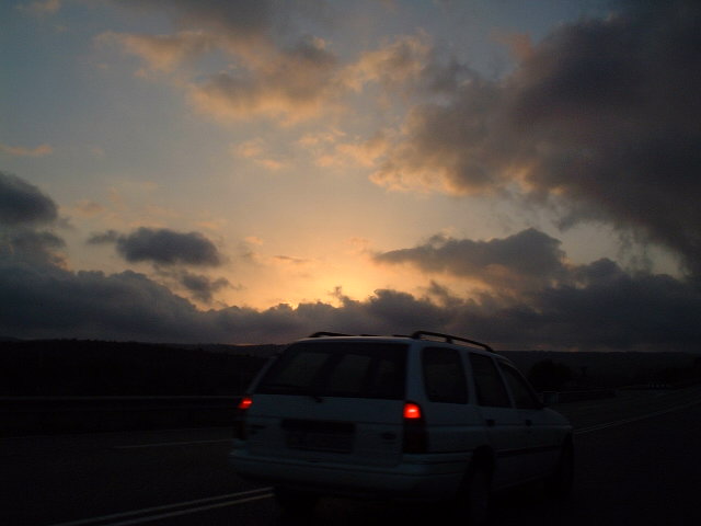
(visited by Captain Peter) 16-Nov-2001 -- At 1400CET I left my home in Taormina by car, to visit again my first successful CP. I took the Highway route A18 to Catania, passing the already a little bit snow capped volcano Mount Etna. From there I followed for a 30 km an Ambulance car of the nearby US Air Force Base of Sigonella. When passing Augusta, Southern Italy's most important terminal for crude oil and refining industry, I decided just to have a look whether there is a ULCC (Ultra Large Crude Oil Carrier) in port, but the last one had just left a two days ago. So there was only a medium size tanker available. In the Harbor-Bar I had a nice coffee before proceeding to the Point near the small town of Canicattini Bagni. As I was familiar with the area from my former visit, I found the point without any difficulties. As there has been sporadic rainfall during the last weeks, all looks a bit greener than in August. Even mushrooms are growing now. This time I attach views towards East and West. The Geocache in position 37°00.009N and 15°00.009E was no longer there. Most probably a farmer has found it and taken away. Otherwise all is as usual, the rusty road sign is still not changed. Things take time in Sicily and everything has to be abundantly discussed prior to take decisions and actions. At sunset I left this nice place and drove back to my home. 16-Nov-2001 -- Partii da Taormina alle hh 1400 per visitare un'altra volta il mio primo punto d'intersezione visitato con successo. Presi l'autostrada A18 per Catania, passando l'Etna già coperto con un po' di neve. Da Catania seguii per km 30 un'ambulanza degli AFI proveniente da Sigonella. Passando Augusta, decisi di fare un salta là per vedere se non ci fosse una superpetroliera in porto. Sfortunatamente l'ultima grande nave era partita due giorni fa. Era disponibile solo una petroliera a dimensioni modeste. Prima di proseguire al punto vicino di Canicattini Bagni avevo un bel cappuccio nel bar del porto. Già conoscendo la strada arrivai al punto senza delle difficoltà. Siccome c'era un po' di pioggia durante gli giorni scorsi tutto è un po' più verde dell'agosto. Stanno crescendo magari dei funghi. Questa volta allego le viste verso Est ed Ovest. Il Geocache in posizione 37°00.009N e 15°00.009E non c'era più. Molto probabilmente qualche contadino se l'aveva mangiato. Tutte le altre condizioni sono inalterate, c'è ancora il segno stradale rugginoso. Le cose vogliono tempo in Sicilia e prima di decidere e realizzare qualcose tutto dev'essere discusso a fondo. Al tramonto del Sole lasciai quel posto bello e tornai a casa. |
| All pictures |
| #1: View to the East #2: Ambulance encountered on the way #3: Tanker in Augusta #4: Peter getting coffee in Augusta #5: Mount Etna #6: GPS #7: View to the West #8: Confluence Mushrooms #9: Nearby road sign #10: Sunset ALL: All pictures on one page |