|
Canada : British Columbia
29.5 km (18.3 miles) SE of Salmo, BC, Canada
Approx. altitude: 1966 m
(6450 ft)
([?] maps: Google MapQuest OpenStreetMap topo topo250 ConfluenceNavigator)
Antipode: 49°S 63°E
Accuracy: 5 m (16 ft)
Quality: good
Click on any of the images for the full-sized picture.
| 49°N 117°W (visit #4) |

(visited by Dave Patton) In 2001, while processing Brian Butler's visit to
60°N 102°W
I became aware of the
BoundaryPoint
group, where people discuss political boundaries, and points where multiple
political divisions meet(e.g countries, states, provinces, counties, etc.).
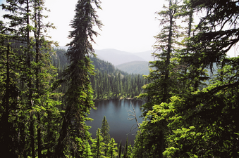
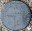
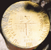
In 2002, while planning a 'confluence hunting trip' I had noticed that 49°N 117°W was near the 'tripoint' where the boundary between the states of Idaho(ID) and Washington(WA) meets the Canada/USA border at British Columbia(BC). My visit to 49°N 117°W on that trip ended as incomplete, and I didn't try to find the BCIDWA tripoint. In 2004, in preparation for another attempt to visit 49°N 117°W, I did some further research on the location of the BCIDWA tripoint. My research, and information provided by others, is documented in this message thread from the BoundaryPoint group. On July 15, 2004 I left Vancouver, B.C. and drove East. 9 hours 20 minutes and 720 kilometers later, I was at the summit of Kootenay Pass(the highest year-round highway pass in Canada), on highway 3, between Salmo and Creston. The first visitors mention initially trying a logging road that was blocked by snow, and on the map from visit #3 you can see that the skiing route initially followed this same road. The road is called Stagleap Forest Service Road, and starts at highway 3, immediately to the West of the maintenance yard, as shown in the Ripple Ridge Cabins info I provided with the narrative for my prior attempt. On the topographic map and landsat image the start of this road is marked by the "START" waypoint. From highway 3, I drove up the Stagleap FSR. There are signs at the start that the road has been deactivated, and is not maintained. I have a 4-wheel drive truck, and didn't have any problems getting up the road, but of course there was no snow. At the crest of the road is a sign for the boundary of Stagleap Provincial Park, as well as the sign for the Ripple Ridge Trail. A little further along the road is the short trail to the Ripple Ridge Cabin. I parked there, and walked a short distance to the new cabin - the old cabin has been demolished. The cabin is quite nice, and has a nice view. After walking back to my truck, I proceeded downhill from this point on the road. There has been recent logging activity in the area, so this downhill road was in much better condition than the uphill portion, and may in fact not even be considered to be Stagleap FSR. I continued downhill, passing a branch road to the East labelled Spur #15. Eventually, after passing through numerous water bars, and shortly after passing under the power lines, I met up with a 'main' gravel road. The road I had just descended was labelled Spur #14. I believe this 'main' gravel road is Monk Creek FSR. I turned right(to the West) on this main road, following it towards Ripple Mountain. After passing under the power lines twice more, and heading uphill, I turned left onto a rougher road that had signs indicating it had been deactivated. If you miss this turnoff you will soon come to a crest on the 'main road', and start heading downhill. A "deavtivated" forest service road is a gravel road where there is usually no maintenance, and manmade structures such as bridges and culverts have been removed. In their place are 'cross-ditches' or 'water bars' to allow water, whether it be streams or runoff from rain or melting snow, to flow across the road, rather than randomly along the road, which tends to washout the roads. It was almost 7:30PM by this time, so I didn't have any plans to get to the confluence today, but I wanted to check out the area before camping for the night. I drove past one junction with a road that headed south, and continued towards the East. Just before a fork in the road I came to a fairly deep dip in the road, where there used to be a bridge over a stream. This is, I believe, the location of the "raging mountain stream" mentioned by the first visitors. There wasn't much water in the stream, so I was able to drive through the dip, using 4 wheel drive in low range. At the fork in the road, the branch to the left heads uphill and ends at a clearing. The branch to the right heads slightly downhill, and then is blocked by a tree that has fallen across the road. I walked down that road until it also ended. I then drove back to the first junction on this deactivated road system, and turned South. The road comes to a point where it becomes overgrown. I parked my truck at this point, and made camp for the night.16-Jul-2004 -- After having breakfast and packing up my camping stuff into my truck, I hiked south along the overgrown road. It curves around towards the east, crosses a stream where there used to be a bridge, then heads south. Parts of this road are very overgrown, while other parts are easy to walk on. A little ways after crossing the stream, there is another overgrown section, and then the road ends. I continued towards the border, following parts of old skidder trails from when the area was logged many years ago. After about 30 minutes, I arrived at the Canada/USA border vista(a 6 metre wide swath that is maintained all along the border). Because I was using my GPS to "goto" a waypoint that I had created that was supposed to be the location of the British Columbia/Idaho/Washington(BCIDWA) tripoint, as I stepped out of the bush into the vista, I immediately saw the monument marking BCIDWA. I spent some time looking at the monument, taking pictures, and recording the information on the markers in case it didn't show up properly in my pictures. The picture of the monument is looking north, and shows the US Geological Survey brass cap on top, and at the base of the monument the US General Land Office brass cap and the LSAW Historical Society plaque. The yellow plastic marker stake was lying on the ground, so I placed it next to the monument. It dates from July 3, 1998, when Delores & Denny DeMeyer found the monument as part of the planning by the Land Surveyors’ Association of Washington(LSAW) to commemorate the Washington-Idaho Boundary Survey of 1873. The U.S. Geological Survey brass cap is dated 1909. The U.S. General Land Office brass cap is dated 1925. The LSAW Historical Society plaque was placed on September 13, 1998, and bears the coordinates of the center of the USGS brass cap on top of the monument. I placed my GPS(Garmin etrex Venture), using an external amplified re-radiating antenna, at the center of the USGS brass cap, and recorded 43 trackpoints over 3 minutes 27 seconds. Averaging the trackpoint positions gave a result that differred from the LSAW plaque latitude/longitude coordinates by 4.4 meters, which is typical of the sort of accuracy found in consumer-grade GPS receivers. The Professional Surveyor Magazine article, Commemorating the Washington-Idaho Boundary Survey of 1873 tells the interesting story of the original boundary survey, and how it fell short of reaching the Canada/USA border. The story of the 1998 commemoration of the 1873 survey also makes for interesting reading. From the top of the monument I took a picture looking west along the boundary vista. Although it can't be seen in the photo, i could see something bright on the top of the ridge in the distance - likely Canada/USA boundary marker 194 shining in the sunlight. The photo looking east from the BCIDWA monument shows the boundary vista as well. I walked up the hill, where it levels off before descending the other side of the ridge. At the top is Canada/USA boundary marker 195, where I took pictures looking looking west and looking east. Although I couldn't see it, Canada/USA boundary marker 196 should be located at the top of the ridge seen in the distance to the east. The 49°N 117°W degree confluence is located in the distance, to the left(north) of the boundary vista. The nearby lake is hidden by a ridge. After spending some time at the area of the monuments, I walked back to my truck. I then drove north, then east, back to the area I had scouted the prior evening, and after driving through the stream again, I took the fork to the left, and parked at the clearing. The first visitors to this confluence stated that they had parked at the stream, then headed south until they reached the border vista, then followed the vista east towards the confluence area. My plan was to head in a 'straight line' from my truck to the confluence. For the benefit of future visitors, I'd suggest not using my planned approach. The first part was quite easy, walking through an area that had been logged many years ago. However, after that there was more vegetation, because the area had not been logged, and it became steep. I needed to keep changing directions to work my way up the slope, past various cliffs. One advantage was that I ended up on a ridge, with a view over the valley to the west and the mountains. I knew I was higher than the confluence, so I started heading down the slope towards the confluence. I then discovered that I was out of water. Despite being in the mountains, the temperatures had been quite hot in BC lately, and it was probably close to 30°C. Shortly after this discovery, my hiking pole broke, and I wasn't at the confluence yet. Getting from the ridge down to the confluence wasn't easy. It was quite steep in places, and I had to be carefull not to slip and end up sliding down the slope. I ended up at what I think is the top of the rock outcropping that the first visitors refer to. As my GPS was reading 49°00'00"N 117°00'00.2"W I figured I was close enough. The photos to the North and West give some sense of the steepness of the area. The hike back to the truck wasn't easy. I tried to work my way around the ridge, gradually losing elevation, but many times had to take a zig-zag course. In addition, I was getting dehydrated. Eventually I got back to the easier area, and then to the truck. It's probably much easier to get to the confluence by making use of the boundary vista. On the Toporama topographic map the tracklogs for my hikes are shown in black. The blue tracklogs show the roads. Although they do not always match the roads drawn on the Toporama map images, my tracklogs show the actual road locations. The same tracks are shown on the Landsat7 satellite image from the year 2000. My recorded tracklogs line up exactly with the roads shown on the satellite image. The cursor arrow shown on this image is pointing to the lake shown in the photo looking SouthWest from the confluence. |
| All pictures |
| #1: View to SouthWest from 49N 117W #2: BCIDWA monument #3: USGS brass cap #4: US GLO brass cap #5: LSAW plaque #6: View West from BCIDWA monument #7: View East from BCIDWA monument #8: Boundary monument 195 facing West #9: Boundary monument 195 facing East #10: View to SouthEast from 49N 117W #11: View to North from 49N 117W #12: View to West from 49N 117W #13: Toporama topographic map #14: Landsat7 satellite image ALL: All pictures on one page |
| Notes |
|
The borderline with the U.S. is running about 90 m south of the Confluence. |


![Visit #3: [02-May-04] Visit #3: [02-May-04]](/ca/bc/n49w117v3/preview.jpg)
![Visit #1: [30-Jun-02] Visit #1: [30-Jun-02]](/ca/bc/n49w117/preview.jpg)
![Visit #2: [01-Aug-02] Visit #2: [01-Aug-02]](/ca/bc/n49w117v2/preview.jpg)