
| { Main | Search | Countries | Information | Member Page } | |
Chile : Los Lagos (visit information) |
2 incomplete, 3 visited, 11 total. | |
| There are no Plans for this Region. | |
| Region Notes | |
|
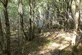
43°S 73°W 29.4 km (18.3 miles) WSW of Chaitén, Los Lagos, Chile |
|
|
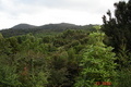
43°S 74°W 24.2 km (15.0 miles) NW of Puerto Carmen, Isla Chiloé, Los Lagos, Chile |
|
|
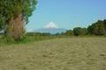
42°S 72°W 37.4 km (23.2 miles) E of Río Negro, Los Lagos, Chile |

|
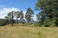
42°S 73°W 14.7 km (9.1 miles) SE of Isla Tabón (Island), Los Lagos, Chile [incomplete] |
|
42°S 74°W 4.9 km (3.0 miles) NW of Chepu, Isla Chiloé, Los Lagos, Chile [incomplete] |
|
41°S 72°W 11.5 km (7.1 miles) NNE of Peulla, Los Lagos, Chile |
|
|
41°S 73°W 9.2 km (5.7 miles) WSW of Puerto Octay, Los Lagos, Chile |
|
41°S 74°W 4.8 km (3.0 miles) WSW of Cabo Quedal (Cape), Los Lagos, Chile |
|
|
40°S 72°W 19.4 km (12.0 miles) SSE of Shoshuenco, Los Lagos, Chile |
|
|
40°S 73°W 4.7 km (2.9 miles) ESE of Cufeo, Los Lagos, Chile |
|
40°S 74°W 27.6 km (17.1 miles) WSW of Punta Falsa Galera (Cape), Los Lagos, Chile |
Region Notes:
In 2006, a reorganization of the Chilean regions was made. The new Región de
Los Ríos was created out of the northern part of the Región de Los Lagos,
and became operative in October 2007. This new regional organization is not
yet reflected on this region page and map. Thus, the Confluences 40S 72W,
40S 73W, and 40S 74W now have to be attributed to the new Región de Los
Ríos.