
| { Main | Search | Countries | Information | Member Page } | |
Rod Kevill's confluences |
| Kevill, Rod | ||
| This Visitor does not have any Plans. | View confluence map | |
| 37 visits (37 unique) | 37 active, 0 pending, 0 submitting | |
| 31 successful (31 unique): | 31 primary, 0 secondary | |
| 6 incomplete (6 unique): | 6 primary, 0 secondary | |
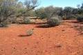
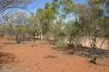
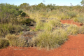 | 22°S 121°E 93.0 km (57.8 miles) E of Nullagine, WA, Australia [06-Jul-07] |
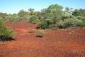
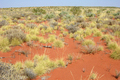 | 23°S 121°E 135.7 km (84.3 miles) ENE of Newman, WA, Australia [30-Sep-06] |
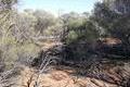
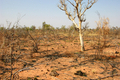 | 18°S 123°E 40.8 km (25.3 miles) NNE of Gingerah, WA, Australia [24-Sep-06] |
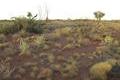
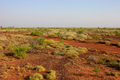 | 19°S 122°E 42.0 km (26.1 miles) SE of Lagrange, WA, Australia [incomplete] [23-Sep-06] |
 | 20°S 121°E 105.9 km (65.8 miles) SW of Eighty Mile Beach, WA, Australia [23-Sep-06] |
 | 31°S 136°E 24.1 km (15.0 miles) E of Glendambo, SA, Australia [26-Mar-06] |
 | 30°S 135°E 89.1 km (55.3 miles) NNE of Tarcoola, SA, Australia [25-Mar-06] |
 | 29°S 135°E 24.0 km (14.9 miles) E of Coober Pedy, SA, Australia [25-Mar-06] |
 | 27°S 114°E 43.7 km (27.1 miles) SSE of Tamala, WA, Australia [incomplete] [05-Jan-06] |
 | 23°S 116°E 48.8 km (30.3 miles) SW of Nanutarra, WA, Australia [15-Oct-05] |
 | 22°S 116°E 38.1 km (23.7 miles) E of Cane, WA, Australia [13-Oct-05] |
 | 23°S 118°E 17.8 km (11.1 miles) SW of Karijini, WA, Australia [incomplete] [12-Oct-05] |
 | 22°S 118°E 15.8 km (9.8 miles) S of Chichester, WA, Australia [12-Oct-05] |
 | 23°S 119°E 62.2 km (38.6 miles) SSE of Juna Downs, WA, Australia [11-Oct-05] |
 | 22°S 120°E 16.9 km (10.5 miles) SW of Nullagine, WA, Australia [10-Oct-05] |
 | 24°S 121°E 92.1 km (57.2 miles) E of Capricorn, WA, Australia [incomplete] [09-Oct-05] |
 | 26°S 121°E 101.8 km (63.2 miles) NE of Wiluna, WA, Australia [25-Sep-05] |
 | 24°S 119°E 43.9 km (27.3 miles) SE of Angelo River, WA, Australia [24-Sep-05] |
 | 27°S 115°E 29.0 km (18.0 miles) S of Toolonga, WA, Australia [16-Jul-05] |
 | 26°S 123°E 86.8 km (53.9 miles) E of Lake Carnegie, WA, Australia [23-Apr-05] |
 | 26°S 122°E 17.0 km (10.6 miles) SW of Lake Carnegie, WA, Australia [23-Apr-05] |
 | 27°S 121°E 54.5 km (33.8 miles) NNW of Lake Darlot, WA, Australia [23-Apr-05] |
 | 27°S 120°E 49.9 km (31.0 miles) SSW of Wiluna, WA, Australia [22-Apr-05] |
 | 24°S 115°E 68.7 km (42.7 miles) NE of Kennedy Range, WA, Australia [28-Mar-05] |
 | 24°S 116°E 13.2 km (8.2 miles) N of West Lyons River, WA, Australia [27-Mar-05] |
 | 24°S 117°E 60.7 km (37.7 miles) NNW of East Lyons River, WA, Australia [26-Mar-05] |
 | 24°S 118°E 81.2 km (50.4 miles) WSW of Angelo River, WA, Australia [25-Mar-05] |
 | 26°S 115°E 19.3 km (12.0 miles) SW of Gilroyd, WA, Australia [incomplete] [06-Oct-04] |
 | 25°S 116°E 48.8 km (30.3 miles) NNW of Gascoyne River, WA, Australia [04-Oct-04] |
 | 25°S 117°E 65.5 km (40.7 miles) SSW of East Lyons River, WA, Australia [incomplete] [03-Oct-04] |
 | 25°S 118°E 51.2 km (31.8 miles) NW of Peak Hill, WA, Australia [03-Oct-04] |
 | 27°S 117°E 71.0 km (44.1 miles) WNW of Weld Range, WA, Australia [02-Oct-04] |
 | 28°S 117°E 49.4 km (30.7 miles) NE of Yalgoo, WA, Australia [02-Oct-04] |
 | 25°S 114°E 25.3 km (15.7 miles) WSW of Inggarda, WA, Australia [21-Aug-04] |
 | 24°S 114°E 50.3 km (31.2 miles) NW of Yandoo Creek, WA, Australia [21-Aug-04] |
 | 21°S 118°E 24.5 km (15.2 miles) SE of Whim Creek, WA, Australia [19-Aug-04] |
 | 21°S 120°E 32.7 km (20.3 miles) NE of Marble Bar, WA, Australia [17-Aug-04] |