|

South Africa : KwaZulu-Natal
5.8 km (3.6 miles) W of Dannhauser, KwaZulu-Natal, South Africa
Approx. altitude: 1279 m
(4196 ft)
([?] maps: Google MapQuest OpenStreetMap ConfluenceNavigator)
Antipode: 28°N 150°W
Accuracy: 10 m (32 ft)
Quality: good
Click on any of the images for the full-sized picture.


| 28°S 30°E |

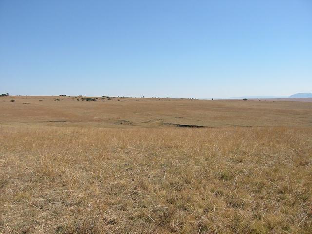
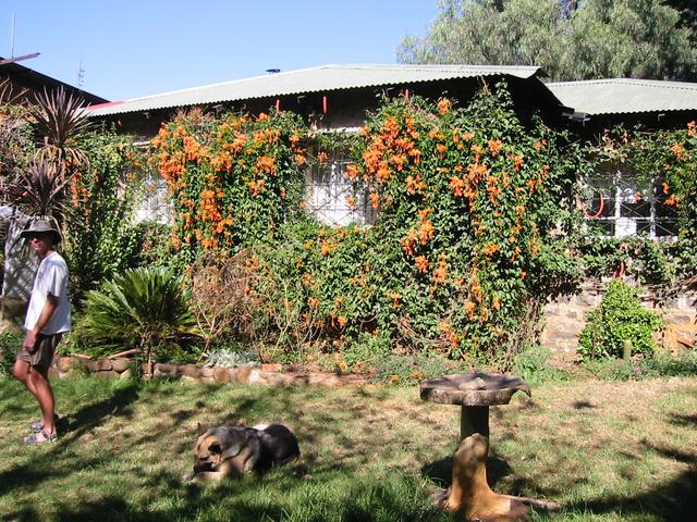
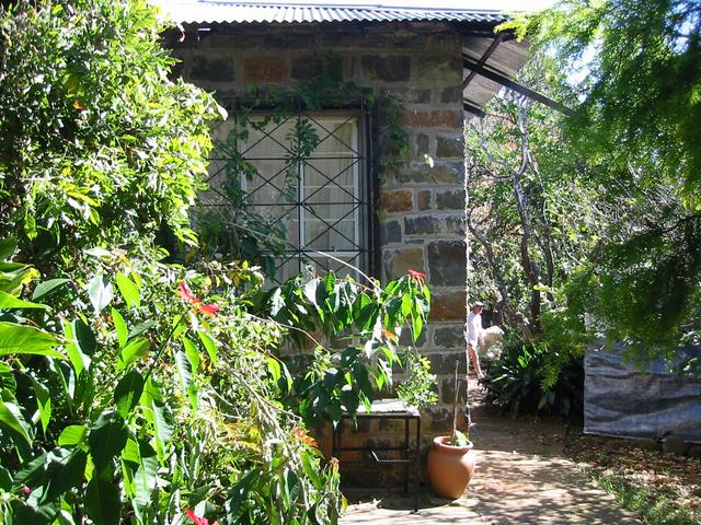
(visited by Walter Sigl, Stephen Burgoyne, Brian Walker, Jeff Hilliar and Dave Watson) 12-May-2002 -- Stephen, his family and some of his friends had planned to spend a weekend at a small lake near Dannhauser. He asked me if I would like to join them, we could then visit a confluence point situated very near to the camping spot. At this time of the year it can get very cold there at night, therefore I decided not to stay for the whole weekend, but I would visit them on Sunday morning. I left Empangeni on Sunday morning, after breakfast at 7:30. After a two and a half hours drive and a few problems to find the access road to the yacht club at Hattingspruit, I finally arrived at the camping site. The people where busy preparing breakfast and I was served with a can of Castle Lager beer. I was told that the night had been very cold, however at the time when I arrived, the sun was bright and it was very pleasant. South African breakfasts are always very rich. Eggs, vegetables and mega-steaks were cooked on a gas-fired Braai. As it became warmer, the legs of one of the ladies trousers where cut. Having finished breakfast, we decided to visit the Confluence 28S 30E just a view kilometers away. We where a group of four men, Stephen Burgoyne, Brian Walker, Jeff Hilliar, and myself. After a 15 minutes drive, we reached Watson’s farm, which is the closest point we could reach with our car (approx. 2 km away from the Confluence). Entering the farm, the dogs kept barking at us. Brian went to see the owners of the property and to explain what we intended to do. We received a very warm welcome from the Watson family and Mr. Dave Watson offered to drive us closer to the point in his bakkie (pick-up). We drove on a cleared band of a very dry field. Mr. Watson explained that this serves as fire barricade to protect the farm during the dry winter season. After about 1 km drive, we ended-up at a wired fence from which we had to walk the last couple of hundred meters. Mr. Watson joined us walking to the point and we arrived at the Confluence, in the middle of a field, at about 12:30. We took pictures, inspected the area and then we returned to the bakkie. Mr. Watson explained his family's history on the farm as he drove us back to the homestead. He showed us the family graveyard, with the graves of his grandfather, grandmother and other family members. Mr. Watson’s grandparents where part of the Voortrekkers who arrived by ox-wagon and erected the farm. We received a tour through the magnificent old farmhouse, which was built around 1845. The house is built entirely out of hand-cut stones, with old wooden floors and original furniture. It is just like in a museum, we where all very impressed. Mr. Watson’s daughter served us cool-drinks in the garden and Mrs. Watson invited us to have lunch with them. Unfortunately we had to leave as people at the camping spot where waiting for us. The tents still had to be broken down and some of us had a long drive home. We are very pleased to have met the Watson family, thank you for your hospitality! |
| All pictures |
| #1: Looking West #2: Looking East #3: Looking North #4: Looking South #5: GPS readings #6: At the Confluence 1 #7: At the Confluence 2 #8: Farmhouse 1 #9: Farmhouse 2 ALL: All pictures on one page |