|

Nigeria : Rivers
5.5 km (3.4 miles) NNW of Agrita, Rivers, Nigeria
Approx. altitude: 32 m
(104 ft)
([?] maps: Google MapQuest OpenStreetMap ConfluenceNavigator)
Antipode: 5°S 173°W
Accuracy: 800 m (874 yd)
Quality: good
Click on any of the images for the full-sized picture.


| 5°N 7°E | (incomplete) |

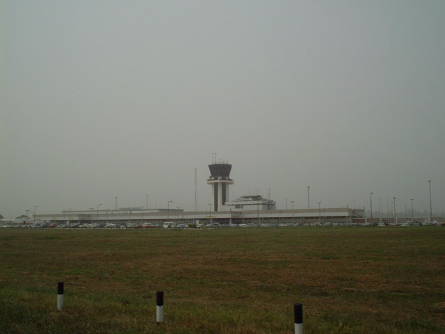
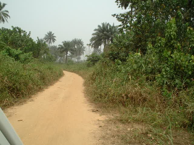
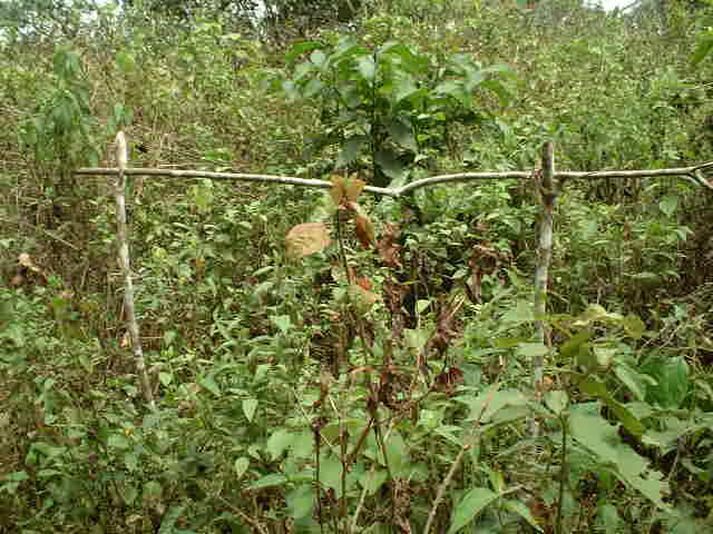
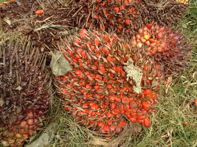
(visited by Captain Peter and Akparanta U. Collins) 13-Jan-2002 -- NIGERIA! That's a country really only an old hard-boiled seaman as Captain Peter can enjoy. Having discharged a part of the cargo already at Abidjan I had to proceed to Port Harcourt. As my berth was not yet available, I dropped the anchor into the mud off the delta of the river Niger on Jan. 8th, and stood by for information from "Bonny River Signal Station". Well, this time I took my British Admiralty chart of the Delta of the river Niger and was scrutinizing it with other eyes. Nigeria is a huge country with a lot of Confluences. And just a 22 km North of Port Harcourt there is one. But 22 km in Africa can be a horrible distance, the delta of the rivers Niger, Benin, Warri, Escravos, Forcados, Dodo, Pennington, Nun, Brass, Saint Nicolas, Santa Barbara, San Bartholomeo, Sambreiro, Opobo, Cross, Imo, Bonny, New Calabar, just to name a few, flowing into the Gulf of Guinea is a confused jumble of rivers, creeks, bayoos, estuaries, swamps and marshes, either linked with each other or ending blind. How, - I tried to picture -, can one travel there? Port Harcourt itself is located on the East-side of the Bonny River, a 30 naut. miles (56 km) from the open sea. That was well known to me. Checking my chart I found out that 5N 7E is close to a small village, called Agrita, linked with Port Harcourt by something like a road, existing at least still in 1911, the year the original survey for this chart had been carried out. Really good prospects. Who would be able to tell me something about Agrita? I tried my local shipping agent, Mr. Collins: "Have you ever heard about a village north of Port Harcourt, called AGRITA?", I asked him timidly, and he answered: "Of course, that's where our International Airport is located!" That was really good news and a typical example for our shipping biz. We are using British Admiralty charts almost 100 years old for our navigation on African rivers, and not being aware of anything else going on around us. Ashore they are building highway routes and airports, and we seamen, instead, are running aground with our ships on these rivers because nobody takes the trouble to mapping their frequently changing courses and to sound their depths properly. Then I explained him the Confluence Project. I told him Nigeria still to be virgin, and he agreed immediately to go for this point together with me. I am frequently travelling to Central Africa since 25 years, and again I was delighted and amazed to learn what an objective, unprejudiced and natural relation Africans have maintained with their local fauna. On Sunday, Jan. 13th, we started by car from Port Harcourt, drove on a quite well paved road in the direction of Agrita. We passed the famous Airport, being located exactly on 5°N, but we were at least 4 km too far in the West. The British Admiralty chart of 1911 I had with me, seemed to be a little bit out of wack. No wonder, who knew about WGS84 in 1911? The British had other problems then in their "British West Africa" (or rather no problems at all, still... except the usual "white man's burden"). So we turned around and drove back the highway, until we found a smaller road, seeming to bring us closer to the Confluence. Needless to say that we had no road map at hand, and the more hunchbacked this dirt road became, the more our driver was enjoying it. Again we reached the latitude of 5°N quite comfortably, and now we were only a 1500 metres too far in the West. To proceed by car was useless, as the road led exactly N-S. But we detected a path in direction E-W. We followed it by walking, and we came as close as 5°00.000'N and 6°59.544'E, 800 metres off the Confluence, when the path ended, and heavy thicket began. And another extremely interesting item we encountered avoided us to enter and go farther: An idol fence, something still exisiting even in modern Nigeria. This structure has been built by an idol worshipper and means "do not trespass this line without a life sacrifice"! An idol is living in this area and guides the community. Whoever passes this fence without sacrifying will be inflicted with mysterious and incurable illnesses! A life sacrifice can be usually a chicken, a goat or a cow, slaughtered in front of this fence and eaten prior to entering the area. According to many African believers the sacrifice helps to pacify the God through their ancestors. The idol worshipper is a kind of priest, and only he is entitled to carry out the respective ceremony. That was the end of the excursion, and we drove back to Port Harcourt, where we arrived at 14:30 hrs. The most interesting vegetation there are the huge Palm Fruits, full of dates. Mr. Collins was quite disappointed about our "only attempt", but I consoled him, telling him this to be part of Confluence Hunting, and if he wanted to go on by his own to make other points in Nigeria, he would frequently encounter such "disappointments". Nothing to worry about, peanuts for a Confluence Visitor - as crocodiles are for him. And what about the idols? One can believe in these things or not... - but what made the idol worshipper erect his symbol just exactly on 5°00.000'N? I would never dare to violate these sacred areas without having previously sacrified properly, and an African certainly not, too. So confluence hunting in Central Africa might turn out to be a tricky, sacrifice consuming operation. A real "Macumba..." |
| All pictures |
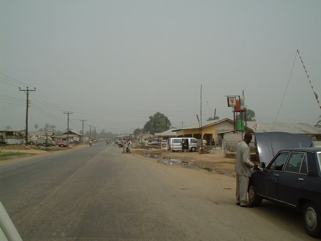
| #1: Idol fence #2: The delta is a jumble of rivers #3: The town of Agrita, which was shown as close to the Confluence in a 1911 map #4: Port Harcourt International Airport #5: Dirt road towards Confluence #6: Intrepid explorers #7: Path towards Confluence #8: GPS #9: Heavy thicket at end of path #10: Palm fruit ALL: All pictures on one page |