|

Canada : British Columbia
13.3 km (8.3 miles) S of Dalton Post (YT), BC, Canada
Approx. altitude: 1692 m
(5551 ft)
([?] maps: Google MapQuest OpenStreetMap topo topo250 ConfluenceNavigator)
Antipode: 60°S 43°E
Accuracy: 8.0 km (5.0 mi)
Quality: good
Click on any of the images for the full-sized picture.

")
| 60°N 137°W | (secondary, incomplete) |
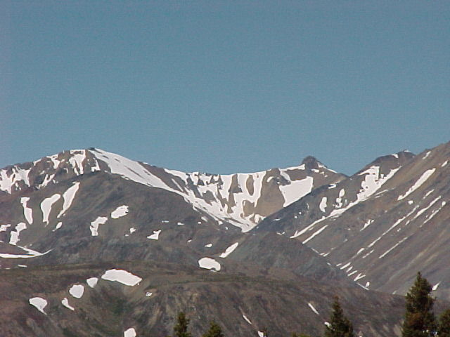
 (visited by Brian Butler) 14-Jun-2002 -- My trip to Haines Alaska took me past the confluence at 60N 137W. This confluence is high in the Squaw Range of the St. Elias Mountains. Four photos were used to create this panorama of the range As you can see from the photos, this is not an easy hike but rather a serious climb. The confluence is approx. 500 meters north (to the right) of the narrow peak in the rear peak photo. The satellite image also indicates how far from the Haines road this confluence is located. |
| All pictures |
| #1: Squaw Range panorama from Pringle overlook #2: Peak closest to confluence #3: Landsat image of Squaw Range (north is up) ALL: All pictures on one page |
| Notes |
|
The Yukon Territory/British Columbia demarcation line is passing exactly through the Confluence. |