|


Germany : Mecklenburg-Vorpommern
2.2 km (1.4 miles) SSW of Düvier-Zarnekla, Mecklenburg-Vorpommern, Germany
Approx. altitude: 6 m
(19 ft)
([?] maps: Google MapQuest OpenStreetMap ConfluenceNavigator)
Antipode: 54°S 167°W
Accuracy: 3 m (9 ft)
Quality: good
Click on any of the images for the full-sized picture.


| 54°N 13°E (visit #17) |

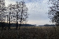


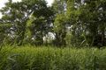


 (visited by Lord Helmchen) 02-Oct-2026 -- Dieses war der 15. CP (von insgesamt 20) auf unserer 5-wöchigen Skandinavientour 2026 – erster CP der Tour war 51°N 13°E gewesen. Vom Vor-CP 55°N 15°E über die Fähre “Gedser-Rostock” kommend, fuhren wir via A 20, später die L 26 ostwärts Richtung CP. Kurz hinter der Ortschaft “Jahnkow” verließen wir die L 26 im Bereich einer Kurve und fuhren geradeaus auf sehr holpriger Piste durch ein kleines Wäldchen. Ich parkte unser WoMo dann kurz vor Erreichen der Ortschaft “Zarnekla” mehr schlecht als recht unmittelbar im Bereich einer Feldweg-Einfahrt ca. 930 Meter Luftlinie vom CP entfernt. (Bild 7) Danach zunächst knapp 200 Meter auf Feldweg am Waldrand lang gelaufen, dann diagonal über ein große Wiese in südöstlicher Richtung zum CP marschiert. Dieser befand sich dann am Ende der Wiese ca. 40 Meter in einem Gestrüpp aus Brennesseln, Schilf und sonstigem Grünzeug (Bild 8 zeigt CP-Gegend aus 40 Metern Entfernung). Ging ziemlich einfach da durch und war überraschenderweise doch relativ trocken. Empfang war auch ganz ordentlich, so dass CP-Lokalisierung und die Fotos schnell vonstatten gingen. Danach auf gleichem Weg zurück; Dauer der Aktion ca. 45 Minuten. Danach machten wir den Fehler via „Zarnekla“ über „Drosedow“ nach „Loitz“ zu fahren – eine viele km lange, üble Kopfsteinpflasterpiste, die wir so selten erlebt haben. Kann sein, dass es an der harten Federung des WoMos liegt und/oder am Reifendruck von gut 4 bar; wir krochen jedenfalls mit teils unter 10 km/h durch die Landschaft, bis wir kurz vor „Loitz“ die B 194 und damit wieder Asphalt erreichten. Nächster CP war dann 53°N 13°E. 02-Oct-2026 -- This was the 15th CP (of 20) on our 5-week campingcartour to Scandinavia 2026 – the tour had started at 51°N 13°E . Coming from 55°N 15°E we took the ferry from „Gedser“ to „Rostock“, then drove on A 20, later road L 26 in easterly direction towards the CP. After having passed the village „Jahnkow“ we left the road L 26 in a bend and drove on rather bad natural track through a small forest. Just before arriving at „Zarnekla“ I parked our campingcar rather badly at the beginning of a fieldtrack in a distance of approx. 930 meters beeline to the CP. (pic. 7) I first walked along the track for about 200 meters, then crossed a huge meadow in south-easterly direction. After reaching the end of the meadow a remaining distance of approx. 40 meters through sting nettles, reed and other plants had to be passed. This went rather easy and was surprisingly not really wet. GPS reading was also quite good, so CP localisation and taking the pictures went fast. Then same way back to the campingcar, where I arrived after about 45 minutes. Then we made the mistake to take the „road“ between „Zarnekla“ to „Loitz“ by passing „Drosedow“. Several km of rather bad cobblestone track, that we „managed“ with a speed of under 10 km/h, perhaps also caused by hard suspension of the campingcar and/or high tire pression of approx. 4 bars. So we were really happy, when finally reaching B 194 and asphalted roads just before arriving at „Loitz“. Next CP there was 53°N 13°E. |
| All pictures |
| #1: Norden #2: Osten #3: Süden #4: Westen #5: GPS 1 #6: GPS 2 #7: parking beside road, distance to CP approx. 930 meters #8: CP area at a distance of 40 meters ALL: All pictures on one page |