|

Spain : Valencia
3.4 km (2.1 miles) ENE of Castellón de la Plana, Castellón, Valencia, Spain
Approx. altitude: 0 m
(0 ft)
([?] maps: Google MapQuest OpenStreetMap ConfluenceNavigator)
Antipode: 40°S 180°
Accuracy: 170 m (557 ft)
Quality: good
Click on any of the images for the full-sized picture.


| 40°N 0° (visit #2) |
![Visit #11: [11-Aug-25]](/es/all/n40e000v11/preview.jpg "Visit #11: [11-Aug-25]")
![Visit #10: [02-Apr-25]](/es/all/n40e000v10/preview.jpg "Visit #10: [02-Apr-25]")
![Visit #9: [01-Mar-24]](/es/all/n40e000v9/preview.jpg "Visit #9: [01-Mar-24]")
![Visit #8: [28-Jun-19]](/es/all/n40e000v8/preview.jpg "Visit #8: [28-Jun-19]")
![Visit #7: [20-Mar-18]](/es/all/n40e000v7/preview.jpg "Visit #7: [20-Mar-18]")
![Visit #6: [09-Jul-15]](/es/all/n40e000v6/preview.jpg "Visit #6: [09-Jul-15]")
![Visit #5: [24-Feb-14]](/es/all/n40e000v5/preview.jpg "Visit #5: [24-Feb-14]")
![Visit #4: [10-May-13]](/es/all/n40e000v4/preview.jpg "Visit #4: [10-May-13]")
![Visit #3: [27-Oct-06]](/es/all/n40e000v3/preview.jpg "Visit #3: [27-Oct-06]")
![Visit #1: [31-Mar-01]](/es/all/n40e000/preview.jpg "Visit #1: [31-Mar-01]")

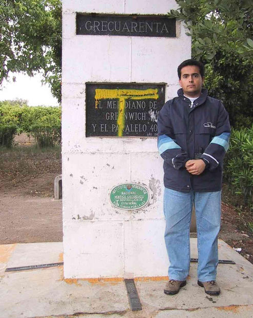
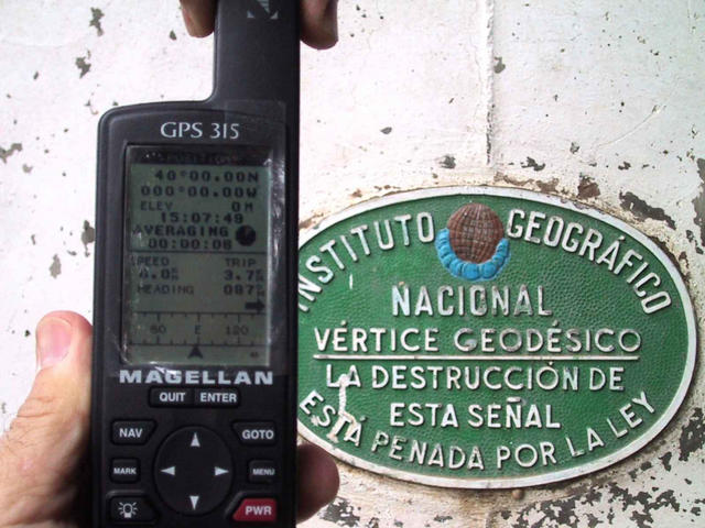
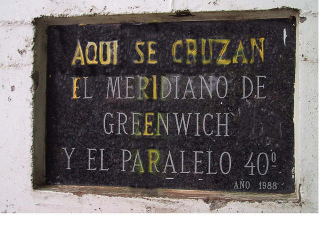
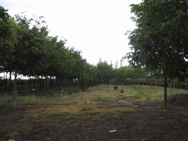
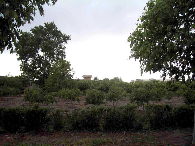
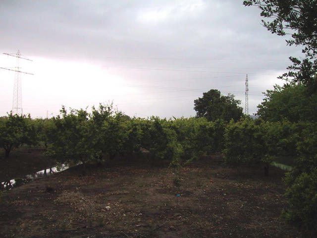
(visited by Ernesto Sendra and Pablo Sendra) 01-Apr-2001 -- Since I saw for the first time the Meteosat image on TV, years ago, I was captured by the little cross marking that confluence. I knew that it was near my own home, but never looked for it. Each time I drove to the Castellón beach, I watched to the north when I passed by a traffic sign: “Parc del Meridià”. But never followed that path. I read about the Confluence Project, a few months ago, in a magazine and I searched for my point. Nobody had been there. But since then I couldn’t find the time or the occasion of going there. Yesterday I decided the time had come. I made sure my point hadn’t been submitted yet. Today after lunch I picked up my GPS and my camera and set out with my son Pablo. The weather in this region is usually clear, sunny and hot. But today the sky was cloudy. We took the road to the beach, followed the sign “Parc del Meridià”. Finally we reached a big sign. (Picture #9). The local City Hall bought a piece of land, put a fence around, and planted trees. It’s a nice place, and we walk looking for our famous point. Finally, behind some mulberry-trees we find a sort of big milestone marking the confluence. (Picture #3). We check co-ordinates with the GPS and it’s exactly 40ºN, 0º. (Picture #4). Some huge clouds cover quickly the sky, and rain begins slowly. In the base of the stone four pieces of marble mark the four directions. A sign states the confluence (Picture #5). We take some pictures (Picture #1, #6, #7, #8). And we have to open the umbrella. As we leave, rain gets harder and drops get hard as well. It’s a hail-storm. All that area near the sea was originally a marshland. The owners dried these lands during the last two centuries, in order to grow vegetables and orange trees. Lots of small canals cross here and there. Nowadays there are lots of country houses where families from Castellón (150.000 people) use to spend their summertime (June-September). In this country we use to have a winter house (normally a flat) in the city, and a summer one near the beach. As there are not enough houses for everybody, most of them spend their summertime in crowded apartments over the seaside. They say they love it. |
| All pictures |
| #1: Picture to the east #2: The point #3: Pole marking the confluence. #4: GPS image #5: Marble sign #6: Picture to the north #7: Picture to the south #8: Picture to the west #9: Sign anouncing the "Meridian park" ALL: All pictures on one page |