|

Canada : British Columbia
13.1 km (8.1 miles) W of Ladysmith, Vancouver Island, BC, Canada
Approx. altitude: 323 m
(1059 ft)
([?] maps: Google MapQuest OpenStreetMap topo topo250 ConfluenceNavigator)
Antipode: 49°S 56°E
Accuracy: 450 m (492 yd)
Quality: good
Click on any of the images for the full-sized picture.


| 49°N 124°W (visit #2) | (incomplete) |
![Visit #4: [08-Jun-02]](/ca/bc/n49w124v4/preview.jpg "Visit #4: [08-Jun-02]")
![Visit #5: [24-May-11]](/ca/bc/n49w124v5/preview.jpg "Visit #5: [24-May-11]")
![Visit #3: [19-Jan-02]](/ca/bc/n49w124v3/preview.jpg "Visit #3: [19-Jan-02]")
![Visit #1: [27-Apr-01]](/ca/bc/n49w124/preview.jpg "Visit #1: [27-Apr-01]")

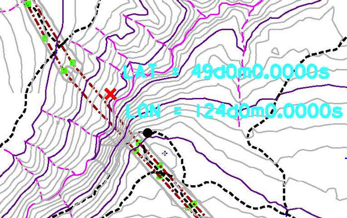
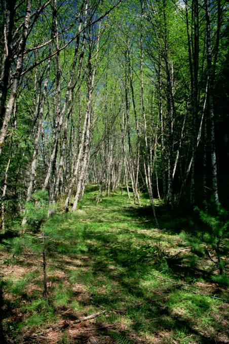
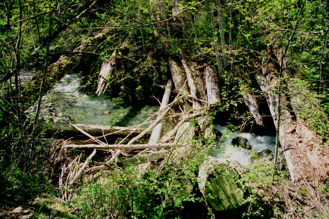
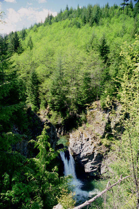
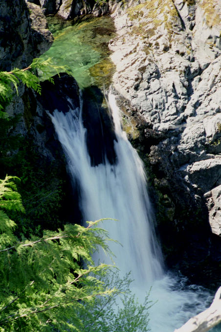
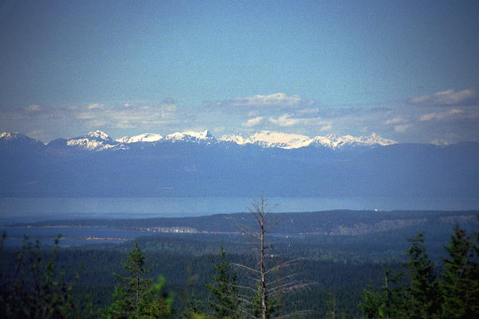
(visited by Dave Patton) 20-May-2001 -- This was to be my second attempt at this confluence. I started from Victoria, and drove up Highway 1, over the scenic Malahat drive, and on up Vancouver Island towards Ladysmith. This time I turned left off the highway at Grouhel Road(just north of the Ladysmith City Hall), and then turned right onto Christie Road, following it until it turns into the Ladysmith Main logging road. I then went up the logging road, parking again at the same spot as my first attempt - under the transmission lines. This spot is marked by the black dot on the map image shown in my first attempt. If you look at the map image, you can see that the map indicates a logging road(dashed line) running along somewhat parallel to the creek, just below the spot where I was parked. I never saw any such road on my previous visit. This time, I started just to the right of the parking spot, and headed into the woods to start working my way downhill into the ravine. Within a few minutes I found the logging road indicated on the map - it is an abandoned road, probably not used for 15-20 years. I decided to try walking "down" the road for a bit to see what I could discover about possible routes across the ravine. At that point, the road actually did slope downwards somewhat, which meant travelling 'up' the ravine(to the left on the map). After walking for a few minutes, the trees opened up enough to allow me to get a glimpse of the creek in the ravine, and that's when I came to the conclusion that this was probably going to have to be listed as a second attempt. It turns out that the spot where the transmission lines cross the ravine is, from what I've seen, probably the worst location to start when trying to reach this confluence! The ravine in the area of the transmission line crossing is, at least on the side I was on, extremely steep and rocky. I suspect that climbing gear would be needed to descend the ravine in that area. I decided to walk 'down' the road, and eventually came to the old wooden bridge crossing Haslam Creek. I had lunch there, and then returned via the same road. On the way down I had seen a nice waterfall, so on my way back I took a bit of a detour to get closer to take some pictures, including a close-up of the waterfall, taken with a 1/10 second exposure. Picture #5 is taken back at the parking spot, looking across the Strait of Georgia at mountains on the BC mainland. Picture #6 is also at the parking spot, showing a "12-satellite day". I would suggest that the next attempt at this confluence start from the opposite side of the ravine. If it proves to be too difficult to reach the area under the transmission lines on the other side, it may be possible to start where I started from, go down the old logging road, cross Haslam Creek via the old bridge, and, if the maps are correct, follow the old logging road back along the other side of the ravine to get near to the confluence area. |
| All pictures |
| #1: Waterfall on Haslam Creek #2: Old wooden bridge across Haslam Creek #3: A scenic spot on the old logging road #4: A close-up view of the waterfall #5: Mountains on the BC mainland #6: A "12-satellite day" ALL: All pictures on one page |