|

United States : Wisconsin
6.4 miles (10.3 km) E of Webb Lake (Burnett), Washburn, WI, USA
Approx. altitude: 305 m
(1000 ft)
([?] maps: Google MapQuest OpenStreetMap topo aerial ConfluenceNavigator)
Antipode: 46°S 88°E
Accuracy: 6 m (19 ft)
Quality: good
Click on any of the images for the full-sized picture.


| 46°N 92°W (visit #1) |
![Visit #4: [28-Sep-19]](/us/wi/n46w092v4/preview.jpg "Visit #4: [28-Sep-19]")
![Visit #3: [20-Aug-06]](/us/wi/n46w092v3/preview.jpg "Visit #3: [20-Aug-06]")
![Visit #2: [25-Mar-06]](/us/wi/n46w092v2/preview.jpg "Visit #2: [25-Mar-06]")

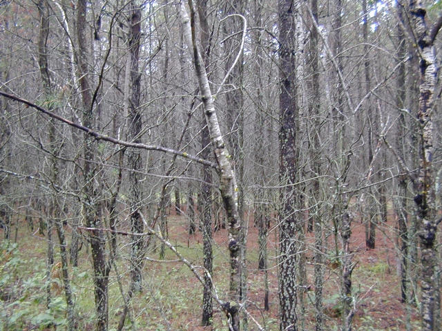
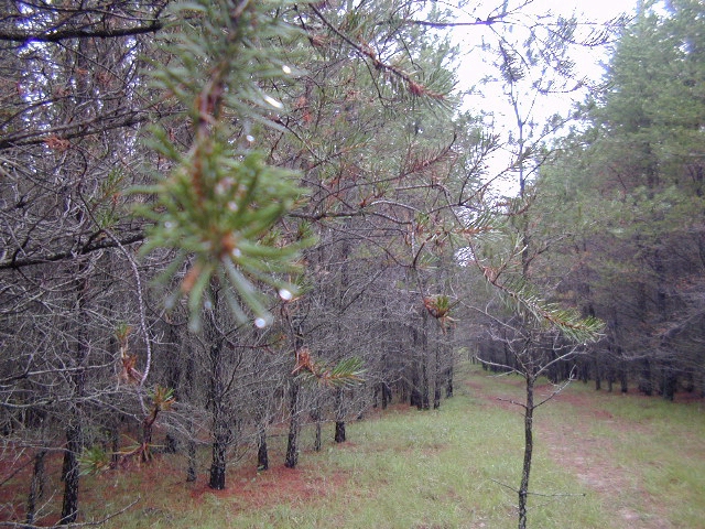
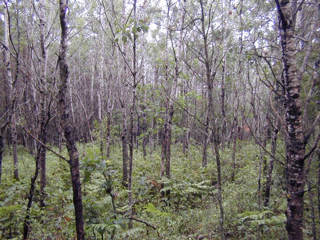
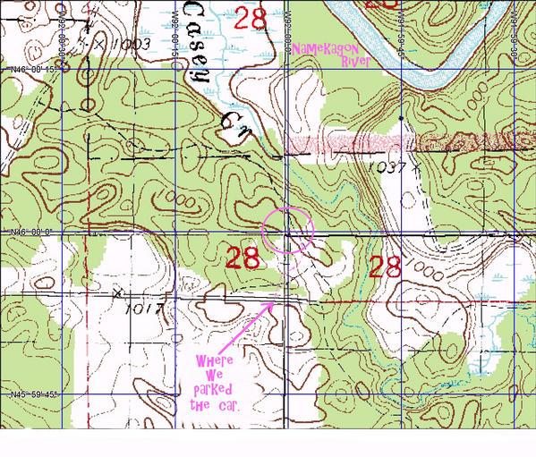
(visited by digiboy dotcom) 28-Jul-2001 -- Ah the luck. The only confluence unvisited in Wisconsin just happens to be about an hour from the ol' family cabin. July 28th was a gloomy and rainy day (a nice departure from the 90 degree summer days back home in Madison). After stopping for breakfast in Stone Lake we headed west toward Spooner. Just outside of Spooner we hooked up with U.S. Highway "53" which we followed north to Minong. We turned west onto Wis."77" and followed it west to Lower McKenzie Lake Road. This we took southerly for a few miles before turning east onto, I think, Zehm Road. A mile or so due east the pavement veered to the south and a sand "road" continued eastbound. We forged ahead, up and down over the rolling terrain, plowing the wet sand and trying to keep the Toyota Corolla in the truck ruts. We parked on the crest of a hill once we were due south of the confluence (see photo #4). Donning our raingear and boots we headed north into the thicket of Jack Pine and Aspen. It was downhill towards the Namekagon River and the National Scenic Riverway Recreation Area. After fighting the scrub (see photo #2) we happened upon a small lane through the pines which we followed in the direction of the confluence (see photo #3). Another jaunt through the pine brush to a small aspen grove (see photo #1) that just happened to be the intersection of 46 Degrees North and 92 Degrees West. A bit more wandering to get those magic zeros, now for a picture... ...damn digital camera batteries. All this effort and no money shot? Oh no! We decided to move the new batteries from the GPS unit to the camera and put two of the so-so camera batteries into the GPS unit. Success. A GPS picture(see photo #5), a shot looking north (see photo #1), and we're outta here. See photo #6 for the map of our hike. |
| All pictures |
| #1: Looking North from the confluence. #2: Pine Thicket #3: The Lane #4: Looking west down the sand"road" just south of 46N-92W #5: Magic Zeros #6: Map of the hike. ALL: All pictures on one page |