|

Italy : Calabria
4.0 km (2.5 miles) SSE of Cutro, Crotone, Calabria, Italy
Approx. altitude: 139 m
(456 ft)
([?] maps: Google MapQuest OpenStreetMap ConfluenceNavigator)
Antipode: 39°S 163°W
Accuracy: 3 m (9 ft)
Quality: good
Click on any of the images for the full-sized picture.


| 39°N 17°E (visit #2) |
![Visit #5: [14-Oct-22]](/it/all/n39e017v5/preview.jpg "Visit #5: [14-Oct-22]")
![Visit #4: [03-Feb-19]](/it/all/n39e017v4/preview.jpg "Visit #4: [03-Feb-19]")
![Visit #3: [12-Jun-05]](/it/all/n39e017v3/preview.jpg "Visit #3: [12-Jun-05]")
![Visit #1: [01-Sep-01]](/it/all/n39e017/preview.jpg "Visit #1: [01-Sep-01]")
")
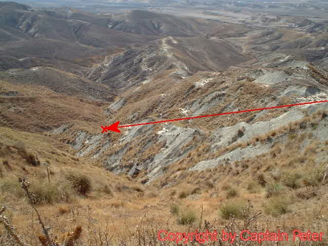
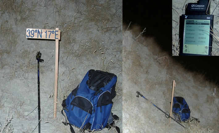
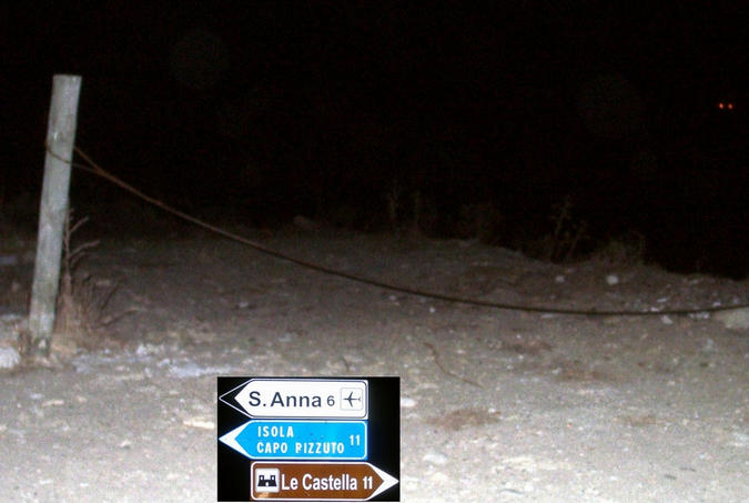
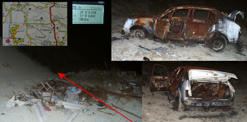
(visited by Hans Augdoppler) 07-Oct-2001 -- Well prepared by Captain Peter and with some delay caused by the misfortune at 38°N16°E I arrived at the proposed entry point 250 meters off the road. Because time was pressing and sunset was approaching rapidly I had to get dressed quickly. Then I was ready to step down into the deserted valley wearing heavy-duty mountain boots. I proceeded straight to the west and realized that I had to cross a kind of rivulets in this semi-arid landscape (some kind of clay and sand). The slopes are profiled with goat tracks, which you may use as step or as path. With ease I reached the exact position, planted the confluence plate and was happy to see a thorn and thistle free place in this area. At the bottom of the valley I saw a gravel road and some cattle grazing. Unfortunately the sun has set so fast that photos could not be taken anymore. I asked Captain Peter for permission to use one of his pictures. While walking upwards along the ridge (see marker in Picture #1) I considered myself as overdressed. This could be a family walk on a Sunday afternoon. My way up ended directly at a garbage depot and a scrap car close to my car. At the intersection should be the entrance to the gravel road, but it is closed with a chain. However there is no requirement to access the spot from the base. Italian Version (translated & interpreted as courtesy by Maria Fedele) 07-Ott-2001 -- Ben preparato da Capitano Peter e con un po' ritardo a causa della sfortuna al 38°N16°E sono arrivato al punto di entrata proposto a 250 metri dalla strada. Poiché il tempo incalzava ed il tramonto si avvicinava rapidamente, mi sono vestito velocemente. Ero, quindi, pronto ad avanzare nella valle deserta indossando pesanti stivali di montagna. Ho proceduto diritto ad ovest ed ho realizzato che dovevo attraversare una specie di ruscelletti in questo paesaggio quasi arido (creta e sabbia). I pendii sono profilati da sentieri per capre, utilizzabili come passi o percorsi. Ho raggiunto con facilità la posizione esatta, ho posizionato la piastra di confluenza e mi sono rallegrato di vedere, in quest’area, un luogo libero da spine e cardi selvatici. In fondo alla valle si poteva vedere una stradina ghiaiosa e dei buoi pascolare. Sfortunatamente il tramonto ci ha colto così velocemente non permettendoci di scattare ulteriori foto. Ho chiesto al Capitano Peter di usare una delle sue fotografie. Mentre salivo lungo la vetta (vedi indicatore in fotografie #1), ho avuto la sensazione di essere troppo vestito. Tale esperienza potrebbe considerarsi una passeggiata familiare della domenica pomeriggio. Il mio percorso è terminato direttamente in un deposito d’immondizia ed in un’auto da rottamare accanto alla mia. All’intersezione ci sarebbe dovuto essere l’ingresso alla strada ghiaiosa, ma è chiuso per mezzo di una catena. Non c’è nessuna richiesta, tuttavia di accedere al punto dalla base. |
| All pictures |
| #1: Confluence area seen from 39N / L’area di confluenza vista da 39N (Copyright Captain Peter) #2: CP with sign and GPS reading / CP con indicazione e lettura GPS #3: Access point from the roadside / Punto d’accesso dal bordo della strada #4: Junction close to CP – entry to gravel road / Congiungimento vicino a CP – ingresso alla strada ghiaiosa #5: Nice thistles / Graziosi cardi selvatici ALL: All pictures on one page |