|

Romania
3.1 km (1.9 miles) NW of Răstoliţa, Mureş, Romania
Approx. altitude: 1008 m
(3307 ft)
([?] maps: Google MapQuest OpenStreetMap ConfluenceNavigator)
Antipode: 47°S 155°W
Accuracy: 1.0 km (1093 yd)
Quality: good
Click on any of the images for the full-sized picture.

| 47°N 25°E (visit #1) | (incomplete) |
![Visit #3: [23-Jul-05]](/ro/all/n47e025v3/preview.jpg "Visit #3: [23-Jul-05]")
![Visit #2: [13-Jul-05]](/ro/all/n47e025v2/preview.jpg "Visit #2: [13-Jul-05]")

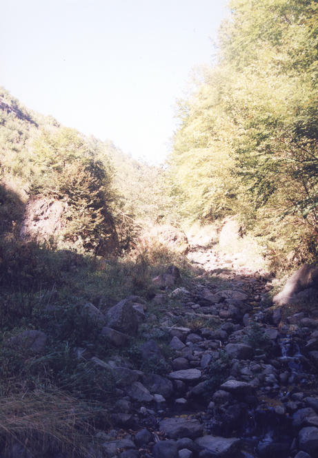
(visited by Ciprian Cosma and Ioana Stefan) 03-Oct-2001 -- This confluence is located in the Căliman mountains near the village of Răstoliţa. From the main road to Topliţa you must turn left on a secondary road right in the middle of Răstoliţa and continue on this road for 1 km. At this point you are nearly 2 km away from the confluence. You can proceed by foot on an old forest road which goes uphill. After 1 km this road ends leaving no other choice but to proceed on a small mountain creek directly uphill for 1 more kilometer. Photo 1 represents the end of the road and photo 2 is taken uphill so you can see the creek. |
| All pictures |
| #1: The end of the forest road #2: The creek ALL: All pictures on one page |