|

Japan : Shikoku
1.9 km (1.2 miles) S of Irino, Ōgata-chō, Kōchi-ken, Shikoku, Japan
Approx. altitude: 35 m
(114 ft)
([?] maps: Google MapQuest OpenStreetMap ConfluenceNavigator)
Antipode: 33°S 47°W
Accuracy: 5 m (16 ft)
Quality: good
Click on any of the images for the full-sized picture.


| 33°N 133°E (visit #1) |
![Visit #3: [20-Mar-09]](/jp/all/n33e133v3/preview.jpg "Visit #3: [20-Mar-09]")
![Visit #2: [20-Apr-07]](/jp/all/n33e133v2/preview.jpg "Visit #2: [20-Apr-07]")

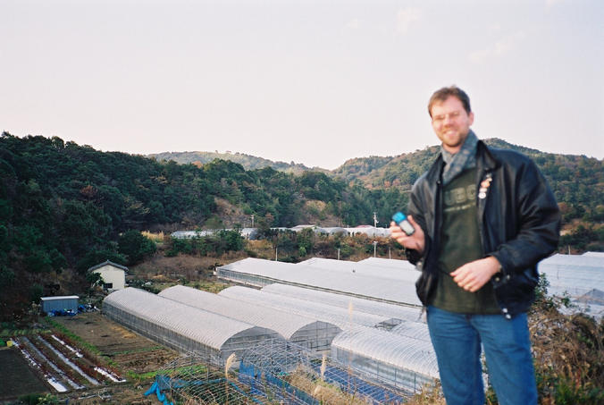
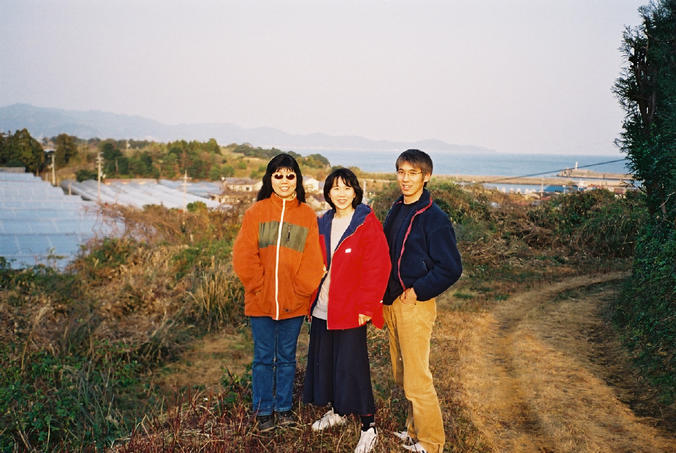
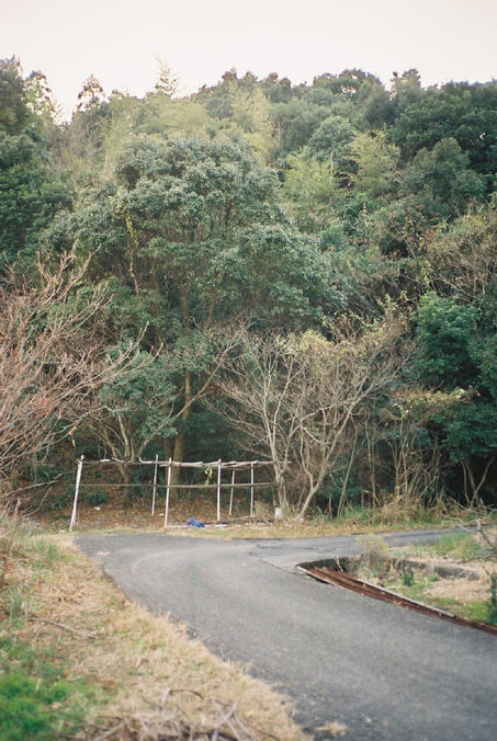
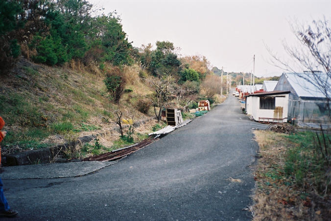
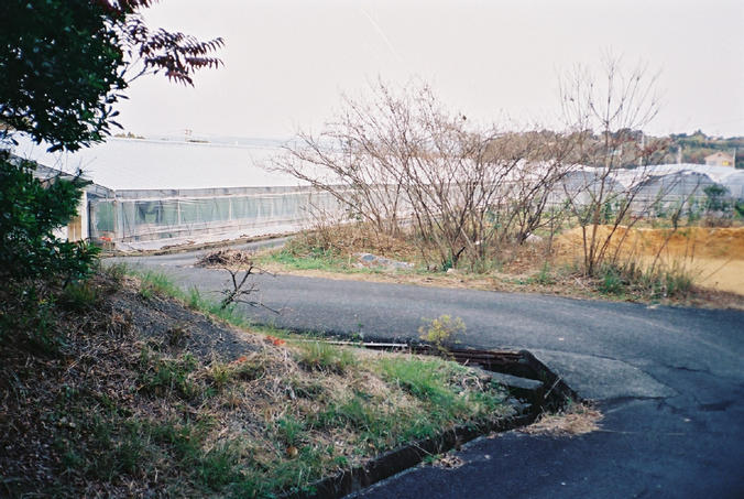
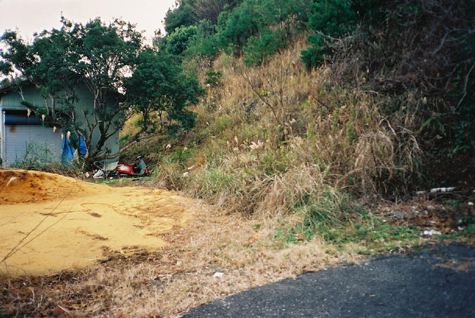
(visited by Fred Bremmer, Satsuki, Mitsue and Junichi) 04-Jan-2002 -- Satsuki and I set out from Vancouver, Canada at the end of December to visit her family and our friends in the town of Johen, Ehime Prefecture, Japan. We took along our new GPS and hoped to do some geocaching and confluence hunting while we were there. Soon after I got my GPS and learned about the Degree Confluence Project I noticed that the confluence of N33 and E133 is very close to Tomarotto, a campground we like to stay at in Kochi Prefecture, so I decided to try to find the spot while we were in the area. Our friends Mitsue and Junichi liked the idea of looking for the confluence, so the four of us drove about an hour east from Johen in Ehime past the city of Nakamura in Kochi to find it. It was close to 4pm and the sun was getting low in the sky when we left route 56 to follow the GPS navigation pointer which led us onto smaller local roads. We wanted to take pictures of the confluence before it got much darker, but we didn't know how long it would take to zero in on it. After winding through some hills we reached our closest approach by car at a curve in the two-lane local road. We were still a few hundred meters away from the confluence, but there were only a dirt path and a one-lane road leading toward the point, so we decided to park the car and search on foot. First we tried the dirt path. It headed straight toward the confluence, but only as far as the top of a hill overlooking a field filled with greenhouses and some other buildings. We were still 130 meters from the correct point and couldn't get any closer from that direction, so we took pictures of the view toward the confluence (Picture #2, showing me, with the confluence hidden behind the small yellowish building) and toward the Pacific Ocean (Picture #3, showing Satsuki, Mitsue and Junichi), and turned back to look for another route to the confluence. Back at our parking spot we started walking downhill to the narrow paved road that runs between the greenhouses. I got a few curious stares from the people working in the area (they probably don't see many 197cm foreigners walking down that road) but nobody stopped us and the GPS told us we were getting close. We cheered when we got within 100 meters of the point, and again when we reached the quiet curve in the road where the GPS zeroed (Picture #1, showing the view looking west). The actual confluence point (given the GPS error) is either on the road or inside the structure made out of poles beside the road. The poles appear to be intended either for growing climbing plants or for drying something, maybe persimmons, but nothing was growing or drying on the poles when we saw them. Picture #4 shows the view of the hill to the north of the confluence and the ends of a lot of greenhouses off into the distance. Picture #5 looks to the east and shows the path we took to the confluence, beside the greenhouse, with just a bit of the Pacific Ocean visible in the distance. Picture #6 is the view to the south, showing the other side of the building seen in the lower right corner of Picture #2. We thought we were only the second team of confluence hunters in Japan, but it turns out we were the third, by just a few days. Still, we were proud that we found the first confluence on the island of Shikoku. Some of my friends who heard the story of our hunt and saw my GPS are now thinking of buying their own, so there may be more confluence hunters in Japan soon. |
| All pictures |
| #1: The view to the west #2: Fred overlooking the confluence from 130 meters away #3: Satsuki, Mitsue and Junichi 130 meters from the confluence #4: The view to the north #5: The view to the east #6: The view to the south #7: N 33 00.000 E 133 00.005 ALL: All pictures on one page |