|
United States : Washington
1.7 miles (2.7 km) NE of Delphi, Thurston, WA, USA
Approx. altitude: 71 m
(232 ft)
([?] maps: Google MapQuest OpenStreetMap topo aerial ConfluenceNavigator)
Antipode: 47°S 57°E
Accuracy: 5 m (16 ft)
Quality: good
Click on any of the images for the full-sized picture.
| 47°N 123°W (visit #2) |
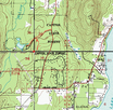
 (visited by Terje Mathisen and Tone Norløff) 06-Mar-2002 -- While on a business trip to Seattle and Portland we decided to drive down along I5 instead of taking a plane, this meant that we would pass quite close to a confluence! We followed I5 to Olympia, then took 101 North (i.e. west) for a few km, until we found the exit to Black Lake Blvd. We followed this road to the south, until we had just passed the 47N line. There we took another road (Delphi, the one that the first visitor, Mike Blaszczak, used) back to the north until we once again passed 47N. At this point we found the entrance sign to 'McLane Creek Centennial Demonstration Forest' (pic #2) and drove past the open gate for about 400m until we came to a parking area. (pic #3) We went past the parking, to the end of the road and turned around at the loop there, before driving back to the parking spot. At this spot there's a staircase from the road (pic #4), almost directly towards the confluence point, very convenient! As Mike described, the forest on the hillside is quite dense, so we tried to follow the paths as much as possible, and got up on top of the hill this way. A couple of minutes later we found the exact spot, in the middle of a somewhat boggy area (gps, pic #5). From Mike's narrative, his visit in 1999 had problems locating the exact point due to both the GPS SA noise, and lots of tall trees. Now that the GPS noise is gone and many of the trees have been cleared, it is much easier to move around. We also made a panorama from the hilltop just before (about 75 m) the confluence itself. (pic #6) The GPS track log (pic #7) was made using OziExplorer, with the background map from TopoZone. From the description Mike wrote, I believe he located a spot up to 100 m to the west of the point we found, i.e. on the slope back to the parking instead of down in the boggy area. |
| All pictures |
| #1: Panorama #2: Sign #3: Parking #4: Stairs #5: GPS #6: View from nearby hill #7: Track log ALL: All pictures on one page |


![Visit #4: [29-Aug-22] Visit #4: [29-Aug-22]](/us/wa/n47w123v4/preview.jpg)
![Visit #3: [03-Jan-05] Visit #3: [03-Jan-05]](/us/wa/n47w123v3/preview.jpg)
![Visit #1: [30-Oct-99] Visit #1: [30-Oct-99]](/us/wa/n47w123/preview.jpg)