|

South Africa : Eastern Cape
7.8 km (4.8 miles) ENE of Jeffreys Bay-Wavecrest, Eastern Cape, South Africa
Approx. altitude: 0 m
(0 ft)
([?] maps: Google MapQuest OpenStreetMap ConfluenceNavigator)
Antipode: 34°N 155°W
Accuracy: 5.7 km (3.6 mi)
Quality: good
Click on any of the images for the full-sized picture.

| 34°S 25°E (visit #1) | (incomplete) |
![Visit #2: [10-Jan-03]](/za/all/s34e025v2/preview.jpg "Visit #2: [10-Jan-03]")

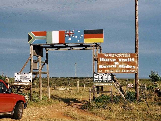
(visited by Peter Hers and Jocelyn Hers) 02-Mar-2002 -- This one was just for fun... Not having a boat, we did not really expect to be able to reach this confluence point, which is quite clearly in the sea off the coast near to Jeffrey's Bay, west of Port Elizabeth. It had been a long day, with one successful visit (31S 26E) and one attempt (32S 26E) already behind us, and we were looking forward to some rest and a long, cool drink at our destination further down the coast at Cape St. Francis. But the possibility of at least looking out to sea to this point was attractive. The N2 national route runs fairly near to the coast in this area, and we came across this entrance to Papiesfontein farm right on the main road. Perhaps because we were very tired, we decided not to drive in although there was no reason not to. The GPS shows that we were facing directly towards the Confluence, about 5.7 km away, and most definitely out to sea. But perhaps it is not so far away from the beach – I noticed that the edge of the sea as indicated by my GPS is not always accurate, as in many places it is approximated by straight lines. In fact, two nights later it indicated we were sleeping about 500 metres out to sea in our chalet at Sedgefield! So, maybe next trip when we have more time to spare... |
| All pictures |
| #1: View towards the Confluence #2: GPS showing Confluence out to sea ALL: All pictures on one page |
| Notes |
|
In the Saint Francis Bay, about 2.3 km from shore. |