|

Tunisia
5.6 km (3.5 miles) W of Protville (Aryāna), Banzart, Tunisia
Approx. altitude: 6 m
(19 ft)
([?] maps: Google MapQuest OpenStreetMap ConfluenceNavigator)
Antipode: 37°S 170°W
Accuracy: 10 m (32 ft)
Quality: good
Click on any of the images for the full-sized picture.


| 37°N 10°E (visit #1) |
![Visit #3: [07-Mar-22]](/ts/all/n37e010v3/preview.jpg "Visit #3: [07-Mar-22]")
![Visit #2: [16-Aug-08]](/ts/all/n37e010v2/preview.jpg "Visit #2: [16-Aug-08]")

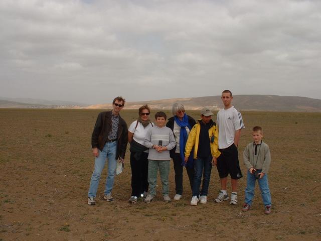
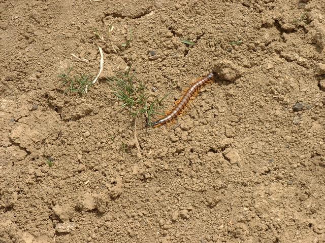
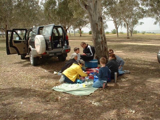
(visited by Philip Breeden, Laurence Breeden, Tristan Breeden, Didier Olivier, Marie Christine Olivier, Francois Olivier, Nicolas Brichet and Clement Durand) 09-Apr-2002 -- We chose 9 April 2002 to be the first group to attempt a Confluence in Tunisia. April 9 is Martyrs’ Day in Tunisia, and so we were on holiday. Our group left Tunis at 11:00 headed north for 37N 10E, which according to our map was about halfway between Tunis and Bizerte. Getting there was quite easy. We drove on the two lane highway (soon to be replaced by a brand-new divided lane freeway) until we crossed the Medjerda river, the only river in Tunisia that has water year-round. Immediately after the bridge we turned left and drove a few more kilometers. Then we parked near an irrigation ditch. We were in an agricultural region and according to our GPS, the Confluence was about one and ½ kilometers away in the middle of a field. As it turned out, a dirt road led us to the spot, an empty field in the midst of more empty fields. On the way we met a lovely centipede, and the air was full of bird song, although curiously we couldn’t see many birds. We savoured the moment, happy to be pioneers. Then we headed off to celebrate with a picnic by the river. |
| All pictures |
| #1: A general view of the Confluence #2: Proof positive #3: Looking north from the Confluence #4: The merry Confluence hunters #5: A local resident! #6: Celebrating our first Confluence ALL: All pictures on one page |
| Notes |
|
9.5 km SW of the antique ruins of Utica. |