|

Italy : Basilicata
4.6 km (2.9 miles) SE of Montemilone, Potenza, Basilicata, Italy
Approx. altitude: 360 m
(1181 ft)
([?] maps: Google MapQuest OpenStreetMap ConfluenceNavigator)
Antipode: 41°S 164°W
Accuracy: 5 m (16 ft)
Quality: good
Click on any of the images for the full-sized picture.


![]()

![]()


| 41°N 16°E (visit #2) |
![Visit #3: [09-Oct-22]](/it/all/n41e016v3/preview.jpg "Visit #3: [09-Oct-22]")
![Visit #1: [05-May-01]](/it/all/n41e016/preview.jpg "Visit #1: [05-May-01]")

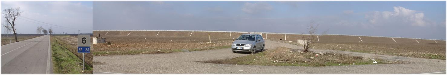
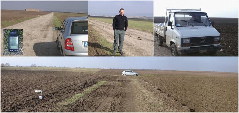
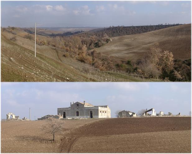
(visited by Hans Augdoppler) 06-Jan-2002 -- It had snowed in Taranto and on this Sunday I decided to have a look at the hinterland. It seemed reasonable to go for a CP, even for an already visited one. Shortly before the city of Spinazzola I discovered some snow remains [pic#2.jpg]. The journey to the CP itself was very simple this time. Just follow the secondary road SP25 from Spinazzola to the WEST. Keep on straight at the junction (40.9574°N16, 052°E) into direction Lavello, then do not turn off at the crossroads (40.97°N16, 057°E) to Canosa and keep on straight to Venosa. On the right (NORTH) the national highway SS168 is under construction and an underpass allows the entry to the gravel road in direction to NORTH-EAST. After about 3.5 km the field with the CP, already prepared for the seed, appeared. The soil was dry and it wasn't a difficulty to go up to the CP (picture 5 - lower part). A farmer was busy with the seed on the nearby field. A service car was also present and there was the possibility to have a talk with this man (picture 5 - upper part). It had snowed January 1st and even this on this day it was very windy and cold. I am not sure whether this man understood my plan completely but he took my CP plate as a reference. On my way back I was able to have a look into the ravines explored during our pre-visit. For more information see: http://linz.orf.at/gast/augdoppl/Confluence/Main.htm |
| All pictures |
| #1: View from CP to NORTH - Minervino Murge #2: Remaining snow fields south of Spinazzola #3: Access route via SP25 – direction WEST #4: SS168 under construction – entry to gravel road northwards #5: View NORTH; Farmers service man; view WEST #6: Panorama NORTH to EAST #7: CP to NW; GPS reading & map #8: Ravine direction NE; abounded farmstead to the EAST ALL: All pictures on one page |