|

Ukraine : Zakarpats'ka Oblast'
0.8 km (0.5 miles) SSW of Nevetlenfolu, Zakarpats'ka Oblast', Ukraine
Approx. altitude: 123 m
(403 ft)
([?] maps: Google MapQuest OpenStreetMap ConfluenceNavigator)
Antipode: 48°S 157°W
Accuracy: 1.4 km (1498 yd)
Quality: good
Click on any of the images for the full-sized picture.

")

![]()


| 48°N 23°E (visit #1) | (incomplete) |
![Visit #3: [27-Apr-14]](/up/all/n48e023v3/preview.jpg "Visit #3: [27-Apr-14]")
![Visit #2: [30-Oct-04]](/up/all/n48e023v2/preview.jpg "Visit #2: [30-Oct-04]")

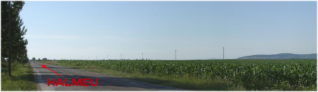
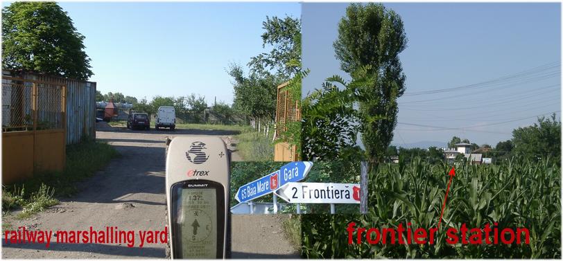
(visited by Hans Augdoppler and Klaus Baumgartner) 21-Jun-2002 -- This CP stands for no man's land and naivety. Various maps showed a very interesting constellation for this point. It is situated on the national territory of the Ukraine but should be less than 100 m away from the Romanian border. The situation therefore is well comparable with 49°N 15°E. Also this can be reached from the Czech territory within the DCP tolerance. A journey to the Ukraine is very difficult because of the strict visa regulations while on the other hand nowadays an entry into Romania is completely easy. We couldn't find the road 1C to Halmeu in Satu Mare. Therefore we made a small excursion via the village of Milac. The condition of the road in this place can be described as disastrous. We reached Halmeu via Turulung and after a police check point. The GPS indication surprisingly led us directly to the border post to the Ukraine. We turned back and tried come closer along the rail track. The shunting station is gigantic (the Ukrainian broad gauge track enters Romania, and the normal one enters Ukraine) and a discussion with a couple of railroaders didn't help either. Another trial west of the train lines then showed us the difference of national frontiers between here (watch-towers) and Central Europe anyway. The only way left was finally to contact directly the border post. In regard on the difficult explanation of our plan, the language problems and the danger of a possible arrest, we cancelled our expedition down and drove back to Satu Mare. Probably it will be necessary to obtain a special permission from the Ukraine for the visit of this CP. In any case a VISA is required. An approach from the Romanian territory still seems to us too dangerous at the moment and a contact with the border authorities would be necessary for sure. It will take some time till this CP is visited successfully.
Maps in pic#7 © MapPoint Europe http://www.microsoft.com and © MapQuest.com For more information see: http://linz.orf.at/gast/augdoppl/Confluence/Main.htm |
| All pictures |
| #1: Confluence area with watch tower >= 1km from Romanian village of Halmeu #2: Looking towards Halmeu – NORTH – towards Ukraine #3: Two approach routes (railway marshalling & border post) #4: Railway marshalling station with view towards CP #5: Panorama from NORTH to EAST– towards Ukraine #6: Widely used farming equipment in Romania #7: Maps ALL: All pictures on one page |
| Notes |
|
The border to Romania is passing about 240 m WSW of the Confluence. |