|

China : Húběi Shěng
9.7 km (6.0 miles) NW of Sanchabu, Húběi, China
Approx. altitude: 51 m
(167 ft)
([?] maps: Google MapQuest OpenStreetMap ConfluenceNavigator)
Antipode: 31°S 66°W
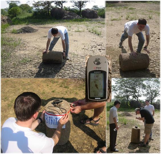
Accuracy: 3 m (9 ft)
Quality: good
Click on any of the images for the full-sized picture.


")


")
| 31°N 114°E (visit #1) |
![Visit #3: [01-Jul-05]](/cn/all/n31e114v3/preview.jpg "Visit #3: [01-Jul-05]")
![Visit #2: [29-Jul-03]](/cn/all/n31e114v2/preview.jpg "Visit #2: [29-Jul-03]")
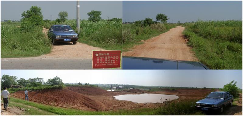
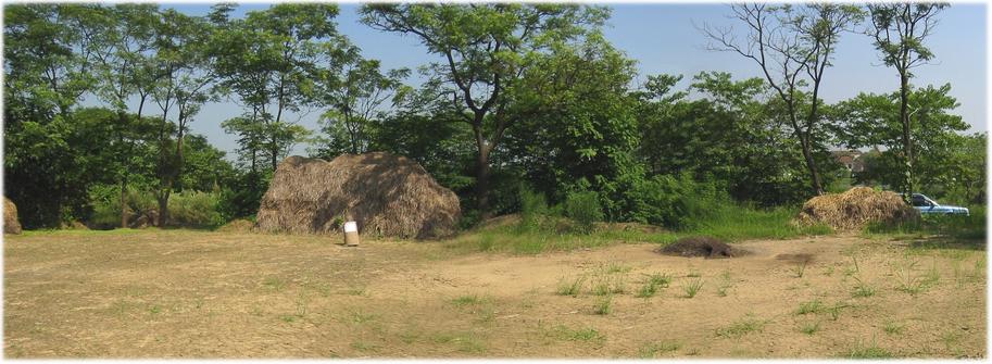
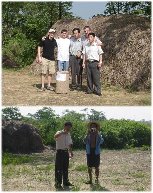
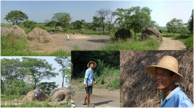
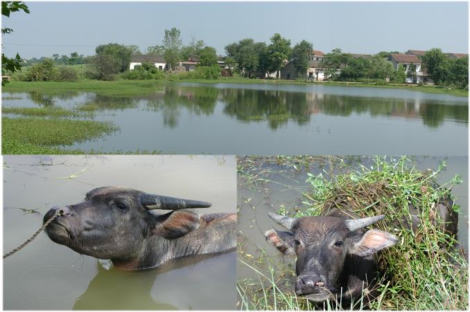
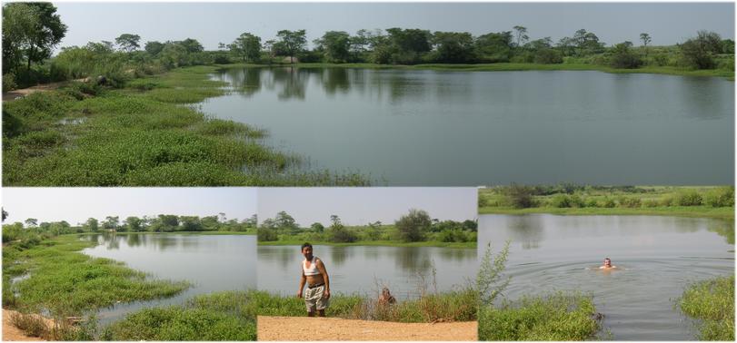
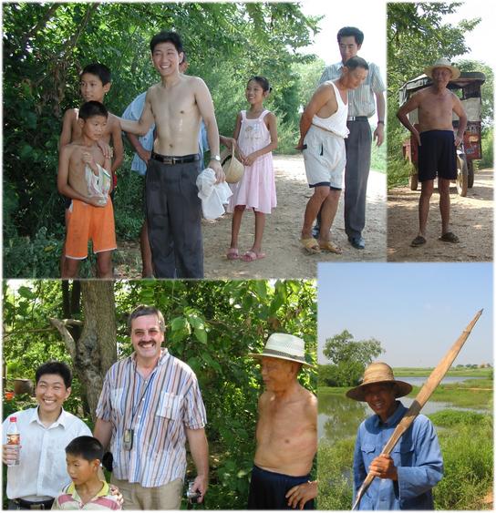
 (visited by Hans Augdoppler, Helmut Wahl, Jürgen Meisel, Bi Wei Fan and Hanzhong Yang) 04-Aug-2002 -- On this tremendous hot Sunday we started from WUHAN towards the north. In XIAOGAN we drove towards the northeast on an excellent road, which led us to our target. Shortly before the village XI HE the distance to the CP already fell below one kilometre. The first road towards the north ended at desolate brickyard, however, which nevertheless was in operation. The confluence point seemed to lie behind the clay pit. Based on information we received from these people we turn back to find the correct access path. We found it with ease and a passable clay road led straight to the confluence point. We passed the clay pit and were already within the project limits. Behind the pit we turned to the east and the CP is approx. 10 m to the south on a rice threshing place, 1 meter in front of a rice straw pile. Helmut rolled a threshing stone to the spot and we put a sheet of paper indicating the coordinates on it in order to mark the point for the group photo. We invited a passing rice farmer to take a photo of us. FAN BI WEI had to make some training beforehand. The village XONG JIA ZAI is situated on the northern side of a big buffalo pond. We were able to watch our photographer while cleaning his rice harvest. During our walk along this pond we watched the water buffalos enjoyed their bath and in contrast we sweated enormously. Taught by villagers, an inviting access point and the clean water also lured Hans into a short bath. The water was very warm at the surface but in deeper regions definitely refreshing. The quality matches with the very popular natural European swimming pools. It isn't everyone's thing to swim together with water buffalos, though. A rural background is surely helpful ;-)
After a small talk with some villagers and in spite of the unexpected fast and easy approach we decided not to return to WUHAN yet but to continue on to |
| All pictures |
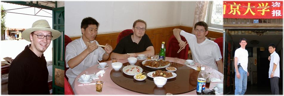
| #1: Rice threshing floor as confluence area, north view #2: Brick factory, from the south & from the north #3: Access road to north, clay pit & brickyard from NW #4: Marking the spot with a threshing stone #5: Hunters with photographer (Jürgen, Helmut, Yang Hanzhong, Hans & Fan Bi Wei) #6: View to village with our photographer cleaning rice nearby #7: North view across the pond with XONG JIA ZAI village & water buffalos #8: Lake from seen from the XONG JIA ZAI village, N & NE &, swimmers #9: Small talk with local residents of the XONG JIA ZAI village #10: Lunch at HUANGPI (Jürgen; Fan Bi Wei, Jürgen, Helmut; Helmut & Fan Bi Wei) ALL: All pictures on one page |