|

Norway : Oppland
19.0 km (11.8 miles) N of Dokka, Oppland, Norway
Approx. altitude: 419 m
(1374 ft)
([?] maps: Google MapQuest OpenStreetMap ConfluenceNavigator)
Antipode: 61°S 170°W
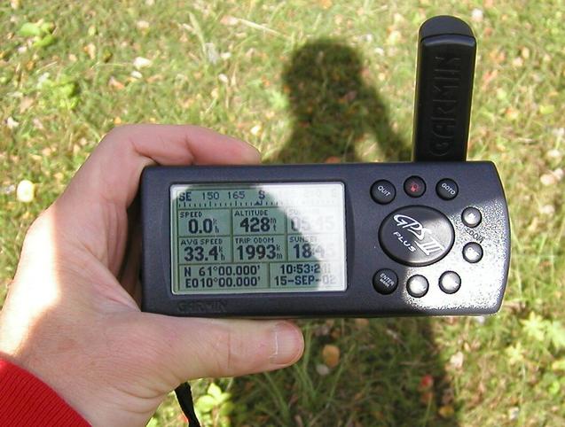
Accuracy: 5 m (16 ft)
Quality: good
Click on any of the images for the full-sized picture.


| 61°N 10°E (visit #2) |
![Visit #8: [02-Sep-25]](/no/all/n61e010v8/preview.jpg "Visit #8: [02-Sep-25]")
![Visit #7: [03-Aug-14]](/no/all/n61e010v7/preview.jpg "Visit #7: [03-Aug-14]")
![Visit #6: [12-Aug-13]](/no/all/n61e010v6/preview.jpg "Visit #6: [12-Aug-13]")
![Visit #5: [09-Jul-13]](/no/all/n61e010v5/preview.jpg "Visit #5: [09-Jul-13]")
![Visit #4: [16-Mar-12]](/no/all/n61e010v4/preview.jpg "Visit #4: [16-Mar-12]")
![Visit #3: [26-Jul-09]](/no/all/n61e010v3/preview.jpg "Visit #3: [26-Jul-09]")
![Visit #1: [29-Nov-00]](/no/all/n61e010/preview.jpg "Visit #1: [29-Nov-00]")
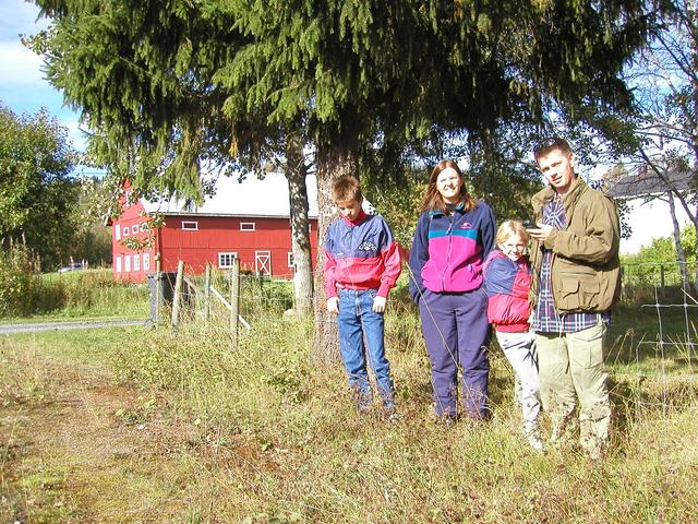
 (visited by Terje Mathisen, Tone Norløff, Fredrik Norløff-Mathisen, Cathinka Norløff-Mathisen and Magne Wiig Mathisen) 15-Sep-2002 -- For his 70'th birthday, my father decided to invite the entire family on a long weekend (thursday to sunday) trip to Skeikampen, a mountain area about 35 km NNW of Lillehammer. I had checked my maps before leaving home, and decided that we could combine this with at least one confluence hunt, so on the last day we (myself, my wife and kids, plus my brother Magne who had sprained his ankle so he couldn't make any more mountain hikes) left the hotel just after breakfast and drove west over the Synnfjell mountain area, following the river Synna south towards Torpa and the confluence site. As we drove the last few km down into the valley, we made a little stop on a nice overlook, admiring the view. The trip took about one hour, and as expected we found the site very close to the road: About 25 m from the asphalt, a little bit into a grassy field. I walked up the the house at the SE end of the field to ask permission, but there were nobody at home. Since this is Norway, I took a chance that they probably wouldn't mind me taking a few photos for a panorama from the exact spot, so I got all the zeroes I wanted on the GPS. :-) |
| All pictures |
| #1: 360° panorama #2: Looking out over Torpa valley #3: Confluence hunters #4: Looking back up towards the overlook #5: GPS ALL: All pictures on one page |