
| { Main | Search | Countries | Information | Member Page } | |
United States : Nebraska; showing visits by Joseph Kerski |
| There are no Plans for this Region. |
|
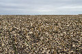
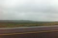
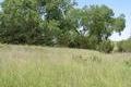
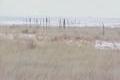
41°N 99°W 4.9 miles (7.9 km) WSW of Ravenna, Buffalo, NE, USA [07-Aug-25] |

|
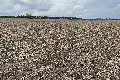
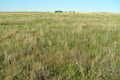
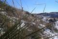
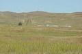
42°N 99°W 16.5 miles (26.6 km) NNE of Burwell, Garfield, NE, USA [09-Jul-25] |

|
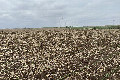
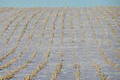
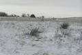
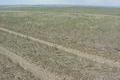
42°N 100°W 8.1 miles (13.1 km) NW of Brewster, Blaine, NE, USA [09-Jul-25] |
|
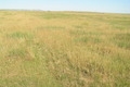
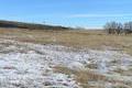
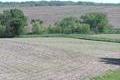
41°N 98°W 0.7 miles (1.1 km) SE of Marquette, Hamilton, NE, USA [18-Oct-21] |
|
42°N 98°W 4.4 miles (7.2 km) ENE of Elgin, Antelope, NE, USA [02-Sep-21] |

|
42°N 97°W 2.8 miles (4.6 km) ESE of Pilger (Stanton), Cuming, NE, USA [31-Aug-21] |
|
43°N 104°W 15.6 miles (25.1 km) SSW of Provo (SD), Sioux, NE, USA [27-Aug-14] |
|
43°N 104°W 15.6 miles (25.1 km) SSW of Provo (SD), Sioux, NE, USA [incomplete] [21-Jul-14] |
|
41°N 101°W 10.9 miles (17.6 km) S of Hershey, Lincoln, NE, USA [05-Aug-08] |
|
41°N 100°W 8.5 miles (13.7 km) W of Buffalo, Dawson, NE, USA [22-Mar-07] |
|
42°N 104°W 2.4 miles (3.9 km) E of Henry, Scotts Bluff, NE, USA [02-Jan-06] |
|
42°N 103°W 9.6 miles (15.5 km) SW of Alliance (Box Butte), Morrill, NE, USA [01-Jan-06] |
|
41°N 101°W 10.9 miles (17.6 km) S of Hershey, Lincoln, NE, USA [27-Dec-05] |
|
41°N 97°W 3.0 miles (4.8 km) ESE of Bee, Seward, NE, USA [27-Jul-05] |
|
41°N 96°W 6.2 miles (10.0 km) WSW of Plattsmouth, Cass, NE, USA [27-Jul-05] |
|
42°N 102°W 4.0 miles (6.5 km) SW of Ashby, Grant, NE, USA [14-Sep-04] |
|
41°N 102°W 5.9 miles (9.4 km) SE of Big Springs (Deuel), Perkins, NE, USA [17-Feb-04] |

|
42°N 101°W 3.6 miles (5.8 km) SE of Mullen, Hooker, NE, USA [17-Feb-04] |
|
43°N 103°W 11.7 miles (18.9 km) N of Chadron, Dawes, NE, USA [21-Jun-02] |