|
Switzerland
4.2 km (2.6 miles) WSW of Doppleschwand, Luzern, Switzerland
Approx. altitude: 942 m
(3090 ft)
([?] maps: Google MapQuest OpenStreetMap ConfluenceNavigator)
Antipode: 47°S 172°W
Accuracy: 34 m (111 ft)
Quality: good
Click on any of the images for the full-sized picture.
| 47°N 8°E (visit #13) |
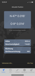
 (visited by Rainer Mautz) 21-Mar-2020 -- Currently – during the crisis of coronavirus - there are only 4 confluence points that I can legally visit, because I cannot leave Switzerland. The Canton of Ticino is closed. This confluence point is only 100 km from the current worldwide epicenter of the pandemic in nothern Italy. The remaining other 3 confluence points within Switzerland are far from being visitable at this time. Only this confluence point remains visitable. Since the current curfew does not include cycling for individuals, I made the best of this Saturday to visit this confluence point. I left home at 7 AM and cycled via Lucerne, Doppleschwand and Romoos to the confluence (one way 103 km). At 1 PM I reached the nearest spot on a public road, where I parked my bicycle. I hiked down to the confluence, but the ground was soaked with water from the heavy rain last night. At the steep part, it was slippery and dangerous. Since I had not planned to visit this confluence when I left home, I didn’t bring my GPS device with me. Navigating with the mobile phone was difficult. Generally speaking, confluencing is not directly hit from Covid-19. As long as the satellites are still around, the hunt can go on. In addition, confluence points tend to be in nature where hardly any people can be found. However, due to the imposed travel restrictions worldwide, I doubt that there will be many visits in 2020. I coasted down to the main road and cycled all the way back, reaching home at 7:15 PM in a frozen, hungry and exhausted state. CP Visit Details:
The story finishes here. |
| All pictures |
| #1: The Confluence from 15 m Distance #2: View to the South #3: View to the West #4: View to the North #5: View to the East #6: GPS Reading #7: Ground Zero #8: The Confluence Hunter #9: View from 150 m #10: Bicycle Parking ALL: All pictures on one page |


![Visit #12: [27-Jul-18] Visit #12: [27-Jul-18]](/ch/all/n47e008v12/preview.jpg)
![Visit #11: [12-Jun-18] Visit #11: [12-Jun-18]](/ch/all/n47e008v11/preview.jpg)
![Visit #9: [28-Mar-15] Visit #9: [28-Mar-15]](/ch/all/n47e008v9/preview.jpg)
![Visit #10: [11-Jan-15] Visit #10: [11-Jan-15]](/ch/all/n47e008v10/preview.jpg)
![Visit #8: [23-Aug-14] Visit #8: [23-Aug-14]](/ch/all/n47e008v8/preview.jpg)
![Visit #6: [24-Oct-09] Visit #6: [24-Oct-09]](/ch/all/n47e008v6/preview.jpg)
![Visit #5: [01-Nov-07] Visit #5: [01-Nov-07]](/ch/all/n47e008v5/preview.jpg)
![Visit #4: [06-Jan-07] Visit #4: [06-Jan-07]](/ch/all/n47e008v4/preview.jpg)
![Visit #3: [20-Aug-06] Visit #3: [20-Aug-06]](/ch/all/n47e008v3/preview.jpg)
![Visit #2: [02-Jul-04] Visit #2: [02-Jul-04]](/ch/all/n47e008v2/preview.jpg)
![Visit #1: [18-Nov-00] Visit #1: [18-Nov-00]](/ch/all/n47e008/preview.jpg)
![Visit #7: [19-Jan-14] Visit #7: [19-Jan-14]](/ch/all/n47e008v7/preview.jpg)