|
Czech Republic
near Nižbor, Středočeský Kraj, Czech Republic
Approx. altitude: 272 m
(892 ft)
([?] maps: Google MapQuest OpenStreetMap ConfluenceNavigator)
Antipode: 50°S 166°W
Accuracy: 11 m (36 ft)
Quality: good
Click on any of the images for the full-sized picture.
| 50°N 14°E (visit #17) | (secondary) |
 (visited by Karl Bryk and Michael Bryk) 02-Aug-2020 -- This the second of 14 CP visits made during a road trip through the Czech republic and Germany. The previous is N49 E14. The next is N51 E14.
|
| All pictures |
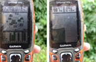
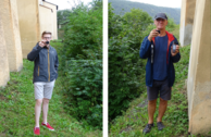
| #1: Overview #2: North #3: East #4: South #5: West #6: GPS #7: Visitors #8: Views around the CP #9: Marker ALL: All pictures on one page |


![Visit #16: [03-Oct-19] Visit #16: [03-Oct-19]](/cz/all/n50e014v16/preview.jpg)
![Visit #15: [22-Jun-17] Visit #15: [22-Jun-17]](/cz/all/n50e014v15/preview.jpg)
![Visit #13: [04-Sep-15] Visit #13: [04-Sep-15]](/cz/all/n50e014v13/preview.jpg)
![Visit #14: [08-Jul-15] Visit #14: [08-Jul-15]](/cz/all/n50e014v14/preview.jpg)
![Visit #12: [06-Aug-12] Visit #12: [06-Aug-12]](/cz/all/n50e014v12/preview.jpg)
![Visit #11: [16-Jan-11] Visit #11: [16-Jan-11]](/cz/all/n50e014v11/preview.jpg)
![Visit #10: [16-Jan-11] Visit #10: [16-Jan-11]](/cz/all/n50e014v10/preview.jpg)
![Visit #9: [07-Nov-09] Visit #9: [07-Nov-09]](/cz/all/n50e014v9/preview.jpg)
![Visit #8: [21-Sep-08] Visit #8: [21-Sep-08]](/cz/all/n50e014v8/preview.jpg)
![Visit #7: [23-Mar-07] Visit #7: [23-Mar-07]](/cz/all/n50e014v7/preview.jpg)
![Visit #6: [06-Aug-06] Visit #6: [06-Aug-06]](/cz/all/n50e014v6/preview.jpg)
![Visit #5: [28-May-05] Visit #5: [28-May-05]](/cz/all/n50e014v5/preview.jpg)
![Visit #4: [23-Mar-05] Visit #4: [23-Mar-05]](/cz/all/n50e014v4/preview.jpg)
![Visit #3: [08-Oct-03] Visit #3: [08-Oct-03]](/cz/all/n50e014v3/preview.jpg)
![Visit #2: [04-May-02] Visit #2: [04-May-02]](/cz/all/n50e014v2/preview.jpg)
![Visit #1: [07-Jan-01] Visit #1: [07-Jan-01]](/cz/all/n50e014/preview.jpg)