|

Oman
7.0 km (4.3 miles) SSE of Ma'bas, al-Zāhira, Oman
Approx. altitude: 602 m
(1975 ft)
([?] maps: Google MapQuest OpenStreetMap ConfluenceNavigator)
Antipode: 23°S 123°W
Quality: good
Click on any of the images for the full-sized picture.
")


| 23°N 57°E (visit #1) |
![Visit #6: [12-Jan-13]](/om/all/n23e057v6/preview.jpg "Visit #6: [12-Jan-13]")
![Visit #5: [22-Sep-09]](/om/all/n23e057v5/preview.jpg "Visit #5: [22-Sep-09]")
![Visit #4: [06-Apr-08]](/om/all/n23e057v4/preview.jpg "Visit #4: [06-Apr-08]")
![Visit #3: [01-Jan-07]](/om/all/n23e057v3/preview.jpg "Visit #3: [01-Jan-07]")
![Visit #2: [19-Apr-06]](/om/all/n23e057v2/preview.jpg "Visit #2: [19-Apr-06]")

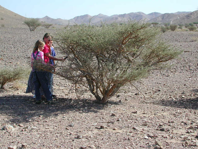
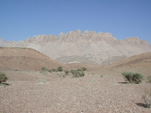
(visited by Alasdair MacKenzie, Christine MacKenzie, Neil MacKenzie, Helen MacKenzie, Roger Martin, Anne-Kari Martin, Daniel Martin and Kristina Martin) 03-Dec-2001 -- The Martin and MacKenzie families had spent a few days camping in Oman, unfortunately not near any confluence points, but visited 23N 57E on our way back to Abū Ẓaby on Monday 3rd December. The main road on the south side of the Jabal Akhḍar links the United Arab Emirates and the Sultanate of Oman and passes (picture 3) within a few hundred metres of the Confluence. The area is typical of many parts of Oman – the ground covered with stones, and a scattering of thorn bushes, one of which marks the Confluence. We also managed to spot a camel (picture 2) while we visited the area. The camels roam free, but are always owned by somebody! Looking to the north (picture 1), the mountains of the Jabal Akhḍar (Green Mountain) rise up sharply. Not much evidence of anything green in the photos, but once you get above 6000 ft (1800 m), the temperature is about 10° C cooler than the temperature down on the plains, and there’s a lot more vegetation about. |
| All pictures |
| #1: Looking north #2: Looking west (Spot the camel!) #3: Looking south to the main road #4: Looking east #5: The thorn bush marks the Confluence #6: The visitors ALL: All pictures on one page |