|

United Kingdom : England
2.9 km (1.8 miles) SE of Frith Bank, Lincolnshire, England, United Kingdom
Approx. altitude: 2 m
(6 ft)
([?] maps: Google MapQuest OpenStreetMap ConfluenceNavigator)
Antipode: 53°S 180°
Accuracy: 5 m (16 ft)
Quality: good
Click on any of the images for the full-sized picture.


| 53°N 0° (visit #2) |
![Visit #19: [03-Jan-20]](/uk/en/n53e000v19/preview.jpg "Visit #19: [03-Jan-20]")
![Visit #20: [04-Sep-19]](/uk/en/n53e000v20/preview.jpg "Visit #20: [04-Sep-19]")
![Visit #18: [24-Jun-15]](/uk/en/n53e000v18/preview.jpg "Visit #18: [24-Jun-15]")
![Visit #17: [22-Aug-14]](/uk/en/n53e000v17/preview.jpg "Visit #17: [22-Aug-14]")
![Visit #16: [10-Feb-14]](/uk/en/n53e000v16/preview.jpg "Visit #16: [10-Feb-14]")
![Visit #15: [09-Jun-12]](/uk/en/n53e000v15/preview.jpg "Visit #15: [09-Jun-12]")
![Visit #13: [10-Sep-09]](/uk/en/n53e000v13/preview.jpg "Visit #13: [10-Sep-09]")
![Visit #12: [04-Apr-08]](/uk/en/n53e000v12/preview.jpg "Visit #12: [04-Apr-08]")
![Visit #11: [04-Apr-08]](/uk/en/n53e000v11/preview.jpg "Visit #11: [04-Apr-08]")
![Visit #10: [28-Jun-07]](/uk/en/n53e000v10/preview.jpg "Visit #10: [28-Jun-07]")
![Visit #9: [18-Feb-07]](/uk/en/n53e000v9/preview.jpg "Visit #9: [18-Feb-07]")
![Visit #8: [08-Aug-06]](/uk/en/n53e000v8/preview.jpg "Visit #8: [08-Aug-06]")
![Visit #7: [16-Jul-06]](/uk/en/n53e000v7/preview.jpg "Visit #7: [16-Jul-06]")
![Visit #6: [13-May-06]](/uk/en/n53e000v6/preview.jpg "Visit #6: [13-May-06]")
![Visit #5: [06-Aug-05]](/uk/en/n53e000v5/preview.jpg "Visit #5: [06-Aug-05]")
![Visit #4: [11-Jun-05]](/uk/en/n53e000v4/preview.jpg "Visit #4: [11-Jun-05]")
![Visit #3: [31-Aug-03]](/uk/en/n53e000v3/preview.jpg "Visit #3: [31-Aug-03]")
![Visit #1: [31-Dec-00]](/uk/en/n53e000/preview.jpg "Visit #1: [31-Dec-00]")
")
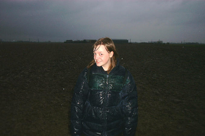
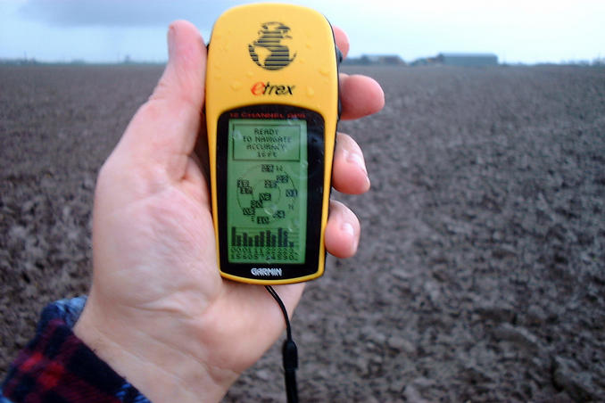
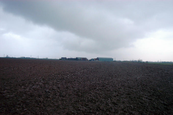
(visited by Gordon Spence and Danielle Spence) 21-Dec-2001 -- Today dawned cold but dry and Danielle was finishing college for Christmas at lunchtime, so I thought I would bring this visit forward a few days... The distance to this one is about 66 miles from home so we set off just after 1pm, allowing ourselves about two and a half hours before darkness set in, don't forget we are at 53N and today is the winter solstice. Finding the location was fairly easy - I have a good road atlas. The 53.00.00.0 came up just before the drainage canal noted by the previous visitor, though the picture suggest just after it. Curious, so we park up and start walking along the public footpath along the drainage canal, the field on this side was planted with a spring crop of cabbages. After about four hundred yards it became obvious that the point was in fact going to be on the other side of the water...back track to the main road. There is a public footpath also on this side, but there is a house cut into the field. We went and knocked to get permission but there was nobody at home...hmmm...looking at the field revealed there were no crops, ok onwards we go. Those of you who have been following my confluence trail will know that when it comes to fields...we never get a nice dry and firm footing, this was to be no exception! We followed the footpath to exactly 0.00.00.0, the exact spot was going to mean walking into the field. Now, to say the mud was a bit thick and sticky would be an understatement, but we became about four inches taller and our trainers about 5lbs heavier....and then to cap it all, the rain started coming in horizontally off the North Sea (just over a mile away). As you can see Danielle is thoroughly soaking and so am I. A little bit of walking in circles soon gave us the exact spot - my first visit to the Greenwich Meridian - the accuracy shot was quickly taken. Looking North all you could see was brown mud almost to the horizon, so the location shot was taken looking East this time, you can see the heavy clouds. Another one wrapped up, we headed quickly back to the car, by this time the rain had turned to sleet mixed with hail and the wind was cutting. |
| All pictures |
| #1: Looking East (nothing to the North!) #2: On the exact spot #3: Is 11 satellites good enough? #4: Danielle soaking wet #5: Gordon & Danielle #6: Drainage canal ALL: All pictures on one page |