|

France : Bretagne
3.1 km (1.9 miles) SE of Boderel, Morbihan, Bretagne, France
Approx. altitude: 93 m
(305 ft)
([?] maps: Google MapQuest OpenStreetMap ConfluenceNavigator)
Antipode: 48°S 177°E
Accuracy: 3 m (9 ft)
Quality: good
Click on any of the images for the full-sized picture.

![]()
![]()


| 48°N 3°W (visit #3) |
![Visit #9: [05-Jun-22]](/fr/all/n48w003v9/preview.jpg "Visit #9: [05-Jun-22]")
![Visit #8: [25-Dec-17]](/fr/all/n48w003v8/preview.jpg "Visit #8: [25-Dec-17]")
![Visit #7: [02-Sep-16]](/fr/all/n48w003v7/preview.jpg "Visit #7: [02-Sep-16]")
![Visit #6: [19-Jun-10]](/fr/all/n48w003v6/preview.jpg "Visit #6: [19-Jun-10]")
![Visit #5: [30-Sep-05]](/fr/all/n48w003v5/preview.jpg "Visit #5: [30-Sep-05]")
![Visit #4: [28-Jul-02]](/fr/all/n48w003v4/preview.jpg "Visit #4: [28-Jul-02]")
![Visit #2: [01-May-02]](/fr/all/n48w003v2/preview.jpg "Visit #2: [01-May-02]")
![Visit #1: [09-Jul-99]](/fr/all/n48w003/preview.jpg "Visit #1: [09-Jul-99]")
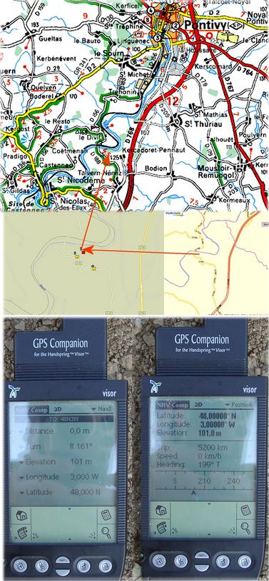
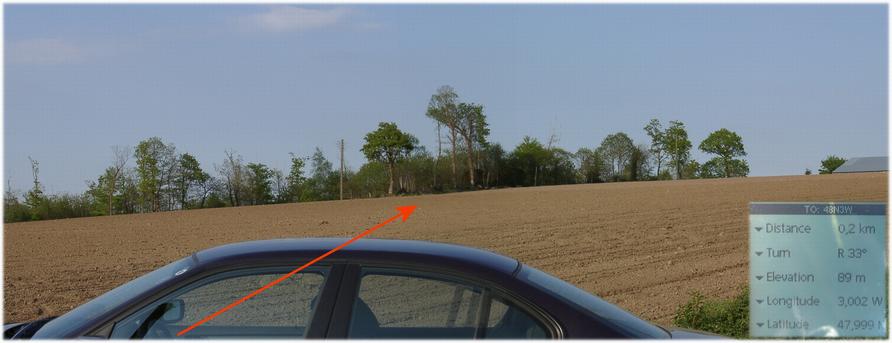
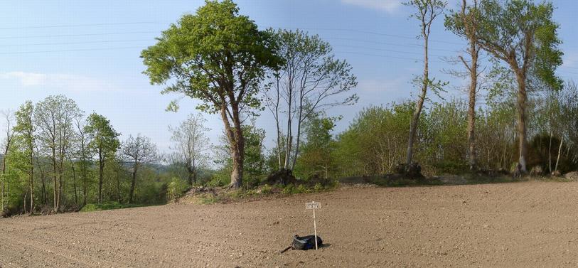
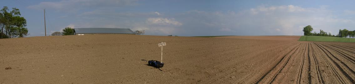
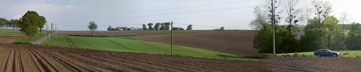
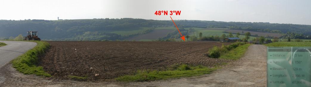
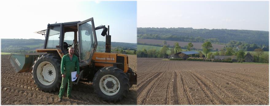
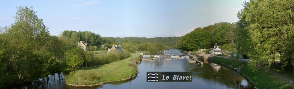
 - view to NORTH – the tree") (visited by Hans Augdoppler) 04-May-2002 -- Coming from the north I bypassed the city of Pontivy and tried to reach the CP as directed by MapPoint. There supposed to be a road along the river Blavet (east) but I was unable to find it. However the map from Michelin does show this road. Finally I used the D768 and then turned into the D188 towards the Blavet. Down to the river valley I came as close as ~200m (marker[2]) and there was perfect opportunity to park the car. A ploughed, harrowed field and fresh tractor tracks did invite to enter without any doubt to harm plants. The exact location of the CP is about 20m inside this field, to the south from a huge, dominant tree at the boundary. Across the hill towards east you may see the assigned farm buildings. Back to the car I enjoyed jumping from track to track like hurdles. Now my aim was to pay a visit to the farm itself. But then I noticed the farmer who was collecting stones from the cultivated field. Aside from some language problems we had a nice conversation supported by a print of the narrative of visitor#1. Happy with this visit I enjoyed the beauty of the Blavet River. Originally my plan was to continue to 43°N 1°W with the intention to complete all CP’s in France. Just before I left the UK I realized that Michel Dupuis plans harmonized with mine, but a few days ahead. When I returned home I experienced that he was also ahead for this CP. I am sorry that we missed us.
Left map in pic#8 © MapPoint Europe http://www.microsoft.com; For more information see: http://linz.orf.at/gast/augdoppl/Confluence/Main.htm |
| All pictures |
| #1: Confluence marked (temporarily) - view to NORTH – the tree #2: From the road towards NE #3: Farm across the hill – EAST to SOUTH #4: SOUTH to WEST – access route #5: From SOUTH – farm access #6: The farmer and his farm #7: Idyllic River Blavet #8: Maps & GPS reading ALL: All pictures on one page |